Property Record
607 Vineyard Point Rd, Guilford, CT 06437


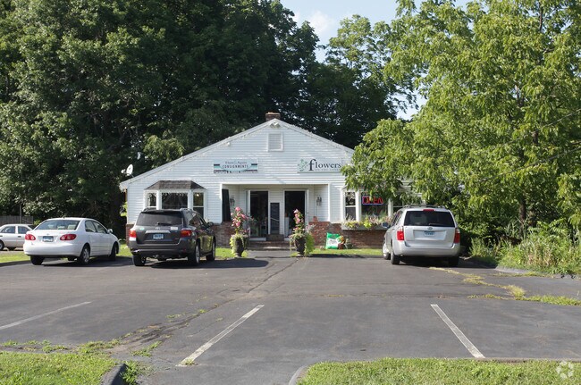
Property Detail
607 Vineyard Point Rd
GUIL-000000-000000-004050
South Central Ct
Residentialacreage
Connecticut
R-5
5.60 AC
AE The base floodplain where base flood elevations are provided. AE Zones are now used on new format FIRMs instead of A1-A30 Zones.
Guilford
2024
Westchester/So Connecticut
2025
New Haven, CT
190302
NEARBY LISTINGS FOR SALE OR LEASE
DEMOGRAPHICS near 607 Vineyard Point Rd
1 mile
3 mile
5 mile
2025 Total Population
3,402
17,265
38,507
2030 Population
3,456
17,669
39,419
Pop Growth 2025-2030
+ 1.59%
+ 2.34%
+ 2.37%
Average Age
48
47
46
2025 Total Households
1,586
7,127
15,480
HH Growth 2025-2030
+ 1.58%
+ 2.33%
+ 2.40%
Median Household Inc
$83,173
$117,953
$137,985
Avg Household Size
2.10
2.40
2.40
2025 Avg HH Vehicles
2.00
2.00
2.00
Median Home Value
$662,376
$609,529
$578,722
Median Year Built
1964
1970
1973
Nearby Places
Map Layers
Map Styles
 Street
 Aerial
Layers
 Traffic
 Biking
Places
Listings with unknown addresses are not visible on the map
- Restaurants
- Banks
- Shops
- Fitness
- Groceries
PUBLIC TRANSPORTATION
COMMUTER RAIL
Guilford (Commuter Rail - Shore Line East)
Drive
Walk
Distance
Guilford (Commuter Rail - Shore Line East)
9 min
3.8 mi
Madison (Commuter Rail - Shore Line East, Shore Line East - Shore Line East)
Drive
Walk
Distance
Madison (Commuter Rail - Shore Line East, Shore Line East - Shore Line East)
15 min
8.1 mi
AIRPORT
Tweed/New Haven
Drive
Walk
Distance
Tweed/New Haven
26 min
15.5 mi
Freight Ports
Port of New Haven
Drive
Walk
Distance
Port of New Haven
26 min
16.1 mi
Nearby Properties
Address
Land Use
TOTAL SIZE
Lot Size
Zoning
Address
Land Use
TOTAL SIZE
Lot Size
Zoning
51,202 SF
19 AC
R-3
Address
Land Use
TOTAL SIZE
Lot Size
Zoning
3.20 AC
PRB1
Address
Land Use
TOTAL SIZE
Lot Size
Zoning
49,145 SF
20.54 AC
R-3
Address
Land Use
TOTAL SIZE
Lot Size
Zoning
30,530 SF
0.55 AC
R-1
Address
Land Use
TOTAL SIZE
Lot Size
Zoning
166,717 SF
SC
Address
Land Use
TOTAL SIZE
Lot Size
Zoning
3.60 AC
AA
Address
Land Use
TOTAL SIZE
Lot Size
Zoning
3.10 AC
Address
Land Use
TOTAL SIZE
Lot Size
Zoning
6.41 AC
I
Address
Land Use
TOTAL SIZE
Lot Size
Zoning
14,466 SF
1.54 AC
PRB1
Address
Land Use
TOTAL SIZE
Lot Size
Zoning
2.94 AC
R-6
Address
Land Use
TOTAL SIZE
Lot Size
Zoning
18.59 AC
R-5
Address
Land Use
TOTAL SIZE
Lot Size
Zoning
3.49 AC
R-5
Address
Land Use
TOTAL SIZE
Lot Size
Zoning
1,260 SF
16.58 AC
R-3
Address
Land Use
TOTAL SIZE
Lot Size
Zoning
8.25 AC
R-1
Address
Land Use
TOTAL SIZE
Lot Size
Zoning
44.65 AC
RS-1
Address
Land Use
TOTAL SIZE
Lot Size
Zoning
16 AC
R-5
Address
Land Use
TOTAL SIZE
Lot Size
Zoning
14.51 AC
SC
Address
Land Use
TOTAL SIZE
Lot Size
Zoning
60,212 SF
25.29 AC
I
Address
Land Use
TOTAL SIZE
Lot Size
Zoning
2.10 AC
R-5
Address
Land Use
TOTAL SIZE
Lot Size
Zoning
22,652 SF
1.90 AC
R-1
Address
Land Use
TOTAL SIZE
Lot Size
Zoning
17,268 SF
0.74 AC
R-1
Address
Land Use
TOTAL SIZE
Lot Size
Zoning
2.38 AC
AA
Address
Land Use
TOTAL SIZE
Lot Size
Zoning
0.45 AC
Address
Land Use
TOTAL SIZE
Lot Size
Zoning
2.30 AC
Address
Land Use
TOTAL SIZE
Lot Size
Zoning
0.59 AC
MC
Address
Land Use
TOTAL SIZE
Lot Size
Zoning
0.80 AC
Address
Land Use
TOTAL SIZE
Lot Size
Zoning
12,270 SF
0.41 AC
GGB
Address
Land Use
TOTAL SIZE
Lot Size
Zoning
18,387 SF
0.95 AC
GGB
Address
Land Use
TOTAL SIZE
Lot Size
Zoning
0.45 AC
R-1
Address
Land Use
TOTAL SIZE
Lot Size
Zoning
9 AC
R-3
The World's #1 Commercial Real Estate Marketplace
Connect with us
© 2026 CoStar Group
The information above has been obtained from sources believed reliable. While we do not doubt its accuracy we have not verified it and make no guarantee, warranty or representation about it. It is your responsibility to independently confirm its accuracy and completeness. Any projections, opinions, assumptions, or estimates used are for example only and do not represent the current or future performance of the property. The value of this transaction to you depends on tax and other factors which should be evaluated by your tax, financial, and legal advisors. You and your advisors should conduct a careful, independent investigation of the property to determine to your satisfaction the suitability of the property for your needs.