Property Record
6070 E Fireweed Rd, Palmer, AK 99645

Save to a Folder
{{folder.Name}}
{{folder.ListingIds.length}} Properties
{{folder.ListingIds.length}} Property
Create a New Folder
Property Detail
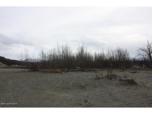
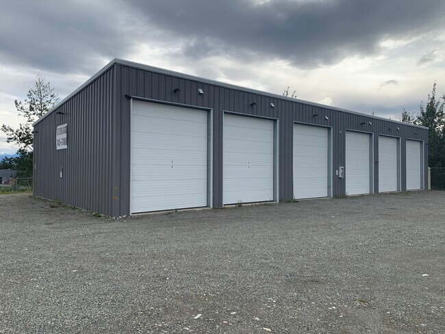
6070 E Fireweed Rd
17N01E16C017
TOWNSHIP 17N RANGE 1E SECTION 16 LOT C17
Commercialnec
MATANUSKA-SUSITNA
6
Alaska
B and X Area of moderate flood hazard, usually the area between the limits of the 100-year and 500-year floods.
c17
2026
2.51 AC
2026
Mat-Su Business Region
001100
Anchorage
4,500 SF
Anchorage, AK
NEARBY LISTINGS FOR SALE OR LEASE
-
-
View all Palmer listings for lease on LoopNet.com
DEMOGRAPHICS near 6070 E Fireweed Rd
1 mile
3 mile
5 mile
2025 Total Population
2,168
11,375
29,830
2030 Population
2,359
12,278
32,184
Pop Growth 2025-2030
+ 8.81%
+ 7.94%
+ 7.89%
Average Age
36
38
37
2025 Total Households
715
3,915
10,437
HH Growth 2025-2030
+ 8.67%
+ 7.99%
+ 7.96%
Median Household Inc
$141,522
$121,070
$108,000
Avg Household Size
3.10
2.90
2.80
2025 Avg HH Vehicles
3.00
3.00
2.00
Median Home Value
$468,965
$427,207
$386,457
Median Year Built
2004
1999
1998
Nearby Places
Map Layers
Map Styles
 Street
 Aerial
Layers
 Traffic
 Biking
Places
Listings with unknown addresses are not visible on the map
- Restaurants
- Banks
- Shops
- Fitness
- Groceries
SALE & LEASE HISTORY
LISTING DATE
SALE/LEASE

Nov 07, 2023
For Lease
Nearby Properties
Address
Land Use
TOTAL SIZE
Lot Size
Zoning
Address
Land Use
TOTAL SIZE
Lot Size
Zoning
23.23 AC
6
Address
Land Use
TOTAL SIZE
Lot Size
Zoning
1,831 SF
16.86 AC
35
Address
Land Use
TOTAL SIZE
Lot Size
Zoning
1.08 AC
6
Address
Land Use
TOTAL SIZE
Lot Size
Zoning
33.48 AC
35
Address
Land Use
TOTAL SIZE
Lot Size
Zoning
3.06 AC
7
Address
Land Use
TOTAL SIZE
Lot Size
Zoning
2.63 AC
7
Address
Land Use
TOTAL SIZE
Lot Size
Zoning
174.31 AC
4
Address
Land Use
TOTAL SIZE
Lot Size
Zoning
1.02 AC
6
Address
Land Use
TOTAL SIZE
Lot Size
Zoning
51,000 SF
14.54 AC
8
Address
Land Use
TOTAL SIZE
Lot Size
Zoning
26,646 SF
3.98 AC
6
Address
Land Use
TOTAL SIZE
Lot Size
Zoning
Address
Land Use
TOTAL SIZE
Lot Size
Zoning
58,214 SF
5.16 AC
35
Address
Land Use
TOTAL SIZE
Lot Size
Zoning
10.89 AC
35
Address
Land Use
TOTAL SIZE
Lot Size
Zoning
Address
Land Use
TOTAL SIZE
Lot Size
Zoning
27,216 SF
12.07 AC
35
Address
Land Use
TOTAL SIZE
Lot Size
Zoning
153,815 SF
11.24 AC
35
Address
Land Use
TOTAL SIZE
Lot Size
Zoning
30,042 SF
2.72 AC
6
Address
Land Use
TOTAL SIZE
Lot Size
Zoning
4.95 AC
7
Address
Land Use
TOTAL SIZE
Lot Size
Zoning
38,919 SF
7.67 AC
35
Address
Land Use
TOTAL SIZE
Lot Size
Zoning
10.39 AC
6
Address
Land Use
TOTAL SIZE
Lot Size
Zoning
49,305 SF
5 AC
6
Address
Land Use
TOTAL SIZE
Lot Size
Zoning
1.26 AC
35
Address
Land Use
TOTAL SIZE
Lot Size
Zoning
392 SF
12.15 AC
7
Address
Land Use
TOTAL SIZE
Lot Size
Zoning
41,468 SF
1.26 AC
35
Address
Land Use
TOTAL SIZE
Lot Size
Zoning
5.72 AC
7
Address
Land Use
TOTAL SIZE
Lot Size
Zoning
184.75 AC
4
Address
Land Use
TOTAL SIZE
Lot Size
Zoning
28,574 SF
13.08 AC
7
Address
Land Use
TOTAL SIZE
Lot Size
Zoning
25,448 SF
4.25 AC
35
Address
Land Use
TOTAL SIZE
Lot Size
Zoning
17,019 SF
2.16 AC
7
Address
Land Use
TOTAL SIZE
Lot Size
Zoning
4,800 SF
3.70 AC
6
The World's #1 Commercial Real Estate Marketplace
Connect with us
© 2026 CoStar Group
The information above has been obtained from sources believed reliable. While we do not doubt its accuracy we have not verified it and make no guarantee, warranty or representation about it. It is your responsibility to independently confirm its accuracy and completeness. Any projections, opinions, assumptions, or estimates used are for example only and do not represent the current or future performance of the property. The value of this transaction to you depends on tax and other factors which should be evaluated by your tax, financial, and legal advisors. You and your advisors should conduct a careful, independent investigation of the property to determine to your satisfaction the suitability of the property for your needs.