Property Record
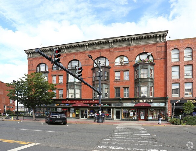
608 Main St, Portland, CT 06480


Property Detail
608 Main St
Notresolvable
Lower Ct River Vly
R10
Connecticut
B and X Area of moderate flood hazard, usually the area between the limits of the 100-year and 500-year floods.
0.48 AC
2024
NW Middlesex/Middletown
2025
Hartford
560200
Hartford-West Hartford-East Hartford, CT
3,015 SF
PORT-000057-000000-000089
NEARBY LISTINGS FOR SALE OR LEASE
DEMOGRAPHICS near 608 Main St
1 mile
3 mile
5 mile
2025 Total Population
10,838
43,372
73,149
2030 Population
10,869
43,616
73,531
Pop Growth 2025-2030
+ 0.29%
+ 0.56%
+ 0.52%
Average Age
37
42
42
2025 Total Households
4,187
17,448
30,472
HH Growth 2025-2030
+ 0.10%
+ 0.45%
+ 0.45%
Median Household Inc
$39,241
$73,028
$83,193
Avg Household Size
2.00
2.20
2.20
2025 Avg HH Vehicles
1.00
2.00
2.00
Median Home Value
$235,810
$294,112
$321,780
Median Year Built
1947
1960
1972
Nearby Places
Map Layers
Map Styles
 Street
 Aerial
Layers
 Traffic
 Biking
Places
Listings with unknown addresses are not visible on the map
- Restaurants
- Banks
- Shops
- Fitness
- Groceries
PUBLIC TRANSPORTATION
AIRPORT
Bradley International
Drive
Walk
Distance
Bradley International
55 min
31.7 mi
Tweed/New Haven
Drive
Walk
Distance
Tweed/New Haven
47 min
32.8 mi
Freight Ports
Port of New Haven
Drive
Walk
Distance
Port of New Haven
43 min
30.5 mi
Nearby Properties
Address
Land Use
TOTAL SIZE
Lot Size
Zoning
Address
Land Use
TOTAL SIZE
Lot Size
Zoning
32 AC
R-45
Address
Land Use
TOTAL SIZE
Lot Size
Zoning
65.89 AC
R-45
Address
Land Use
TOTAL SIZE
Lot Size
Zoning
105 AC
R-45
Address
Land Use
TOTAL SIZE
Lot Size
Zoning
33,524 SF
37.71 AC
ID
Address
Land Use
TOTAL SIZE
Lot Size
Zoning
0.56 AC
B-1
Address
Land Use
TOTAL SIZE
Lot Size
Zoning
27.21 AC
M
Address
Land Use
TOTAL SIZE
Lot Size
Zoning
10.10 AC
IND
Address
Land Use
TOTAL SIZE
Lot Size
Zoning
24.45 AC
HB
Address
Land Use
TOTAL SIZE
Lot Size
Zoning
102,239 SF
1.02 AC
B-1
Address
Land Use
TOTAL SIZE
Lot Size
Zoning
161,959 SF
45.61 AC
R-25
Address
Land Use
TOTAL SIZE
Lot Size
Zoning
15,395 SF
158.10 AC
R-25
Address
Land Use
TOTAL SIZE
Lot Size
Zoning
88,369 SF
26 AC
R-15
Address
Land Use
TOTAL SIZE
Lot Size
Zoning
80,627 SF
10.54 AC
HB
Address
Land Use
TOTAL SIZE
Lot Size
Zoning
146.96 AC
IND
Address
Land Use
TOTAL SIZE
Lot Size
Zoning
37.25 AC
R-25
Address
Land Use
TOTAL SIZE
Lot Size
Zoning
177,765 SF
1.10 AC
B-1
Address
Land Use
TOTAL SIZE
Lot Size
Zoning
58,398 SF
4.80 AC
R-15
Address
Land Use
TOTAL SIZE
Lot Size
Zoning
32,640 SF
1.80 AC
B-1
Address
Land Use
TOTAL SIZE
Lot Size
Zoning
19,258 SF
1.11 AC
IRA
Address
Land Use
TOTAL SIZE
Lot Size
Zoning
26,736 SF
0.46 AC
MXC
Address
Land Use
TOTAL SIZE
Lot Size
Zoning
16.54 AC
R-25
Address
Land Use
TOTAL SIZE
Lot Size
Zoning
83,171 SF
6.33 AC
R-15
Address
Land Use
TOTAL SIZE
Lot Size
Zoning
12.02 AC
M
Address
Land Use
TOTAL SIZE
Lot Size
Zoning
35,866 SF
1.61 AC
B-1
Address
Land Use
TOTAL SIZE
Lot Size
Zoning
70,406 SF
0.73 AC
B-1
Address
Land Use
TOTAL SIZE
Lot Size
Zoning
94,097 SF
2.22 AC
B-1
Address
Land Use
TOTAL SIZE
Lot Size
Zoning
40,327 SF
4.16 AC
M
Address
Land Use
TOTAL SIZE
Lot Size
Zoning
53,415 SF
1.48 AC
MXC
Address
Land Use
TOTAL SIZE
Lot Size
Zoning
81,805 SF
65.10 AC
R-15
Address
Land Use
TOTAL SIZE
Lot Size
Zoning
40.82 AC
R15
The World's #1 Commercial Real Estate Marketplace
Connect with us
© 2026 CoStar Group
The information above has been obtained from sources believed reliable. While we do not doubt its accuracy we have not verified it and make no guarantee, warranty or representation about it. It is your responsibility to independently confirm its accuracy and completeness. Any projections, opinions, assumptions, or estimates used are for example only and do not represent the current or future performance of the property. The value of this transaction to you depends on tax and other factors which should be evaluated by your tax, financial, and legal advisors. You and your advisors should conduct a careful, independent investigation of the property to determine to your satisfaction the suitability of the property for your needs.