Property Record
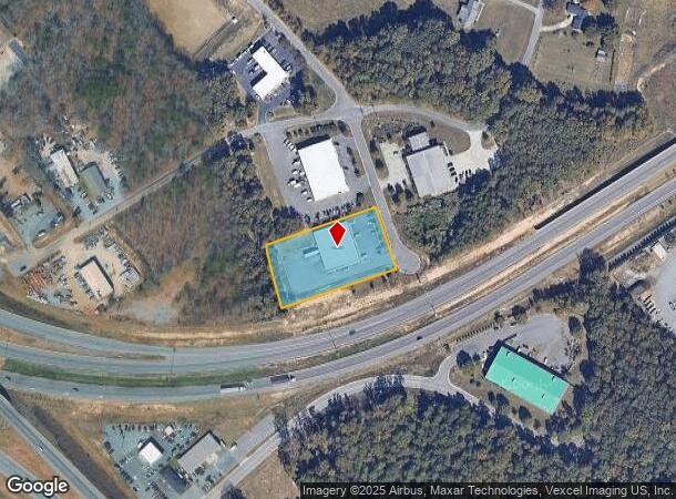
608 Union West Blvd, Matthews, NC 28104


NEARBY LISTINGS FOR SALE OR LEASE
Property Detail
608 Union West Blvd
07-102-296-A
Union West Business
Publicstorage
#22 UNION WEST BUSINESS PK PH3 OPCI-315
X
Union
3710540900J
North Carolina
2025
1.46 AC
2025
Union County
020312
Charlotte
12,000 SF
Charlotte-Concord-Gastonia, NC-SC
DEMOGRAPHICS near 608 Union West Blvd
1 Mile
3 Mile
5 Mile
2024 Total Population
2,281
46,454
121,722
2029 Population
2,613
51,555
133,861
Pop Growth 2024-2029
+ 14.56%
+ 10.98%
+ 9.97%
Average Age
39
40
40
2024 Total Households
858
16,901
43,602
HH Growth 2024-2029
+ 14.80%
+ 11.18%
+ 10.08%
Median Household Inc
$67,913
$85,103
$95,040
Avg Household Size
2.70
2.70
2.80
2024 Avg HH Vehicles
2.00
2.00
2.00
Median Home Value
$266,999
$296,655
$330,946
Median Year Built
1993
1998
1999
Nearby Places
Map Layers
Map Styles
 Street
 Aerial
- Restaurants
- Banks
- Shops
- Fitness
- Groceries
PUBLIC TRANSPORTATION
AIRPORT
Charlotte/Douglas International
DRIVE
WALK
Distance
Charlotte/Douglas International
38 min
22.3 mi
Concord-Padgett Regional
DRIVE
WALK
Distance
Concord-Padgett Regional
37 min
26.6 mi
Nearby Properties
Address
Land Use
TOTAL SIZE
Lot Size
Zoning
Address
Land Use
TOTAL SIZE
Lot Size
Zoning
12.30 AC
SF-1 INDIA
Address
Land Use
TOTAL SIZE
Lot Size
Zoning
262,337 SF
7.35 AC
Address
Land Use
TOTAL SIZE
Lot Size
Zoning
282,922 SF
47.76 AC
R4
Address
Land Use
TOTAL SIZE
Lot Size
Zoning
269,164 SF
18.57 AC
Address
Land Use
TOTAL SIZE
Lot Size
Zoning
18.05 AC
CBD INDIAN
Address
Land Use
TOTAL SIZE
Lot Size
Zoning
281,872 SF
37.85 AC
R12CD
Address
Land Use
TOTAL SIZE
Lot Size
Zoning
274,215 SF
17.50 AC
O9CD
Address
Land Use
TOTAL SIZE
Lot Size
Zoning
8,446 SF
16.89 AC
MFR INDIAN
Address
Land Use
TOTAL SIZE
Lot Size
Zoning
241,703 SF
17.43 AC
R12MFCD
Address
Land Use
TOTAL SIZE
Lot Size
Zoning
174,834 SF
2.51 AC
Address
Land Use
TOTAL SIZE
Lot Size
Zoning
27,900 SF
15.59 AC
MFR INDIAN
Address
Land Use
TOTAL SIZE
Lot Size
Zoning
227,659 SF
26.46 AC
MFR INDIAN
Address
Land Use
TOTAL SIZE
Lot Size
Zoning
2,062 SF
105.82 AC
B-1SCD
Address
Land Use
TOTAL SIZE
Lot Size
Zoning
158,321 SF
9.20 AC
Address
Land Use
TOTAL SIZE
Lot Size
Zoning
498,729 SF
78.21 AC
RBD INDIAN
Address
Land Use
TOTAL SIZE
Lot Size
Zoning
8.82 AC
R-20 STALL
Address
Land Use
TOTAL SIZE
Lot Size
Zoning
75,923 SF
7.29 AC
SF-1 INDIA
Address
Land Use
TOTAL SIZE
Lot Size
Zoning
93,040 SF
16.57 AC
GR STALLIN
Address
Land Use
TOTAL SIZE
Lot Size
Zoning
209,960 SF
26.64 AC
RBD INDIAN
Address
Land Use
TOTAL SIZE
Lot Size
Zoning
15,539 SF
50.79 AC
Address
Land Use
TOTAL SIZE
Lot Size
Zoning
96,456 SF
34.88 AC
R-20 STALL
Address
Land Use
TOTAL SIZE
Lot Size
Zoning
86,960 SF
14.13 AC
SF-1 INDIA
Address
Land Use
TOTAL SIZE
Lot Size
Zoning
88,318 SF
12.10 AC
O(CD)
Address
Land Use
TOTAL SIZE
Lot Size
Zoning
45.21 AC
RBD INDIAN
Address
Land Use
TOTAL SIZE
Lot Size
Zoning
74,111 SF
8.14 AC
R12CD
Address
Land Use
TOTAL SIZE
Lot Size
Zoning
232,678 SF
63 AC
RBD INDIAN
Address
Land Use
TOTAL SIZE
Lot Size
Zoning
45,053 SF
15.03 AC
RBD INDIAN
Address
Land Use
TOTAL SIZE
Lot Size
Zoning
139,072 SF
13.02 AC
B-1SCD
Address
Land Use
TOTAL SIZE
Lot Size
Zoning
15.33 AC
Address
Land Use
TOTAL SIZE
Lot Size
Zoning
47,362 SF
13.59 AC
NBD INDIAN
The World's #1 Commercial Real Estate Marketplace
Connect with us
© 2025 CoStar Group
The information above has been obtained from sources believed reliable. While we do not doubt its accuracy we have not verified it and make no guarantee, warranty or representation about it. It is your responsibility to independently confirm its accuracy and completeness. Any projections, opinions, assumptions, or estimates used are for example only and do not represent the current or future performance of the property. The value of this transaction to you depends on tax and other factors which should be evaluated by your tax, financial, and legal advisors. You and your advisors should conduct a careful, independent investigation of the property to determine to your satisfaction the suitability of the property for your needs.