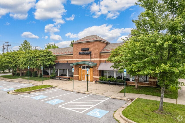
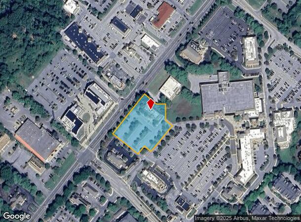
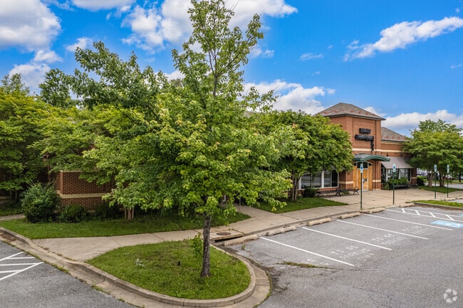
Property Record
6080 Daybreak Cir, Clarksville, MD 21029
NEARBY LISTINGS FOR SALE OR LEASE
Property Detail
6080 Daybreak Cir
Baltimore-Columbia-Towson, MD
Village River Hill
15-137045
PAR W2 1.7029 A 6080 DAYBREAK CIR VILL RIVER HILL S4 A2 RS
Restaurantbuilding
Howard
X
Maryland
24027C0130D
w 2
2024
1.70 AC
2025
Downtown Columbia
605505
Baltimore
5,629 SF
DEMOGRAPHICS near 6080 Daybreak Cir
1 Mile
3 Mile
5 Mile
2024 Total Population
5,058
34,939
91,270
2029 Population
5,154
35,916
93,765
Pop Growth 2024-2029
+ 1.90%
+ 2.80%
+ 2.73%
Average Age
40
41
41
2024 Total Households
1,560
12,118
33,764
HH Growth 2024-2029
+ 1.86%
+ 2.84%
+ 2.84%
Median Household Inc
$234,746
$158,446
$140,619
Avg Household Size
3.20
2.80
2.70
2024 Avg HH Vehicles
3.00
2.00
2.00
Median Home Value
$749,554
$717,246
$642,938
Median Year Built
2000
1988
1985
Nearby Places
Map Layers
Map Styles
 Street
 Aerial
- Restaurants
- Banks
- Shops
- Fitness
- Groceries
PUBLIC TRANSPORTATION
AIRPORT
Baltimore/Washington International Thurgood Marshall
DRIVE
WALK
Distance
Baltimore/Washington International Thurgood Marshall
29 min
20.7 mi
Ronald Reagan Washington Ntl
DRIVE
WALK
Distance
Ronald Reagan Washington Ntl
52 min
31.9 mi
Freight Ports
Port of Baltimore
DRIVE
WALK
Distance
Port of Baltimore
34 min
23.5 mi
Nearby Properties
Address
Land Use
TOTAL SIZE
Lot Size
Zoning
Address
Land Use
TOTAL SIZE
Lot Size
Zoning
51,405 SF
29.14 AC
NT
Address
Land Use
TOTAL SIZE
Lot Size
Zoning
163,814 SF
6.41 AC
NT
Address
Land Use
TOTAL SIZE
Lot Size
Zoning
34,368 SF
54.80 AC
PEC
Address
Land Use
TOTAL SIZE
Lot Size
Zoning
243,836 SF
65.29 AC
NT
Address
Land Use
TOTAL SIZE
Lot Size
Zoning
17,880 SF
11.40 AC
NT
Address
Land Use
TOTAL SIZE
Lot Size
Zoning
19,253 SF
17.97 AC
RRDEO
Address
Land Use
TOTAL SIZE
Lot Size
Zoning
32,898 SF
10.13 AC
NT
Address
Land Use
TOTAL SIZE
Lot Size
Zoning
23,139 SF
11 AC
NT
Address
Land Use
TOTAL SIZE
Lot Size
Zoning
24,894 SF
10.42 AC
NT
Address
Land Use
TOTAL SIZE
Lot Size
Zoning
23,760 SF
8.89 AC
NT
Address
Land Use
TOTAL SIZE
Lot Size
Zoning
6,968 SF
11.74 AC
NT
Address
Land Use
TOTAL SIZE
Lot Size
Zoning
14,478 SF
12.73 AC
NT
Address
Land Use
TOTAL SIZE
Lot Size
Zoning
52,460 SF
15.93 AC
R20
Address
Land Use
TOTAL SIZE
Lot Size
Zoning
79,710 SF
30.67 AC
NT
Address
Land Use
TOTAL SIZE
Lot Size
Zoning
82,960 SF
15.40 AC
NT
Address
Land Use
TOTAL SIZE
Lot Size
Zoning
27,450 SF
10.31 AC
NT
Address
Land Use
TOTAL SIZE
Lot Size
Zoning
60,000 SF
4.25 AC
NT
Address
Land Use
TOTAL SIZE
Lot Size
Zoning
35,355 SF
11.38 AC
NT
Address
Land Use
TOTAL SIZE
Lot Size
Zoning
34.48 AC
B 2
Address
Land Use
TOTAL SIZE
Lot Size
Zoning
28,782 SF
12.04 AC
NT
Address
Land Use
TOTAL SIZE
Lot Size
Zoning
140,191 SF
4.52 AC
NT
Address
Land Use
TOTAL SIZE
Lot Size
Zoning
49,968 SF
39.74 AC
RCDEO
Address
Land Use
TOTAL SIZE
Lot Size
Zoning
84,260 SF
9.89 AC
NT
Address
Land Use
TOTAL SIZE
Lot Size
Zoning
3,260 SF
8.78 AC
B2
Address
Land Use
TOTAL SIZE
Lot Size
Zoning
59,549 SF
10.69 AC
R20
Address
Land Use
TOTAL SIZE
Lot Size
Zoning
160,200 SF
12.28 AC
POR
Address
Land Use
TOTAL SIZE
Lot Size
Zoning
27,564 SF
7.60 AC
B1
Address
Land Use
TOTAL SIZE
Lot Size
Zoning
13,272 SF
3.33 AC
B2
Address
Land Use
TOTAL SIZE
Lot Size
Zoning
24,580 SF
18.39 AC
RED
Address
Land Use
TOTAL SIZE
Lot Size
Zoning
39,008 SF
7.01 AC
B2
The World's #1 Commercial Real Estate Marketplace
Connect with us
© 2025 CoStar Group
The information above has been obtained from sources believed reliable. While we do not doubt its accuracy we have not verified it and make no guarantee, warranty or representation about it. It is your responsibility to independently confirm its accuracy and completeness. Any projections, opinions, assumptions, or estimates used are for example only and do not represent the current or future performance of the property. The value of this transaction to you depends on tax and other factors which should be evaluated by your tax, financial, and legal advisors. You and your advisors should conduct a careful, independent investigation of the property to determine to your satisfaction the suitability of the property for your needs.