Property Record
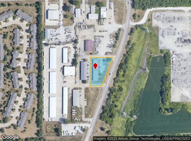
6080 Nw Beaver Dr, Johnston, IA 50131


NEARBY LISTINGS FOR SALE OR LEASE
Property Detail
6080 Nw Beaver Dr
Des Moines-West Des Moines, IA
Johnston Industrial Park
241-00747500101
LOT 1 JOHNSTON INDUSTRIAL PARK
Warehouse
Polk
X
Iowa
19153C0195F
1
2024
1 AC
2025
Western Suburbs
011702
Des Moines
8,000 SF
DEMOGRAPHICS near 6080 Nw Beaver Dr
1 Mile
3 Mile
5 Mile
2024 Total Population
4,149
35,553
147,362
2029 Population
4,337
36,738
152,943
Pop Growth 2024-2029
+ 4.53%
+ 3.33%
+ 3.79%
Average Age
39
39
38
2024 Total Households
1,665
14,056
58,128
HH Growth 2024-2029
+ 4.92%
+ 3.61%
+ 3.93%
Median Household Inc
$79,129
$81,935
$77,921
Avg Household Size
2.50
2.50
2.40
2024 Avg HH Vehicles
2.00
2.00
2.00
Median Home Value
$260,109
$247,816
$232,300
Median Year Built
2001
1985
1977
Nearby Places
Map Layers
Map Styles
 Street
 Aerial
- Restaurants
- Banks
- Shops
- Fitness
- Groceries
PUBLIC TRANSPORTATION
AIRPORT
Des Moines International
DRIVE
WALK
Distance
Des Moines International
24 min
11.7 mi
Freight Ports
Port Milwaukee
DRIVE
WALK
Distance
Port Milwaukee
419 min
376.2 mi
Nearby Properties
Address
Land Use
TOTAL SIZE
Lot Size
Zoning
Address
Land Use
TOTAL SIZE
Lot Size
Zoning
627,104 SF
40.09 AC
Address
Land Use
TOTAL SIZE
Lot Size
Zoning
197,658 SF
15.91 AC
Address
Land Use
TOTAL SIZE
Lot Size
Zoning
184,658 SF
14.61 AC
Address
Land Use
TOTAL SIZE
Lot Size
Zoning
166,160 SF
11.88 AC
Address
Land Use
TOTAL SIZE
Lot Size
Zoning
287,228 SF
27.32 AC
A-R
Address
Land Use
TOTAL SIZE
Lot Size
Zoning
307,734 SF
23.59 AC
R-3
Address
Land Use
TOTAL SIZE
Lot Size
Zoning
71,938 SF
8.23 AC
C-O
Address
Land Use
TOTAL SIZE
Lot Size
Zoning
101,592 SF
7.79 AC
PUD
Address
Land Use
TOTAL SIZE
Lot Size
Zoning
386,236 SF
9.62 AC
C-4
Address
Land Use
TOTAL SIZE
Lot Size
Zoning
141,377 SF
3.16 AC
Address
Land Use
TOTAL SIZE
Lot Size
Zoning
363,736 SF
25.79 AC
M-1
Address
Land Use
TOTAL SIZE
Lot Size
Zoning
188,453 SF
14.20 AC
R-3
Address
Land Use
TOTAL SIZE
Lot Size
Zoning
146,025 SF
9.59 AC
PUD
Address
Land Use
TOTAL SIZE
Lot Size
Zoning
223,876 SF
15.01 AC
Address
Land Use
TOTAL SIZE
Lot Size
Zoning
143,831 SF
16.12 AC
PUD
Address
Land Use
TOTAL SIZE
Lot Size
Zoning
56,478 SF
5.86 AC
Address
Land Use
TOTAL SIZE
Lot Size
Zoning
158,256 SF
8.87 AC
R-3
Address
Land Use
TOTAL SIZE
Lot Size
Zoning
130,686 SF
1.23 AC
Address
Land Use
TOTAL SIZE
Lot Size
Zoning
203,062 SF
17.82 AC
C-2
Address
Land Use
TOTAL SIZE
Lot Size
Zoning
92,392 SF
12.40 AC
C-2
Address
Land Use
TOTAL SIZE
Lot Size
Zoning
140,163 SF
5.87 AC
PUD
Address
Land Use
TOTAL SIZE
Lot Size
Zoning
95,400 SF
4.40 AC
PUD
Address
Land Use
TOTAL SIZE
Lot Size
Zoning
53,827 SF
5.72 AC
Address
Land Use
TOTAL SIZE
Lot Size
Zoning
292,167 SF
9.53 AC
C-4
Address
Land Use
TOTAL SIZE
Lot Size
Zoning
80,559 SF
4.50 AC
Address
Land Use
TOTAL SIZE
Lot Size
Zoning
84,941 SF
2.66 AC
Address
Land Use
TOTAL SIZE
Lot Size
Zoning
51,170 SF
7.86 AC
C-2
Address
Land Use
TOTAL SIZE
Lot Size
Zoning
139,947 SF
7.21 AC
R-4
Address
Land Use
TOTAL SIZE
Lot Size
Zoning
65,592 SF
7.48 AC
A-2
Address
Land Use
TOTAL SIZE
Lot Size
Zoning
39,312 SF
13.08 AC
The World's #1 Commercial Real Estate Marketplace
Connect with us
© 2025 CoStar Group
The information above has been obtained from sources believed reliable. While we do not doubt its accuracy we have not verified it and make no guarantee, warranty or representation about it. It is your responsibility to independently confirm its accuracy and completeness. Any projections, opinions, assumptions, or estimates used are for example only and do not represent the current or future performance of the property. The value of this transaction to you depends on tax and other factors which should be evaluated by your tax, financial, and legal advisors. You and your advisors should conduct a careful, independent investigation of the property to determine to your satisfaction the suitability of the property for your needs.