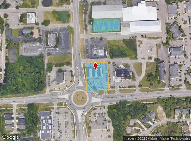
Property Record
6080 W Maple Rd, West Bloomfield, MI 48322

NEARBY LISTINGS FOR SALE OR LEASE
Property Detail
6080 W Maple Rd
18-27-351-020
T2N, R9E, SEC 27 PART OF SW 1/4 BEG AT PT DIST N 89-04-30 E 60 FT & N 00-30-20 W 60 FT FROM SW SEC COR, TH N 00-30-20 W 260.00 FT, TH N 89-04-30 E 201.25 FT, TH S 00-30-20 E 260.00 FT, TH S 89-04-30 W 201.25 FT TO BEG 1.20 A
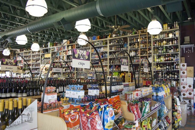
Stripcommercialcenter
Oakland
X
Michigan
26125C0492F
1.20 AC
2024
Bloomfield West
2025
Detroit
157900
Detroit-Warren-Dearborn, MI
10,877 SF
DEMOGRAPHICS near 6080 W Maple Rd
1 mile
3 mile
5 mile
2024 Total Population
10,728
66,550
156,057
2029 Population
10,643
65,853
154,689
Pop Growth 2024-2029
(0.79%)
(1.05%)
(0.88%)
Average Age
45
45
45
2024 Total Households
4,197
25,757
62,827
HH Growth 2024-2029
(0.62%)
(0.94%)
(0.76%)
Median Household Inc
$114,255
$114,242
$107,809
Avg Household Size
2.50
2.50
2.40
2024 Avg HH Vehicles
2.00
2.00
2.00
Median Home Value
$360,407
$362,206
$365,705
Median Year Built
1982
1979
1980
Nearby Places
Map Layers
Map Styles
 Street
 Aerial
Transit
 Traffic
 Biking
Places
Listings with unknown addresses are not visible on the map
- Restaurants
- Banks
- Shops
- Fitness
- Groceries
PUBLIC TRANSPORTATION
AIRPORT
Detroit City
Drive
Walk
Distance
Detroit City
37 min
24.3 mi
Detroit Metro Wayne County
Drive
Walk
Distance
Detroit Metro Wayne County
36 min
33.2 mi
Freight Ports
Port of Baltimore
Drive
Walk
Distance
Port of Baltimore
1 min
420.3 mi
SALE & LEASE HISTORY
LISTING DATE
SALE/LEASE

Sep 05, 2017
For Sale
Sep 01, 2017
For Sale
Nov 07, 2016
For Lease
Aug 31, 2017
For Sale
Aug 10, 2017
For Sale
Aug 10, 2017
For Lease
Nearby Properties
Address
Land Use
TOTAL SIZE
Lot Size
Zoning
Address
Land Use
TOTAL SIZE
Lot Size
Zoning
308,191 SF
51.47 AC
RI
Address
Land Use
TOTAL SIZE
Lot Size
Zoning
308,794 SF
76.30 AC
RI
Address
Land Use
TOTAL SIZE
Lot Size
Zoning
659,897 SF
53.96 AC
AI
Address
Land Use
TOTAL SIZE
Lot Size
Zoning
45,893 SF
5.62 AC
AI
Address
Land Use
TOTAL SIZE
Lot Size
Zoning
115,964 SF
29.91 AC
RI
Address
Land Use
TOTAL SIZE
Lot Size
Zoning
116,086 SF
41.61 AC
RI
Address
Land Use
TOTAL SIZE
Lot Size
Zoning
121,382 SF
10.84 AC
BI
Address
Land Use
TOTAL SIZE
Lot Size
Zoning
110,341 SF
99 AC
RI
Address
Land Use
TOTAL SIZE
Lot Size
Zoning
Address
Land Use
TOTAL SIZE
Lot Size
Zoning
427,062 SF
31.20 AC
AI
Address
Land Use
TOTAL SIZE
Lot Size
Zoning
411,118 SF
43.95 AC
AI
Address
Land Use
TOTAL SIZE
Lot Size
Zoning
75,146 SF
41.22 AC
RI
Address
Land Use
TOTAL SIZE
Lot Size
Zoning
315,206 SF
3.85 AC
AI
Address
Land Use
TOTAL SIZE
Lot Size
Zoning
204,652 SF
9.62 AC
BI
Address
Land Use
TOTAL SIZE
Lot Size
Zoning
367,354 SF
62.73 AC
AI
Address
Land Use
TOTAL SIZE
Lot Size
Zoning
74,297 SF
13 AC
RI
Address
Land Use
TOTAL SIZE
Lot Size
Zoning
82,517 SF
26.39 AC
RI
Address
Land Use
TOTAL SIZE
Lot Size
Zoning
271,650 SF
12.88 AC
BI
Address
Land Use
TOTAL SIZE
Lot Size
Zoning
352,098 SF
28.94 AC
BI
Address
Land Use
TOTAL SIZE
Lot Size
Zoning
269,975 SF
23.88 AC
AI
Address
Land Use
TOTAL SIZE
Lot Size
Zoning
Address
Land Use
TOTAL SIZE
Lot Size
Zoning
61,880 SF
18.62 AC
RI
Address
Land Use
TOTAL SIZE
Lot Size
Zoning
246,695 SF
18.46 AC
BI
Address
Land Use
TOTAL SIZE
Lot Size
Zoning
59,857 SF
16.64 AC
RI
Address
Land Use
TOTAL SIZE
Lot Size
Zoning
260,330 SF
21.04 AC
AI
Address
Land Use
TOTAL SIZE
Lot Size
Zoning
276,825 SF
19.05 AC
AI
Address
Land Use
TOTAL SIZE
Lot Size
Zoning
142,043 SF
17.87 AC
AI
Address
Land Use
TOTAL SIZE
Lot Size
Zoning
158,279 SF
3.63 AC
BI
Address
Land Use
TOTAL SIZE
Lot Size
Zoning
244,500 SF
7.80 AC
AI
Address
Land Use
TOTAL SIZE
Lot Size
Zoning
46,541 SF
41.57 AC
RI
The World's #1 Commercial Real Estate Marketplace
Connect with us
© 2026 CoStar Group
The information above has been obtained from sources believed reliable. While we do not doubt its accuracy we have not verified it and make no guarantee, warranty or representation about it. It is your responsibility to independently confirm its accuracy and completeness. Any projections, opinions, assumptions, or estimates used are for example only and do not represent the current or future performance of the property. The value of this transaction to you depends on tax and other factors which should be evaluated by your tax, financial, and legal advisors. You and your advisors should conduct a careful, independent investigation of the property to determine to your satisfaction the suitability of the property for your needs.