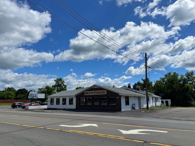
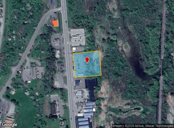
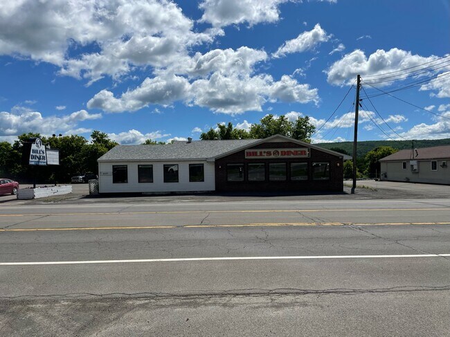
Property Record
6082 State Highway 12, Norwich, NY 13815
NEARBY LISTINGS FOR SALE OR LEASE
Property Detail
6082 State Highway 12
Restaurantbuilding
Chenango
AE
New York
36017C0242E
26.000
2025
1.50 AC
2024
New York Southeast Area
970601
Other Market Areas
162 SF
084200-123-000-0001-026-000-0000
DEMOGRAPHICS near 6082 State Highway 12
1 Mile
3 Mile
5 Mile
2024 Total Population
4,309
9,822
12,258
2029 Population
4,208
9,584
11,976
Pop Growth 2024-2029
(2.34%)
(2.42%)
(2.30%)
Average Age
43
43
43
2024 Total Households
1,872
4,244
5,229
HH Growth 2024-2029
(2.40%)
(2.47%)
(2.33%)
Median Household Inc
$41,918
$50,885
$54,479
Avg Household Size
2.10
2.20
2.20
2024 Avg HH Vehicles
1.00
1.00
2.00
Median Home Value
$128,475
$118,084
$120,078
Median Year Built
1955
1953
1958
Nearby Places
- Restaurants
- Banks
- Shops
- Fitness
- Groceries
SALE & LEASE HISTORY
LISTING DATE
SALE/LEASE

Apr 03, 2023
For Lease
Nearby Properties
Address
Land Use
TOTAL SIZE
Lot Size
Zoning
Address
Land Use
TOTAL SIZE
Lot Size
Zoning
158,396 SF
12.24 AC
05 - COMME
Address
Land Use
TOTAL SIZE
Lot Size
Zoning
21.58 AC
Address
Land Use
TOTAL SIZE
Lot Size
Zoning
2,241 SF
170 AC
03 - MULTI
Address
Land Use
TOTAL SIZE
Lot Size
Zoning
154,303 SF
70.66 AC
Address
Land Use
TOTAL SIZE
Lot Size
Zoning
80.41 AC
Address
Land Use
TOTAL SIZE
Lot Size
Zoning
73,283 SF
12.86 AC
Address
Land Use
TOTAL SIZE
Lot Size
Zoning
36,280 SF
0.92 AC
Address
Land Use
TOTAL SIZE
Lot Size
Zoning
61,400 SF
25.50 AC
Address
Land Use
TOTAL SIZE
Lot Size
Zoning
0.01 AC
Address
Land Use
TOTAL SIZE
Lot Size
Zoning
72,160 SF
7.30 AC
Address
Land Use
TOTAL SIZE
Lot Size
Zoning
67,690 SF
3.56 AC
05 - COMME
Address
Land Use
TOTAL SIZE
Lot Size
Zoning
53,109 SF
2.40 AC
Address
Land Use
TOTAL SIZE
Lot Size
Zoning
18.44 AC
Address
Land Use
TOTAL SIZE
Lot Size
Zoning
15,164 SF
7.45 AC
05 - COMME
Address
Land Use
TOTAL SIZE
Lot Size
Zoning
3,304 SF
0.08 AC
06 - INDUS
Address
Land Use
TOTAL SIZE
Lot Size
Zoning
Address
Land Use
TOTAL SIZE
Lot Size
Zoning
15.54 AC
Address
Land Use
TOTAL SIZE
Lot Size
Zoning
65,407 SF
8.32 AC
Address
Land Use
TOTAL SIZE
Lot Size
Zoning
19,252 SF
2.03 AC
Address
Land Use
TOTAL SIZE
Lot Size
Zoning
5,614 SF
0.95 AC
05 - COMME
Address
Land Use
TOTAL SIZE
Lot Size
Zoning
32,600 SF
4.54 AC
Address
Land Use
TOTAL SIZE
Lot Size
Zoning
23,002 SF
1.42 AC
Address
Land Use
TOTAL SIZE
Lot Size
Zoning
16,158 SF
3.44 AC
Address
Land Use
TOTAL SIZE
Lot Size
Zoning
1,680 SF
10.30 AC
Address
Land Use
TOTAL SIZE
Lot Size
Zoning
413 SF
19.37 AC
Address
Land Use
TOTAL SIZE
Lot Size
Zoning
16,240 SF
0.44 AC
Address
Land Use
TOTAL SIZE
Lot Size
Zoning
317 SF
34.22 AC
Address
Land Use
TOTAL SIZE
Lot Size
Zoning
31,814 SF
2.37 AC
Address
Land Use
TOTAL SIZE
Lot Size
Zoning
7,231 SF
3.59 AC
Address
Land Use
TOTAL SIZE
Lot Size
Zoning
6,136 SF
4.57 AC
The World's #1 Commercial Real Estate Marketplace
Connect with us
© 2025 CoStar Group
The information above has been obtained from sources believed reliable. While we do not doubt its accuracy we have not verified it and make no guarantee, warranty or representation about it. It is your responsibility to independently confirm its accuracy and completeness. Any projections, opinions, assumptions, or estimates used are for example only and do not represent the current or future performance of the property. The value of this transaction to you depends on tax and other factors which should be evaluated by your tax, financial, and legal advisors. You and your advisors should conduct a careful, independent investigation of the property to determine to your satisfaction the suitability of the property for your needs.