Property Record
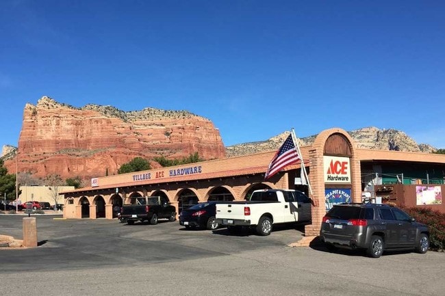
6085 State Route 179, Sedona, AZ 86351

NEARBY LISTINGS FOR SALE OR LEASE
-
-
View all Sedona listings for sale on LoopNet.com
Property Detail
6085 State Route 179
405-33-312
Bell Rock Vista Sub
Storemultistory
BELL ROCK VISTA SUB TRACT B
X
Yavapai
04005C7670G
Arizona
2024
b
2026
0.51 AC
001703
Other Market Areas
6,844 SF
Prescott, AZ
DEMOGRAPHICS near 6085 State Route 179
1 Mile
3 Mile
5 Mile
2024 Total Population
4,652
8,430
10,649
2029 Population
5,272
9,527
11,927
Pop Growth 2024-2029
+ 13.33%
+ 13.01%
+ 12.00%
Average Age
58
60
59
2024 Total Households
2,503
4,418
5,542
HH Growth 2024-2029
+ 13.82%
+ 13.49%
+ 12.32%
Median Household Inc
$65,197
$70,064
$70,287
Avg Household Size
1.80
1.80
1.90
2024 Avg HH Vehicles
2.00
2.00
2.00
Median Home Value
$544,083
$607,899
$638,569
Median Year Built
1991
1993
1992
Nearby Places
Map Layers
Map Styles
 Street
 Aerial
- Restaurants
- Banks
- Shops
- Fitness
- Groceries
PUBLIC TRANSPORTATION
AIRPORT
Flagstaff Pulliam
DRIVE
WALK
Distance
Flagstaff Pulliam
55 min
47.5 mi
Nearby Properties
Address
Land Use
TOTAL SIZE
Lot Size
Zoning
Address
Land Use
TOTAL SIZE
Lot Size
Zoning
180,457 SF
7.42 AC
Address
Land Use
TOTAL SIZE
Lot Size
Zoning
305,420 SF
0.88 AC
CMX4
Address
Land Use
TOTAL SIZE
Lot Size
Zoning
77,290 SF
2.48 AC
Address
Land Use
TOTAL SIZE
Lot Size
Zoning
91,167 SF
7.85 AC
Address
Land Use
TOTAL SIZE
Lot Size
Zoning
69,712 SF
20.80 AC
Address
Land Use
TOTAL SIZE
Lot Size
Zoning
97,769 SF
85.56 AC
Address
Land Use
TOTAL SIZE
Lot Size
Zoning
59,391 SF
4.84 AC
Address
Land Use
TOTAL SIZE
Lot Size
Zoning
53,549 SF
6.52 AC
Address
Land Use
TOTAL SIZE
Lot Size
Zoning
28,387 SF
2.77 AC
Address
Land Use
TOTAL SIZE
Lot Size
Zoning
47,315 SF
2.03 AC
Address
Land Use
TOTAL SIZE
Lot Size
Zoning
21,201 SF
2.83 AC
Address
Land Use
TOTAL SIZE
Lot Size
Zoning
42,467 SF
7.55 AC
Address
Land Use
TOTAL SIZE
Lot Size
Zoning
23,505 SF
3.39 AC
Address
Land Use
TOTAL SIZE
Lot Size
Zoning
24,479 SF
1.48 AC
Address
Land Use
TOTAL SIZE
Lot Size
Zoning
15,596 SF
1.63 AC
Address
Land Use
TOTAL SIZE
Lot Size
Zoning
13,076 SF
9.15 AC
Address
Land Use
TOTAL SIZE
Lot Size
Zoning
18,490 SF
1.13 AC
Address
Land Use
TOTAL SIZE
Lot Size
Zoning
10,312 SF
2.05 AC
Address
Land Use
TOTAL SIZE
Lot Size
Zoning
17,343 SF
0.93 AC
Address
Land Use
TOTAL SIZE
Lot Size
Zoning
15,826 SF
0.46 AC
Address
Land Use
TOTAL SIZE
Lot Size
Zoning
27,328 SF
0.63 AC
Address
Land Use
TOTAL SIZE
Lot Size
Zoning
17,164 SF
0.78 AC
Address
Land Use
TOTAL SIZE
Lot Size
Zoning
18,080 SF
1.13 AC
Address
Land Use
TOTAL SIZE
Lot Size
Zoning
7,481 SF
1 AC
Address
Land Use
TOTAL SIZE
Lot Size
Zoning
7,764 SF
0.31 AC
Address
Land Use
TOTAL SIZE
Lot Size
Zoning
3,697 SF
1.71 AC
Address
Land Use
TOTAL SIZE
Lot Size
Zoning
Address
Land Use
TOTAL SIZE
Lot Size
Zoning
10,973 SF
0.51 AC
Address
Land Use
TOTAL SIZE
Lot Size
Zoning
9,248 SF
30.60 AC
Address
Land Use
TOTAL SIZE
Lot Size
Zoning
29,099 SF
1.37 AC
The World's #1 Commercial Real Estate Marketplace
Connect with us
© 2025 CoStar Group
The information above has been obtained from sources believed reliable. While we do not doubt its accuracy we have not verified it and make no guarantee, warranty or representation about it. It is your responsibility to independently confirm its accuracy and completeness. Any projections, opinions, assumptions, or estimates used are for example only and do not represent the current or future performance of the property. The value of this transaction to you depends on tax and other factors which should be evaluated by your tax, financial, and legal advisors. You and your advisors should conduct a careful, independent investigation of the property to determine to your satisfaction the suitability of the property for your needs.