Property Record
6089 Dement Rd, Rochelle, IL 61068
Property Detail
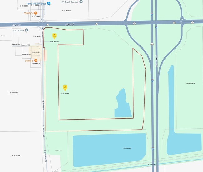
6089 Dement Rd
Rochelle, IL
RNG/BLK:2 TWP:40 SECT/LOT:20 PT NW4 & PT NE4 BK 92 PG 11059 ROW BK 95-3574-75 HWY BK 99-6737
25-20-200-008
OGLE
Commercialnec
Illinois
AE The base floodplain where base flood elevations are provided. AE Zones are now used on new format FIRMs instead of A1-A30 Zones.
20
2025
87.22 AC
2025
I-39 Corr/Ogle Cnty
961100
Chicago
NEARBY LISTINGS FOR SALE OR LEASE
DEMOGRAPHICS near 6089 Dement Rd
1 mile
3 mile
5 mile
2025 Total Population
22
10,792
12,359
2030 Population
21
10,748
12,266
Pop Growth 2025-2030
(4.55%)
(0.41%)
(0.75%)
Average Age
38
39
39
2025 Total Households
8
4,283
4,871
HH Growth 2025-2030
0.00%
(0.42%)
(0.76%)
Median Household Inc
$55,000
$68,433
$68,950
Avg Household Size
2.50
2.40
2.50
2025 Avg HH Vehicles
2.00
2.00
2.00
Median Home Value
$174,999
$170,112
$173,035
Median Year Built
1962
1970
1970
Nearby Places
Map Layers
Map Styles
 Street
 Aerial
Layers
 Traffic
 Biking
Places
Listings with unknown addresses are not visible on the map
- Restaurants
- Banks
- Shops
- Fitness
- Groceries
PUBLIC TRANSPORTATION
AIRPORT
Chicago/Rockford International
Drive
Walk
Distance
Chicago/Rockford International
35 min
23.2 mi
Freight Ports
Port Milwaukee
Drive
Walk
Distance
Port Milwaukee
133 min
114.7 mi
Nearby Properties
Address
Land Use
TOTAL SIZE
Lot Size
Zoning
Address
Land Use
TOTAL SIZE
Lot Size
Zoning
24.14 AC
Address
Land Use
TOTAL SIZE
Lot Size
Zoning
39.59 AC
Address
Land Use
TOTAL SIZE
Lot Size
Zoning
45.20 AC
Address
Land Use
TOTAL SIZE
Lot Size
Zoning
26.63 AC
Address
Land Use
TOTAL SIZE
Lot Size
Zoning
47.91 AC
Address
Land Use
TOTAL SIZE
Lot Size
Zoning
20.21 AC
Address
Land Use
TOTAL SIZE
Lot Size
Zoning
22.16 AC
Address
Land Use
TOTAL SIZE
Lot Size
Zoning
18.14 AC
Address
Land Use
TOTAL SIZE
Lot Size
Zoning
14.66 AC
Address
Land Use
TOTAL SIZE
Lot Size
Zoning
Address
Land Use
TOTAL SIZE
Lot Size
Zoning
39,403 SF
13.64 AC
Address
Land Use
TOTAL SIZE
Lot Size
Zoning
14.33 AC
Address
Land Use
TOTAL SIZE
Lot Size
Zoning
34.90 AC
Address
Land Use
TOTAL SIZE
Lot Size
Zoning
20,000 SF
12 AC
Address
Land Use
TOTAL SIZE
Lot Size
Zoning
Address
Land Use
TOTAL SIZE
Lot Size
Zoning
14.13 AC
Address
Land Use
TOTAL SIZE
Lot Size
Zoning
25.19 AC
Address
Land Use
TOTAL SIZE
Lot Size
Zoning
14.90 AC
Address
Land Use
TOTAL SIZE
Lot Size
Zoning
55.67 AC
Address
Land Use
TOTAL SIZE
Lot Size
Zoning
20,200 SF
5.10 AC
Address
Land Use
TOTAL SIZE
Lot Size
Zoning
23.94 AC
Address
Land Use
TOTAL SIZE
Lot Size
Zoning
41.28 AC
Address
Land Use
TOTAL SIZE
Lot Size
Zoning
68,447 SF
2.04 AC
Address
Land Use
TOTAL SIZE
Lot Size
Zoning
9.55 AC
Address
Land Use
TOTAL SIZE
Lot Size
Zoning
2.64 AC
Address
Land Use
TOTAL SIZE
Lot Size
Zoning
176,200 SF
15.72 AC
Address
Land Use
TOTAL SIZE
Lot Size
Zoning
58,473 SF
2.13 AC
Address
Land Use
TOTAL SIZE
Lot Size
Zoning
21,000 SF
4.81 AC
Address
Land Use
TOTAL SIZE
Lot Size
Zoning
55,200 SF
1.74 AC
The World's #1 Commercial Real Estate Marketplace
Connect with us
© 2026 CoStar Group
The information above has been obtained from sources believed reliable. While we do not doubt its accuracy we have not verified it and make no guarantee, warranty or representation about it. It is your responsibility to independently confirm its accuracy and completeness. Any projections, opinions, assumptions, or estimates used are for example only and do not represent the current or future performance of the property. The value of this transaction to you depends on tax and other factors which should be evaluated by your tax, financial, and legal advisors. You and your advisors should conduct a careful, independent investigation of the property to determine to your satisfaction the suitability of the property for your needs.