Property Record
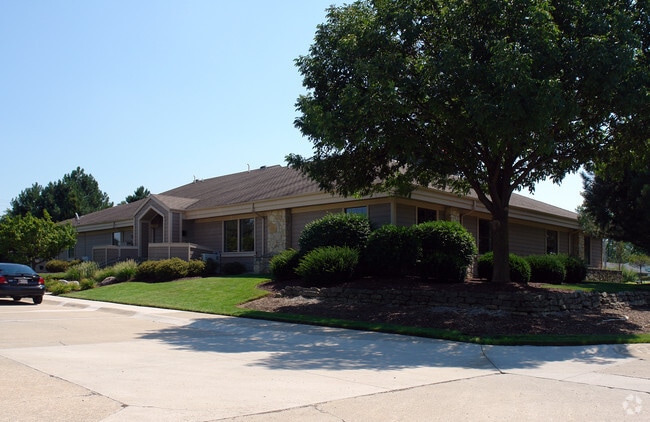
609 E Cook Rd, Fort Wayne, IN 46825


Property Detail
609 E Cook Rd
02-07-12-352-002.000-073
3.07 A TR 689 FT E OF SW CORNER SW1/4 SEC 12
Officebuilding
Allen
B and X Area of moderate flood hazard, usually the area between the limits of the 100-year and 500-year floods.
Indiana
2025
30.70 AC
2025
North Fort Wayne
010705
Fort Wayne
15,776 SF
Fort Wayne, IN
NEARBY LISTINGS FOR SALE OR LEASE
DEMOGRAPHICS near 609 E Cook Rd
1 mile
3 mile
5 mile
2025 Total Population
7,623
53,370
159,167
2030 Population
7,719
54,895
163,895
Pop Growth 2025-2030
+ 1.26%
+ 2.86%
+ 2.97%
Average Age
38
39
38
2025 Total Households
3,202
22,669
65,313
HH Growth 2025-2030
+ 1.34%
+ 3.00%
+ 3.15%
Median Household Inc
$72,095
$64,043
$65,374
Avg Household Size
2.30
2.20
2.30
2025 Avg HH Vehicles
2.00
2.00
2.00
Median Home Value
$196,816
$225,404
$217,740
Median Year Built
1983
1983
1978
Nearby Places
Map Layers
Map Styles
 Street
 Aerial
Layers
 Traffic
 Biking
Places
Listings with unknown addresses are not visible on the map
- Restaurants
- Banks
- Shops
- Fitness
- Groceries
PUBLIC TRANSPORTATION
AIRPORT
Fort Wayne International
Drive
Walk
Distance
Fort Wayne International
28 min
19.0 mi
Nearby Properties
Address
Land Use
TOTAL SIZE
Lot Size
Zoning
Address
Land Use
TOTAL SIZE
Lot Size
Zoning
460,252 SF
47.79 AC
Address
Land Use
TOTAL SIZE
Lot Size
Zoning
487,059 SF
160.30 AC
Address
Land Use
TOTAL SIZE
Lot Size
Zoning
380,319 SF
430.55 AC
Address
Land Use
TOTAL SIZE
Lot Size
Zoning
5,681 SF
54.08 AC
Address
Land Use
TOTAL SIZE
Lot Size
Zoning
855,487 SF
95.76 AC
Address
Land Use
TOTAL SIZE
Lot Size
Zoning
242,556 SF
17.18 AC
Address
Land Use
TOTAL SIZE
Lot Size
Zoning
702,400 SF
37.91 AC
Address
Land Use
TOTAL SIZE
Lot Size
Zoning
206,109 SF
122.14 AC
Address
Land Use
TOTAL SIZE
Lot Size
Zoning
401,523 SF
273.50 AC
Address
Land Use
TOTAL SIZE
Lot Size
Zoning
179,472 SF
232.62 AC
Address
Land Use
TOTAL SIZE
Lot Size
Zoning
152,404 SF
27.41 AC
Address
Land Use
TOTAL SIZE
Lot Size
Zoning
303,926 SF
1,956.20 AC
Address
Land Use
TOTAL SIZE
Lot Size
Zoning
342,303 SF
378.46 AC
Address
Land Use
TOTAL SIZE
Lot Size
Zoning
57,938 SF
34.15 AC
Address
Land Use
TOTAL SIZE
Lot Size
Zoning
68,817 SF
14.72 AC
Address
Land Use
TOTAL SIZE
Lot Size
Zoning
59,089 SF
28.68 AC
Address
Land Use
TOTAL SIZE
Lot Size
Zoning
106,005 SF
33.71 AC
Address
Land Use
TOTAL SIZE
Lot Size
Zoning
171,121 SF
15.40 AC
Address
Land Use
TOTAL SIZE
Lot Size
Zoning
75,690 SF
268.40 AC
Address
Land Use
TOTAL SIZE
Lot Size
Zoning
79,886 SF
58.50 AC
Address
Land Use
TOTAL SIZE
Lot Size
Zoning
81,654 SF
130.70 AC
Address
Land Use
TOTAL SIZE
Lot Size
Zoning
295,073 SF
27.09 AC
Address
Land Use
TOTAL SIZE
Lot Size
Zoning
32,189 SF
9.65 AC
Address
Land Use
TOTAL SIZE
Lot Size
Zoning
156,706 SF
200.38 AC
Address
Land Use
TOTAL SIZE
Lot Size
Zoning
222,349 SF
322.70 AC
Address
Land Use
TOTAL SIZE
Lot Size
Zoning
255,864 SF
9.21 AC
Address
Land Use
TOTAL SIZE
Lot Size
Zoning
85,484 SF
11.61 AC
Address
Land Use
TOTAL SIZE
Lot Size
Zoning
180,238 SF
22.50 AC
Address
Land Use
TOTAL SIZE
Lot Size
Zoning
306,988 SF
21.57 AC
Address
Land Use
TOTAL SIZE
Lot Size
Zoning
158,885 SF
22.96 AC
The World's #1 Commercial Real Estate Marketplace
Connect with us
© 2026 CoStar Group
The information above has been obtained from sources believed reliable. While we do not doubt its accuracy we have not verified it and make no guarantee, warranty or representation about it. It is your responsibility to independently confirm its accuracy and completeness. Any projections, opinions, assumptions, or estimates used are for example only and do not represent the current or future performance of the property. The value of this transaction to you depends on tax and other factors which should be evaluated by your tax, financial, and legal advisors. You and your advisors should conduct a careful, independent investigation of the property to determine to your satisfaction the suitability of the property for your needs.