Property Record
609 E Main St, Louisville, KY 40202


NEARBY LISTINGS FOR SALE OR LEASE
Property Detail
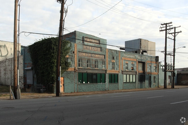
609 E Main St
018E00020000
0.7732 AC +/-, PARCEL NO. 130, TRACT X
Commercialnec
Jefferson
X
Kentucky
21111C0026F
0.77 AC
2025
Old Louisville
2025
Louisville
005902
Louisville-Jefferson County, KY-IN
48,082 SF
DEMOGRAPHICS near 609 E Main St
1 Mile
3 Mile
5 Mile
2024 Total Population
10,710
111,852
264,027
2029 Population
10,762
112,881
266,528
Pop Growth 2024-2029
+ 0.49%
+ 0.92%
+ 0.95%
Average Age
40
39
39
2024 Total Households
5,429
53,272
117,532
HH Growth 2024-2029
+ 1.07%
+ 1.01%
+ 0.93%
Median Household Inc
$30,826
$42,925
$46,629
Avg Household Size
1.60
1.90
2.10
2024 Avg HH Vehicles
1.00
1.00
1.00
Median Home Value
$241,729
$206,233
$187,031
Median Year Built
1965
1949
1951
Nearby Places
Map Layers
Map Styles
 Street
 Aerial
- Restaurants
- Banks
- Shops
- Fitness
- Groceries
PUBLIC TRANSPORTATION
AIRPORT
Louisville Muhammad Ali International
DRIVE
WALK
Distance
Louisville Muhammad Ali International
15 min
7.5 mi
Freight Ports
Port of Toledo
DRIVE
WALK
Distance
Port of Toledo
353 min
304.8 mi
Nearby Properties
Address
Land Use
TOTAL SIZE
Lot Size
Zoning
Address
Land Use
TOTAL SIZE
Lot Size
Zoning
4.80 AC
M3-INDUSTR
Address
Land Use
TOTAL SIZE
Lot Size
Zoning
211,050 SF
Address
Land Use
TOTAL SIZE
Lot Size
Zoning
5.40 AC
Address
Land Use
TOTAL SIZE
Lot Size
Zoning
572,868 SF
1.57 AC
Address
Land Use
TOTAL SIZE
Lot Size
Zoning
826,303 SF
2.90 AC
C3-CENTRAL
Address
Land Use
TOTAL SIZE
Lot Size
Zoning
130,724 SF
2.17 AC
Address
Land Use
TOTAL SIZE
Lot Size
Zoning
106,330 SF
9.44 AC
M3-INDUSTR
Address
Land Use
TOTAL SIZE
Lot Size
Zoning
Address
Land Use
TOTAL SIZE
Lot Size
Zoning
17,916 SF
21.76 AC
EZ1-ENTERP
Address
Land Use
TOTAL SIZE
Lot Size
Zoning
4,337 SF
3.71 AC
(C2)COMMER
Address
Land Use
TOTAL SIZE
Lot Size
Zoning
0.56 AC
(C3)CENTRA
Address
Land Use
TOTAL SIZE
Lot Size
Zoning
23.42 AC
(W
Address
Land Use
TOTAL SIZE
Lot Size
Zoning
20,449 SF
0.55 AC
C3-CENTRAL
Address
Land Use
TOTAL SIZE
Lot Size
Zoning
2.97 AC
C3-CENTRAL
Address
Land Use
TOTAL SIZE
Lot Size
Zoning
2.07 AC
Address
Land Use
TOTAL SIZE
Lot Size
Zoning
260,488 SF
8.07 AC
EZ1-ENTERP
Address
Land Use
TOTAL SIZE
Lot Size
Zoning
21,767 SF
1.47 AC
EZ1-ENTERP
Address
Land Use
TOTAL SIZE
Lot Size
Zoning
549,563 SF
26.13 AC
OTF-OFFICE
Address
Land Use
TOTAL SIZE
Lot Size
Zoning
304,295 SF
0.60 AC
C3-CENTRAL
Address
Land Use
TOTAL SIZE
Lot Size
Zoning
50,946 SF
2.66 AC
(CM)COMMER
Address
Land Use
TOTAL SIZE
Lot Size
Zoning
34,067 SF
0.84 AC
C3-CENTRAL
Address
Land Use
TOTAL SIZE
Lot Size
Zoning
59,648 SF
1.66 AC
OR3-OFFICE
Address
Land Use
TOTAL SIZE
Lot Size
Zoning
699,568 SF
1.96 AC
(C3)CENTRA
Address
Land Use
TOTAL SIZE
Lot Size
Zoning
12.69 AC
Address
Land Use
TOTAL SIZE
Lot Size
Zoning
228,447 SF
7.70 AC
M2-INDUSTR
Address
Land Use
TOTAL SIZE
Lot Size
Zoning
58,935 SF
1.92 AC
TNZD-TRADI
Address
Land Use
TOTAL SIZE
Lot Size
Zoning
248,323 SF
1 AC
C3-CENTRAL
Address
Land Use
TOTAL SIZE
Lot Size
Zoning
19.50 AC
Address
Land Use
TOTAL SIZE
Lot Size
Zoning
6,254 SF
1.48 AC
C2-COMMERC
Address
Land Use
TOTAL SIZE
Lot Size
Zoning
400 SF
13.92 AC
R6-RESIDEN
The World's #1 Commercial Real Estate Marketplace
Connect with us
© 2025 CoStar Group
The information above has been obtained from sources believed reliable. While we do not doubt its accuracy we have not verified it and make no guarantee, warranty or representation about it. It is your responsibility to independently confirm its accuracy and completeness. Any projections, opinions, assumptions, or estimates used are for example only and do not represent the current or future performance of the property. The value of this transaction to you depends on tax and other factors which should be evaluated by your tax, financial, and legal advisors. You and your advisors should conduct a careful, independent investigation of the property to determine to your satisfaction the suitability of the property for your needs.