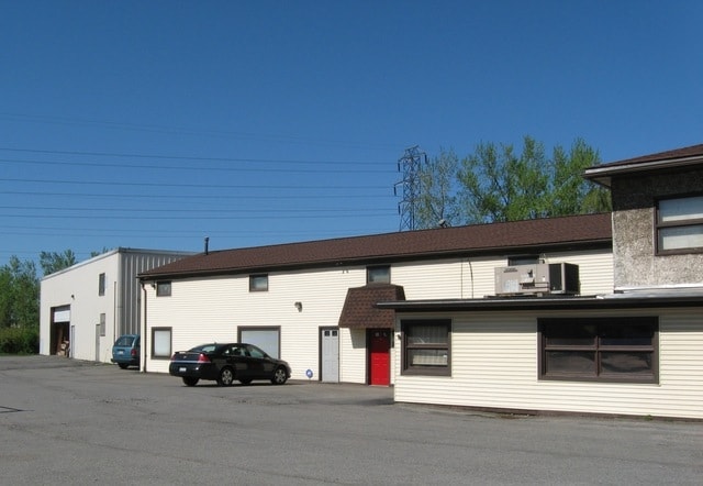
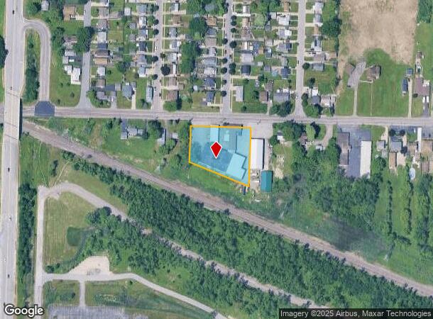
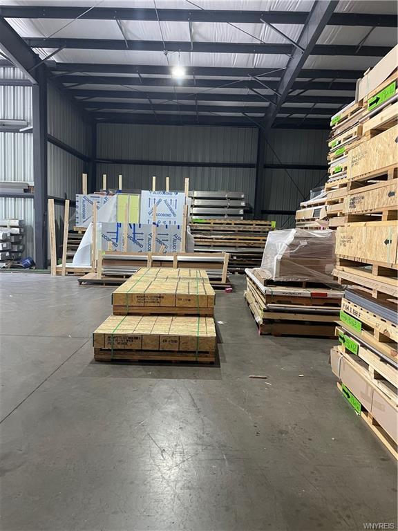
Property Record
609 Indian Church Rd, Buffalo, NY 14224
NEARBY LISTINGS FOR SALE OR LEASE
Property Detail
609 Indian Church Rd
Buffalo-Cheektowaga-Niagara Falls, NY
Buffalo Creek Reservation
146800-134-050-0001-003-100
PART OF FL-192 EBENEZER LAND'S(1.1 AC'S) 248.66 X 236.00 IRR.
Warehouse
Erie
X
New York
36029C0331H
3.100
2025
1.10 AC
2024
South
011300
Buffalo/Niagara Falls
7,709 SF
DEMOGRAPHICS near 609 Indian Church Rd
1 Mile
3 Mile
5 Mile
2024 Total Population
9,048
99,626
225,971
2029 Population
8,819
97,610
221,938
Pop Growth 2024-2029
(2.53%)
(2.02%)
(1.78%)
Average Age
41
42
41
2024 Total Households
4,011
44,486
97,969
HH Growth 2024-2029
(2.59%)
(2.05%)
(1.77%)
Median Household Inc
$63,305
$57,666
$52,298
Avg Household Size
2.20
2.20
2.20
2024 Avg HH Vehicles
2.00
2.00
1.00
Median Home Value
$150,615
$149,946
$151,227
Median Year Built
1951
1953
1954
Nearby Places
- Restaurants
- Banks
- Shops
- Fitness
- Groceries
PUBLIC TRANSPORTATION
COMMUTER RAIL
Buffalo Depew Station (Empire Service - Amtrak, Lake Shore Limited - Amtrak, Maple Leaf - Amtrak)
DRIVE
WALK
Distance
Buffalo Depew Station (Empire Service - Amtrak, Lake Shore Limited - Amtrak, Maple Leaf - Amtrak)
12 min
6.4 mi
Buffalo (Depew) (Toronto - New York - VIA Rail)
DRIVE
WALK
Distance
Buffalo (Depew) (Toronto - New York - VIA Rail)
12 min
6.5 mi
AIRPORT
Buffalo Niagara International
DRIVE
WALK
Distance
Buffalo Niagara International
18 min
10.1 mi
Niagara Falls International
DRIVE
WALK
Distance
Niagara Falls International
39 min
25.6 mi
Freight Ports
Port of Toledo
DRIVE
WALK
Distance
Port of Toledo
355 min
300.9 mi
SALE & LEASE HISTORY
LISTING DATE
SALE/LEASE

Sep 24, 2016
For Sale
Aug 31, 2022
For Sale
Aug 18, 2022
For Sale
Nearby Properties
Address
Land Use
TOTAL SIZE
Lot Size
Zoning
Address
Land Use
TOTAL SIZE
Lot Size
Zoning
1,053,391 SF
88.26 AC
D-IL
Address
Land Use
TOTAL SIZE
Lot Size
Zoning
425,796 SF
7.10 AC
D-M
Address
Land Use
TOTAL SIZE
Lot Size
Zoning
31,608 SF
4.36 AC
05C
Address
Land Use
TOTAL SIZE
Lot Size
Zoning
7,200 SF
20.20 AC
03RA
Address
Land Use
TOTAL SIZE
Lot Size
Zoning
7,242 SF
18 AC
03RA
Address
Land Use
TOTAL SIZE
Lot Size
Zoning
972 SF
194.01 AC
D-OG
Address
Land Use
TOTAL SIZE
Lot Size
Zoning
6,720 SF
11.10 AC
03RA
Address
Land Use
TOTAL SIZE
Lot Size
Zoning
5,304 SF
17.90 AC
03RA
Address
Land Use
TOTAL SIZE
Lot Size
Zoning
92,350 SF
9.20 AC
05C
Address
Land Use
TOTAL SIZE
Lot Size
Zoning
70,480 SF
4.07 AC
05C
Address
Land Use
TOTAL SIZE
Lot Size
Zoning
104,881 SF
24.43 AC
12
Address
Land Use
TOTAL SIZE
Lot Size
Zoning
2,600 SF
14.80 AC
D-IL
Address
Land Use
TOTAL SIZE
Lot Size
Zoning
43,942 SF
14.34 AC
CBD
Address
Land Use
TOTAL SIZE
Lot Size
Zoning
17,920 SF
9 AC
03RA
Address
Land Use
TOTAL SIZE
Lot Size
Zoning
Address
Land Use
TOTAL SIZE
Lot Size
Zoning
42,396 SF
6.48 AC
Address
Land Use
TOTAL SIZE
Lot Size
Zoning
205,680 SF
37.40 AC
11
Address
Land Use
TOTAL SIZE
Lot Size
Zoning
7,200 SF
20 AC
03RA
Address
Land Use
TOTAL SIZE
Lot Size
Zoning
429,787 SF
17.31 AC
05C
Address
Land Use
TOTAL SIZE
Lot Size
Zoning
174,812 SF
52.04 AC
05C
Address
Land Use
TOTAL SIZE
Lot Size
Zoning
107,760 SF
4.14 AC
D-E
Address
Land Use
TOTAL SIZE
Lot Size
Zoning
123 AC
OP
Address
Land Use
TOTAL SIZE
Lot Size
Zoning
166,303 SF
3.82 AC
Address
Land Use
TOTAL SIZE
Lot Size
Zoning
257,258 SF
51.55 AC
D-IL
Address
Land Use
TOTAL SIZE
Lot Size
Zoning
198,558 SF
3.16 AC
N-3R
Address
Land Use
TOTAL SIZE
Lot Size
Zoning
191,026 SF
32.60 AC
10
Address
Land Use
TOTAL SIZE
Lot Size
Zoning
182,741 SF
7.02 AC
D-IL
Address
Land Use
TOTAL SIZE
Lot Size
Zoning
34,968 SF
18.26 AC
10
Address
Land Use
TOTAL SIZE
Lot Size
Zoning
99,000 SF
26.60 AC
N-3R
Address
Land Use
TOTAL SIZE
Lot Size
Zoning
89,838 SF
4.24 AC
The World's #1 Commercial Real Estate Marketplace
Connect with us
© 2025 CoStar Group
The information above has been obtained from sources believed reliable. While we do not doubt its accuracy we have not verified it and make no guarantee, warranty or representation about it. It is your responsibility to independently confirm its accuracy and completeness. Any projections, opinions, assumptions, or estimates used are for example only and do not represent the current or future performance of the property. The value of this transaction to you depends on tax and other factors which should be evaluated by your tax, financial, and legal advisors. You and your advisors should conduct a careful, independent investigation of the property to determine to your satisfaction the suitability of the property for your needs.