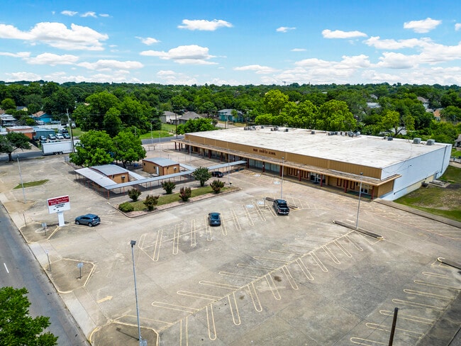
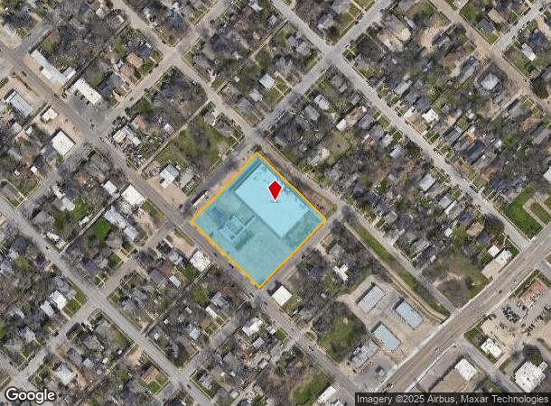
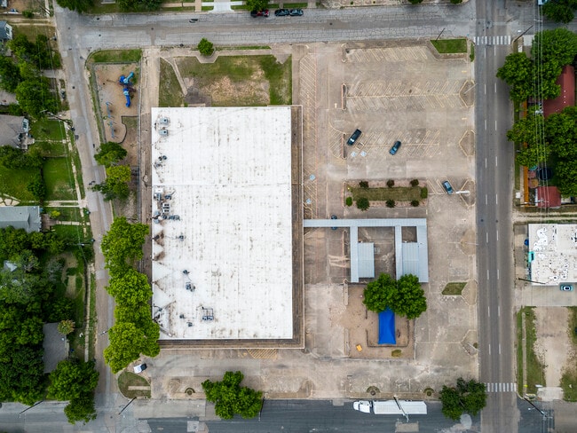
Property Record
609 N 25Th St, Waco, TX 76707
NEARBY LISTINGS FOR SALE OR LEASE
Property Detail
609 N 25Th St
Waco, TX
West End
48-043800-042500-8
WEST END LOT ALL (1-14 & 20 ALLEY) BLOCK MM ACRES 2.8122
Commercialnec
Mclennan
X
Texas
48309C0367D
all
2024
2.81 AC
2025
Downtown Waco
000700
Other Market Areas
46,440 SF
DEMOGRAPHICS near 609 N 25Th St
1 mile
3 mile
5 mile
2024 Total Population
13,921
100,534
138,929
2029 Population
14,919
107,038
147,946
Pop Growth 2024-2029
+ 7.17%
+ 6.47%
+ 6.49%
Average Age
35
34
35
2024 Total Households
5,025
37,619
52,573
HH Growth 2024-2029
+ 7.32%
+ 6.90%
+ 6.83%
Median Household Inc
$44,621
$39,322
$43,741
Avg Household Size
2.70
2.40
2.40
2024 Avg HH Vehicles
2.00
2.00
2.00
Median Home Value
$126,997
$126,275
$151,256
Median Year Built
1957
1970
1973
Nearby Places
Map Layers
Map Styles
 Street
 Aerial
Transit
 Traffic
 Biking
Places
Listings with unknown addresses are not visible on the map
- Restaurants
- Banks
- Shops
- Fitness
- Groceries
PUBLIC TRANSPORTATION
AIRPORT
Waco Regional
Drive
Walk
Distance
Waco Regional
18 min
8.4 mi
Freight Ports
Port of Houston
Drive
Walk
Distance
Port of Houston
219 min
187.9 mi
SALE & LEASE HISTORY
LISTING DATE
SALE/LEASE

Jul 10, 2023
For Sale
Nearby Properties
Address
Land Use
TOTAL SIZE
Lot Size
Zoning
Address
Land Use
TOTAL SIZE
Lot Size
Zoning
93.17 AC
2007 TIF
Address
Land Use
TOTAL SIZE
Lot Size
Zoning
549,274 SF
34.05 AC
O2
Address
Land Use
TOTAL SIZE
Lot Size
Zoning
120,623 SF
55.15 AC
2007 TIF
Address
Land Use
TOTAL SIZE
Lot Size
Zoning
560,620 SF
3.70 AC
O2
Address
Land Use
TOTAL SIZE
Lot Size
Zoning
576,501 SF
4.21 AC
Address
Land Use
TOTAL SIZE
Lot Size
Zoning
452,498 SF
39.43 AC
C-2
Address
Land Use
TOTAL SIZE
Lot Size
Zoning
394,674 SF
21.31 AC
O2
Address
Land Use
TOTAL SIZE
Lot Size
Zoning
206,452 SF
11.97 AC
2007 TIF
Address
Land Use
TOTAL SIZE
Lot Size
Zoning
339,476 SF
Address
Land Use
TOTAL SIZE
Lot Size
Zoning
255,615 SF
18.58 AC
Address
Land Use
TOTAL SIZE
Lot Size
Zoning
248,132 SF
11.51 AC
R3C
Address
Land Use
TOTAL SIZE
Lot Size
Zoning
27.28 AC
C
Address
Land Use
TOTAL SIZE
Lot Size
Zoning
289,245 SF
18.02 AC
C1
Address
Land Use
TOTAL SIZE
Lot Size
Zoning
263,557 SF
12 AC
Address
Land Use
TOTAL SIZE
Lot Size
Zoning
291,167 SF
13.61 AC
R
Address
Land Use
TOTAL SIZE
Lot Size
Zoning
399,747 SF
2.86 AC
C-3,C
Address
Land Use
TOTAL SIZE
Lot Size
Zoning
462,987 SF
36.18 AC
C-3
Address
Land Use
TOTAL SIZE
Lot Size
Zoning
24.75 AC
O2
Address
Land Use
TOTAL SIZE
Lot Size
Zoning
213,814 SF
7.05 AC
2007 TIF
Address
Land Use
TOTAL SIZE
Lot Size
Zoning
69,809 SF
8.12 AC
2007 TIF
Address
Land Use
TOTAL SIZE
Lot Size
Zoning
3,096 SF
51.73 AC
2007 TIF
Address
Land Use
TOTAL SIZE
Lot Size
Zoning
231,717 SF
21.97 AC
O2
Address
Land Use
TOTAL SIZE
Lot Size
Zoning
126,592 SF
5.05 AC
2007 TIF
Address
Land Use
TOTAL SIZE
Lot Size
Zoning
188,746 SF
1.14 AC
O2
Address
Land Use
TOTAL SIZE
Lot Size
Zoning
188,465 SF
5.85 AC
2007 TIF
Address
Land Use
TOTAL SIZE
Lot Size
Zoning
Address
Land Use
TOTAL SIZE
Lot Size
Zoning
98,592 SF
15.16 AC
Address
Land Use
TOTAL SIZE
Lot Size
Zoning
193,780 SF
14.12 AC
C
Address
Land Use
TOTAL SIZE
Lot Size
Zoning
237,081 SF
12.52 AC
2007 TIF
Address
Land Use
TOTAL SIZE
Lot Size
Zoning
107,925 SF
2.20 AC
2007TIF
The World's #1 Commercial Real Estate Marketplace
Connect with us
© 2026 CoStar Group
The information above has been obtained from sources believed reliable. While we do not doubt its accuracy we have not verified it and make no guarantee, warranty or representation about it. It is your responsibility to independently confirm its accuracy and completeness. Any projections, opinions, assumptions, or estimates used are for example only and do not represent the current or future performance of the property. The value of this transaction to you depends on tax and other factors which should be evaluated by your tax, financial, and legal advisors. You and your advisors should conduct a careful, independent investigation of the property to determine to your satisfaction the suitability of the property for your needs.