Property Record
609 S Hazard St, Georgetown, SC 29440
NEARBY LISTINGS FOR SALE OR LEASE
-
-
View all Georgetown listings for sale on LoopNet.com
Property Detail
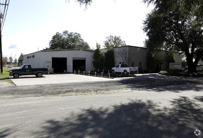
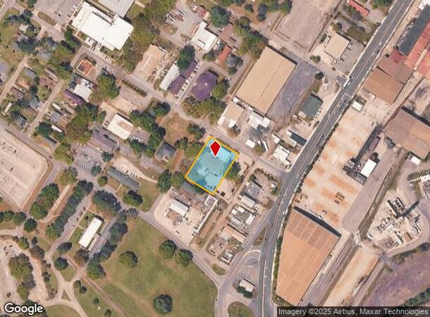
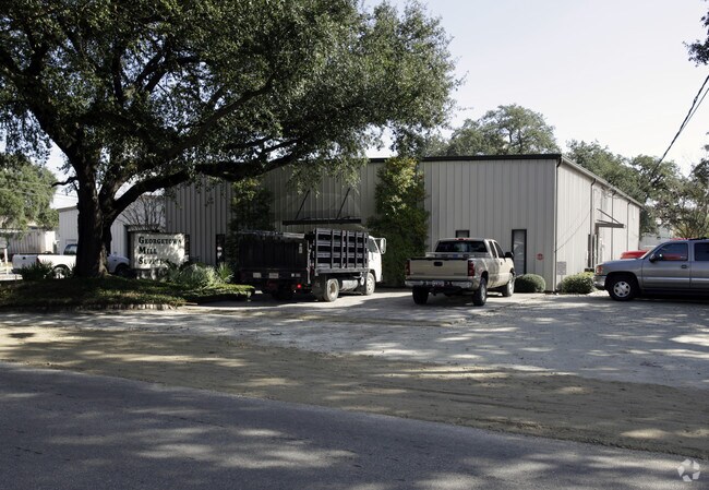
609 S Hazard St
05-0028-007-00-00
PTS 682 & 683 GEO SLD 558-2A
Commercialnec
Georgetown
X
South Carolina
45043C0485G
682&683
2024
0.76 AC
2024
Other Market Areas
920702
Georgetown, SC
10,001 SF
DEMOGRAPHICS near 609 S Hazard St
1 Mile
3 Mile
5 Mile
2024 Total Population
2,938
12,304
15,588
2029 Population
3,136
12,927
16,341
Pop Growth 2024-2029
+ 6.74%
+ 5.06%
+ 4.83%
Average Age
43
42
43
2024 Total Households
1,231
4,968
6,292
HH Growth 2024-2029
+ 6.42%
+ 4.79%
+ 4.55%
Median Household Inc
$32,970
$42,978
$44,953
Avg Household Size
2.30
2.40
2.40
2024 Avg HH Vehicles
1.00
2.00
2.00
Median Home Value
$156,011
$175,911
$184,178
Median Year Built
1978
1979
1980
Nearby Places
Map Layers
Map Styles
 Street
 Aerial
- Restaurants
- Banks
- Shops
- Fitness
- Groceries
PUBLIC TRANSPORTATION
AIRPORT
Myrtle Beach International
DRIVE
WALK
Distance
Myrtle Beach International
54 min
36.9 mi
Freight Ports
Wando Welch Terminal
DRIVE
WALK
Distance
Wando Welch Terminal
70 min
53.6 mi
Nearby Properties
Address
Land Use
TOTAL SIZE
Lot Size
Zoning
Address
Land Use
TOTAL SIZE
Lot Size
Zoning
103.50 AC
Address
Land Use
TOTAL SIZE
Lot Size
Zoning
20.70 AC
Address
Land Use
TOTAL SIZE
Lot Size
Zoning
102.40 AC
Address
Land Use
TOTAL SIZE
Lot Size
Zoning
1 SF
1,293.15 AC
Address
Land Use
TOTAL SIZE
Lot Size
Zoning
Address
Land Use
TOTAL SIZE
Lot Size
Zoning
80,242 SF
5.90 AC
Address
Land Use
TOTAL SIZE
Lot Size
Zoning
27.20 AC
Address
Land Use
TOTAL SIZE
Lot Size
Zoning
10.50 AC
Address
Land Use
TOTAL SIZE
Lot Size
Zoning
Address
Land Use
TOTAL SIZE
Lot Size
Zoning
16.20 AC
Address
Land Use
TOTAL SIZE
Lot Size
Zoning
Address
Land Use
TOTAL SIZE
Lot Size
Zoning
46,056 SF
1.38 AC
Address
Land Use
TOTAL SIZE
Lot Size
Zoning
21.20 AC
Address
Land Use
TOTAL SIZE
Lot Size
Zoning
Address
Land Use
TOTAL SIZE
Lot Size
Zoning
Address
Land Use
TOTAL SIZE
Lot Size
Zoning
4.03 AC
Address
Land Use
TOTAL SIZE
Lot Size
Zoning
Address
Land Use
TOTAL SIZE
Lot Size
Zoning
Address
Land Use
TOTAL SIZE
Lot Size
Zoning
Address
Land Use
TOTAL SIZE
Lot Size
Zoning
1.19 AC
Address
Land Use
TOTAL SIZE
Lot Size
Zoning
Address
Land Use
TOTAL SIZE
Lot Size
Zoning
2,912 SF
3.18 AC
Address
Land Use
TOTAL SIZE
Lot Size
Zoning
0.90 AC
Address
Land Use
TOTAL SIZE
Lot Size
Zoning
19.81 AC
Address
Land Use
TOTAL SIZE
Lot Size
Zoning
1.59 AC
Address
Land Use
TOTAL SIZE
Lot Size
Zoning
72.40 AC
Address
Land Use
TOTAL SIZE
Lot Size
Zoning
7,620 SF
8.82 AC
Address
Land Use
TOTAL SIZE
Lot Size
Zoning
Address
Land Use
TOTAL SIZE
Lot Size
Zoning
20,825 SF
3.40 AC
Address
Land Use
TOTAL SIZE
Lot Size
Zoning
9,200 SF
0.49 AC
The World's #1 Commercial Real Estate Marketplace
Connect with us
© 2025 CoStar Group
The information above has been obtained from sources believed reliable. While we do not doubt its accuracy we have not verified it and make no guarantee, warranty or representation about it. It is your responsibility to independently confirm its accuracy and completeness. Any projections, opinions, assumptions, or estimates used are for example only and do not represent the current or future performance of the property. The value of this transaction to you depends on tax and other factors which should be evaluated by your tax, financial, and legal advisors. You and your advisors should conduct a careful, independent investigation of the property to determine to your satisfaction the suitability of the property for your needs.