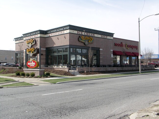
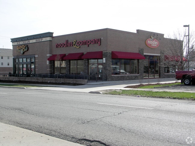
Property Record
609 S Main St, Normal, IL 61761

Save to a Folder
{{folder.Name}}
{{folder.ListingIds.length}} Properties
{{folder.ListingIds.length}} Property
Create a New Folder
Property Detail
609 S Main St
14-28-376-021
22ND ADDITION TO NORMAL LOTS 9 & 12
Commercialnec
MCLEAN
B1
Illinois
B and X Area of moderate flood hazard, usually the area between the limits of the 100-year and 500-year floods.
9,12
2024
0.62 AC
2025
Uptown Normal
000301
Other Market Areas
4,836 SF
Bloomington, IL
NEARBY LISTINGS FOR SALE OR LEASE
DEMOGRAPHICS near 609 S Main St
1 mile
3 mile
5 mile
2025 Total Population
20,320
82,913
130,511
2030 Population
20,416
83,216
130,924
Pop Growth 2025-2030
+ 0.47%
+ 0.37%
+ 0.32%
Average Age
29
36
37
2025 Total Households
6,644
33,992
53,472
HH Growth 2025-2030
+ 0.24%
+ 0.38%
+ 0.37%
Median Household Inc
$39,009
$57,819
$72,426
Avg Household Size
2.10
2.10
2.20
2025 Avg HH Vehicles
2.00
2.00
2.00
Median Home Value
$166,909
$178,509
$213,220
Median Year Built
1976
1973
1981
Nearby Places
Map Layers
Map Styles
 Street
 Aerial
Layers
 Traffic
 Biking
Places
Listings with unknown addresses are not visible on the map
- Restaurants
- Banks
- Shops
- Fitness
- Groceries
PUBLIC TRANSPORTATION
COMMUTER RAIL
Drive
Walk
Distance
2 min
13 min
0.7 mi
AIRPORT
Central Il Regional/Bloomington-Normal
Drive
Walk
Distance
Central Il Regional/Bloomington-Normal
16 min
5.9 mi
Nearby Properties
Address
Land Use
TOTAL SIZE
Lot Size
Zoning
Address
Land Use
TOTAL SIZE
Lot Size
Zoning
1,867,780 SF
48.61 AC
Address
Land Use
TOTAL SIZE
Lot Size
Zoning
562,852 SF
48.94 AC
Address
Land Use
TOTAL SIZE
Lot Size
Zoning
154,502 SF
1.25 AC
Address
Land Use
TOTAL SIZE
Lot Size
Zoning
493,944 SF
2.95 AC
R-3A
Address
Land Use
TOTAL SIZE
Lot Size
Zoning
445,676 SF
20.86 AC
Address
Land Use
TOTAL SIZE
Lot Size
Zoning
426,806 SF
20.93 AC
Address
Land Use
TOTAL SIZE
Lot Size
Zoning
127,569 SF
1.54 AC
Address
Land Use
TOTAL SIZE
Lot Size
Zoning
1,624,618 SF
54.32 AC
Address
Land Use
TOTAL SIZE
Lot Size
Zoning
158,508 SF
3.13 AC
R1C
Address
Land Use
TOTAL SIZE
Lot Size
Zoning
126,418 SF
1.06 AC
Address
Land Use
TOTAL SIZE
Lot Size
Zoning
177,365 SF
11.75 AC
Address
Land Use
TOTAL SIZE
Lot Size
Zoning
123,016 SF
18.52 AC
C-2
Address
Land Use
TOTAL SIZE
Lot Size
Zoning
513,218 SF
20.64 AC
R-3A
Address
Land Use
TOTAL SIZE
Lot Size
Zoning
432,093 SF
15 AC
Address
Land Use
TOTAL SIZE
Lot Size
Zoning
10.13 AC
R2
Address
Land Use
TOTAL SIZE
Lot Size
Zoning
136,382 SF
9.53 AC
Address
Land Use
TOTAL SIZE
Lot Size
Zoning
423,526 SF
25.35 AC
B-1
Address
Land Use
TOTAL SIZE
Lot Size
Zoning
208,876 SF
20.87 AC
B-1
Address
Land Use
TOTAL SIZE
Lot Size
Zoning
422,234 SF
23.17 AC
Address
Land Use
TOTAL SIZE
Lot Size
Zoning
309,750 SF
9.85 AC
R-3A
Address
Land Use
TOTAL SIZE
Lot Size
Zoning
351,360 SF
8.40 AC
R-3A
Address
Land Use
TOTAL SIZE
Lot Size
Zoning
122,112 SF
7.16 AC
Address
Land Use
TOTAL SIZE
Lot Size
Zoning
276,695 SF
12.68 AC
Address
Land Use
TOTAL SIZE
Lot Size
Zoning
388,851 SF
4.40 AC
Address
Land Use
TOTAL SIZE
Lot Size
Zoning
191,880 SF
3 AC
B-1
Address
Land Use
TOTAL SIZE
Lot Size
Zoning
281,134 SF
8.04 AC
R-3A
Address
Land Use
TOTAL SIZE
Lot Size
Zoning
86,950 SF
4 AC
B-1
Address
Land Use
TOTAL SIZE
Lot Size
Zoning
98,646 SF
4 AC
B-1
Address
Land Use
TOTAL SIZE
Lot Size
Zoning
231,077 SF
15.49 AC
The World's #1 Commercial Real Estate Marketplace
Connect with us
© 2026 CoStar Group
The information above has been obtained from sources believed reliable. While we do not doubt its accuracy we have not verified it and make no guarantee, warranty or representation about it. It is your responsibility to independently confirm its accuracy and completeness. Any projections, opinions, assumptions, or estimates used are for example only and do not represent the current or future performance of the property. The value of this transaction to you depends on tax and other factors which should be evaluated by your tax, financial, and legal advisors. You and your advisors should conduct a careful, independent investigation of the property to determine to your satisfaction the suitability of the property for your needs.