Property Record
6090 Etiwanda Ave, Jurupa Valley, CA 91752


NEARBY LISTINGS FOR SALE OR LEASE
-
-
View all Jurupa Valley listings for sale on LoopNet.com
Property Detail
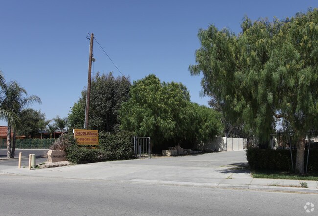
6090 Etiwanda Ave
Riverside-San Bernardino-Ontario, CA
Wineland Vineyards
161-260-006
Riverside
Sfr
California
X
2.50 AC
06065C0682H
Riverside
1,100 SF
Inland Empire (California)
DEMOGRAPHICS near 6090 Etiwanda Ave
1 Mile
3 Mile
5 Mile
2024 Total Population
7,385
71,221
248,012
2029 Population
7,659
74,540
259,465
Pop Growth 2024-2029
+ 3.71%
+ 4.66%
+ 4.62%
Average Age
36
36
36
2024 Total Households
1,765
18,063
65,980
HH Growth 2024-2029
+ 3.12%
+ 4.18%
+ 4.20%
Median Household Inc
$88,052
$114,957
$100,634
Avg Household Size
3.90
3.80
3.60
2024 Avg HH Vehicles
3.00
3.00
3.00
Median Home Value
$639,554
$658,799
$601,522
Median Year Built
1973
1994
1988
Nearby Places
Map Layers
Map Styles
 Street
 Aerial
- Restaurants
- Banks
- Shops
- Fitness
- Groceries
PUBLIC TRANSPORTATION
COMMUTER RAIL
Pedley (Riverside Line - Southern California Regional Rail Authority (Metrolink))
DRIVE
WALK
Distance
Pedley (Riverside Line - Southern California Regional Rail Authority (Metrolink))
7 min
3.4 mi
East Ontario (Riverside Line - Southern California Regional Rail Authority (Metrolink))
DRIVE
WALK
Distance
East Ontario (Riverside Line - Southern California Regional Rail Authority (Metrolink))
13 min
6.8 mi
AIRPORT
Ontario International
DRIVE
WALK
Distance
Ontario International
17 min
9.4 mi
John Wayne/Orange County
DRIVE
WALK
Distance
John Wayne/Orange County
47 min
37.0 mi
Freight Ports
Port of Long Beach
DRIVE
WALK
Distance
Port of Long Beach
68 min
51.0 mi
Nearby Properties
Address
Land Use
TOTAL SIZE
Lot Size
Zoning
Address
Land Use
TOTAL SIZE
Lot Size
Zoning
1,003,458 SF
52.98 AC
Address
Land Use
TOTAL SIZE
Lot Size
Zoning
165,463 SF
17.43 AC
Address
Land Use
TOTAL SIZE
Lot Size
Zoning
329,831 SF
15.51 AC
MSC
Address
Land Use
TOTAL SIZE
Lot Size
Zoning
43.78 AC
Address
Land Use
TOTAL SIZE
Lot Size
Zoning
1,007,705 SF
33.83 AC
Address
Land Use
TOTAL SIZE
Lot Size
Zoning
800,260 SF
37.25 AC
MSC
Address
Land Use
TOTAL SIZE
Lot Size
Zoning
310,406 SF
13.74 AC
Address
Land Use
TOTAL SIZE
Lot Size
Zoning
2,107,892 SF
71.83 AC
MSC
Address
Land Use
TOTAL SIZE
Lot Size
Zoning
645,311 SF
27.33 AC
IP
Address
Land Use
TOTAL SIZE
Lot Size
Zoning
765,456 SF
34.90 AC
IP
Address
Land Use
TOTAL SIZE
Lot Size
Zoning
30,806 SF
17.67 AC
R3
Address
Land Use
TOTAL SIZE
Lot Size
Zoning
28.90 AC
Address
Land Use
TOTAL SIZE
Lot Size
Zoning
880,000 SF
41.72 AC
MSC
Address
Land Use
TOTAL SIZE
Lot Size
Zoning
565,598 SF
27.97 AC
MSC
Address
Land Use
TOTAL SIZE
Lot Size
Zoning
31.13 AC
MSC
Address
Land Use
TOTAL SIZE
Lot Size
Zoning
27.15 AC
R3
Address
Land Use
TOTAL SIZE
Lot Size
Zoning
755,137 SF
31.62 AC
MSC
Address
Land Use
TOTAL SIZE
Lot Size
Zoning
450,867 SF
23.45 AC
IP
Address
Land Use
TOTAL SIZE
Lot Size
Zoning
121,054 SF
6.03 AC
MSC
Address
Land Use
TOTAL SIZE
Lot Size
Zoning
118,644 SF
6.42 AC
Address
Land Use
TOTAL SIZE
Lot Size
Zoning
180,840 SF
9.36 AC
Address
Land Use
TOTAL SIZE
Lot Size
Zoning
420,112 SF
19.36 AC
IP
Address
Land Use
TOTAL SIZE
Lot Size
Zoning
650,451 SF
28.81 AC
IP
Address
Land Use
TOTAL SIZE
Lot Size
Zoning
656,661 SF
26.97 AC
IP
Address
Land Use
TOTAL SIZE
Lot Size
Zoning
216,239 SF
9.95 AC
MSC
Address
Land Use
TOTAL SIZE
Lot Size
Zoning
525,700 SF
7.56 AC
MSC5
Address
Land Use
TOTAL SIZE
Lot Size
Zoning
373,552 SF
16.11 AC
Address
Land Use
TOTAL SIZE
Lot Size
Zoning
217,508 SF
14.05 AC
MM
Address
Land Use
TOTAL SIZE
Lot Size
Zoning
136,850 SF
6.55 AC
MSC
The World's #1 Commercial Real Estate Marketplace
Connect with us
© 2025 CoStar Group
The information above has been obtained from sources believed reliable. While we do not doubt its accuracy we have not verified it and make no guarantee, warranty or representation about it. It is your responsibility to independently confirm its accuracy and completeness. Any projections, opinions, assumptions, or estimates used are for example only and do not represent the current or future performance of the property. The value of this transaction to you depends on tax and other factors which should be evaluated by your tax, financial, and legal advisors. You and your advisors should conduct a careful, independent investigation of the property to determine to your satisfaction the suitability of the property for your needs.