Property Record
6091 W University Dr, Mckinney, TX 75071
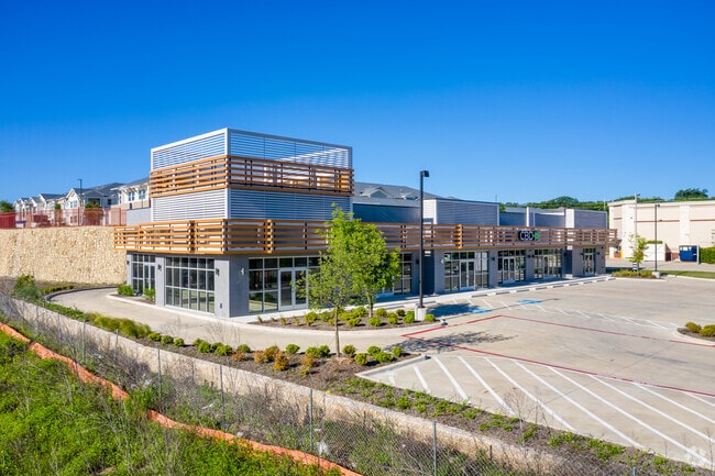

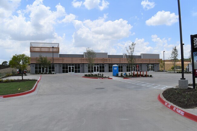
Property Detail
6091 W University Dr
Dallas-Fort Worth-Arlington, TX
CVS RIDGE ADDITION, BLK A, LOT 3R; (REPLAT)
R-10728-00A-003R-1
COLLIN
Commercialnec
Texas
B and X Area of moderate flood hazard, usually the area between the limits of the 100-year and 500-year floods.
3r
2025
0.97 AC
2025
McKinney
030548
Dallas/Ft Worth
8,011 SF
NEARBY LISTINGS FOR SALE OR LEASE
DEMOGRAPHICS near 6091 W University Dr
1 mile
3 mile
5 mile
2025 Total Population
10,056
83,274
241,365
2030 Population
11,579
95,593
275,713
Pop Growth 2025-2030
+ 15.15%
+ 14.79%
+ 14.23%
Average Age
37
39
37
2025 Total Households
3,316
27,840
81,706
HH Growth 2025-2030
+ 15.23%
+ 14.94%
+ 14.54%
Median Household Inc
$167,185
$154,552
$136,298
Avg Household Size
2.90
2.90
2.90
2025 Avg HH Vehicles
2.00
2.00
2.00
Median Home Value
$590,699
$579,719
$569,343
Median Year Built
2009
2007
2008
Nearby Places
Map Layers
Map Styles
 Street
 Aerial
Layers
 Traffic
 Biking
Places
Listings with unknown addresses are not visible on the map
- Restaurants
- Banks
- Shops
- Fitness
- Groceries
PUBLIC TRANSPORTATION
AIRPORT
Dallas-Fort Worth International
Drive
Walk
Distance
Dallas-Fort Worth International
46 min
36.3 mi
Dallas Love Field
Drive
Walk
Distance
Dallas Love Field
47 min
37.9 mi
SALE & LEASE HISTORY
LISTING DATE
SALE/LEASE

Jul 09, 2019
For Lease
Nearby Properties
Address
Land Use
TOTAL SIZE
Lot Size
Zoning
Address
Land Use
TOTAL SIZE
Lot Size
Zoning
1,826,199 SF
117.79 AC
Address
Land Use
TOTAL SIZE
Lot Size
Zoning
469,170 SF
56.84 AC
Address
Land Use
TOTAL SIZE
Lot Size
Zoning
691,265 SF
53.52 AC
Address
Land Use
TOTAL SIZE
Lot Size
Zoning
256,445 SF
10.42 AC
Address
Land Use
TOTAL SIZE
Lot Size
Zoning
681,949 SF
71.30 AC
Address
Land Use
TOTAL SIZE
Lot Size
Zoning
641,090 SF
60.44 AC
Address
Land Use
TOTAL SIZE
Lot Size
Zoning
398,732 SF
25.88 AC
MF-M
Address
Land Use
TOTAL SIZE
Lot Size
Zoning
291,577 SF
69.24 AC
APTTOWNH
Address
Land Use
TOTAL SIZE
Lot Size
Zoning
274,184 SF
20.34 AC
COMM
Address
Land Use
TOTAL SIZE
Lot Size
Zoning
282,528 SF
5.14 AC
MF-R
Address
Land Use
TOTAL SIZE
Lot Size
Zoning
264,070 SF
15.74 AC
MF-M
Address
Land Use
TOTAL SIZE
Lot Size
Zoning
197,115 SF
10.37 AC
MF-M
Address
Land Use
TOTAL SIZE
Lot Size
Zoning
243,827 SF
13.23 AC
MF
Address
Land Use
TOTAL SIZE
Lot Size
Zoning
201,902 SF
11.22 AC
MF-M
Address
Land Use
TOTAL SIZE
Lot Size
Zoning
216,591 SF
33.51 AC
Address
Land Use
TOTAL SIZE
Lot Size
Zoning
232,400 SF
13.32 AC
RG-18
Address
Land Use
TOTAL SIZE
Lot Size
Zoning
131,417 SF
12 AC
AG
Address
Land Use
TOTAL SIZE
Lot Size
Zoning
151,317 SF
11.58 AC
Address
Land Use
TOTAL SIZE
Lot Size
Zoning
224,254 SF
21.01 AC
SFR
Address
Land Use
TOTAL SIZE
Lot Size
Zoning
118,608 SF
5.24 AC
Address
Land Use
TOTAL SIZE
Lot Size
Zoning
144,545 SF
13.21 AC
COMM MULTI
Address
Land Use
TOTAL SIZE
Lot Size
Zoning
105,321 SF
12.29 AC
Address
Land Use
TOTAL SIZE
Lot Size
Zoning
126,334 SF
26.04 AC
Address
Land Use
TOTAL SIZE
Lot Size
Zoning
113,730 SF
Address
Land Use
TOTAL SIZE
Lot Size
Zoning
202,093 SF
23.07 AC
Address
Land Use
TOTAL SIZE
Lot Size
Zoning
56,973 SF
6.78 AC
PD
Address
Land Use
TOTAL SIZE
Lot Size
Zoning
81,464 SF
19.93 AC
Address
Land Use
TOTAL SIZE
Lot Size
Zoning
92,946 SF
9.06 AC
SFR
Address
Land Use
TOTAL SIZE
Lot Size
Zoning
73,256 SF
4.97 AC
Address
Land Use
TOTAL SIZE
Lot Size
Zoning
117,132 SF
6.78 AC
MF-H
The World's #1 Commercial Real Estate Marketplace
Connect with us
© 2026 CoStar Group
The information above has been obtained from sources believed reliable. While we do not doubt its accuracy we have not verified it and make no guarantee, warranty or representation about it. It is your responsibility to independently confirm its accuracy and completeness. Any projections, opinions, assumptions, or estimates used are for example only and do not represent the current or future performance of the property. The value of this transaction to you depends on tax and other factors which should be evaluated by your tax, financial, and legal advisors. You and your advisors should conduct a careful, independent investigation of the property to determine to your satisfaction the suitability of the property for your needs.