Property Record
6092 W Pierson Rd, Flushing, MI 48433
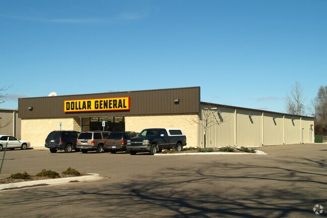

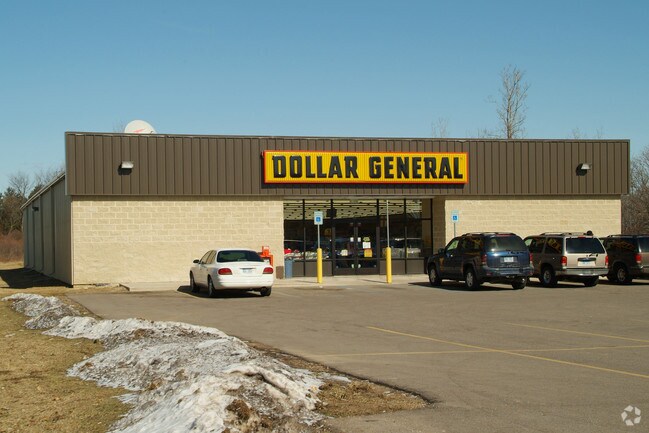
Property Detail
6092 W Pierson Rd
Flint, MI
W 10 A OF E 60 A OF SE 1/4 EXCEPT A PARCEL OF LAND BEG 1597.67 FT W AND 740 FT S AND S 55 DEG 15 MIN 50 SEC E 726.55 FT FROM
14-30-400-007
Genesee
Commercialnec
Michigan
B and X Area of moderate flood hazard, usually the area between the limits of the 100-year and 500-year floods.
7.53 AC
2024
Flint
2025
Detroit
010502
NEARBY LISTINGS FOR SALE OR LEASE
DEMOGRAPHICS near 6092 W Pierson Rd
1 mile
3 mile
5 mile
2025 Total Population
1,978
22,792
83,057
2030 Population
1,929
22,345
83,244
Pop Growth 2025-2030
(2.48%)
(1.96%)
+ 0.23%
Average Age
41
43
41
2025 Total Households
816
9,293
34,062
HH Growth 2025-2030
(2.45%)
(1.97%)
+ 0.22%
Median Household Inc
$53,470
$72,179
$53,162
Avg Household Size
2.30
2.40
2.30
2025 Avg HH Vehicles
2.00
2.00
2.00
Median Home Value
$169,230
$197,931
$126,410
Median Year Built
1967
1971
1964
Nearby Places
Map Layers
Map Styles
 Street
 Aerial
Layers
 Traffic
 Biking
Places
Listings with unknown addresses are not visible on the map
- Restaurants
- Banks
- Shops
- Fitness
- Groceries
PUBLIC TRANSPORTATION
AIRPORT
Bishop International
Drive
Walk
Distance
Bishop International
27 min
12.1 mi
Freight Ports
Port of Toledo
Drive
Walk
Distance
Port of Toledo
140 min
118.1 mi
Nearby Properties
Address
Land Use
TOTAL SIZE
Lot Size
Zoning
Address
Land Use
TOTAL SIZE
Lot Size
Zoning
72,367 SF
10.60 AC
R3-B (HDR)
Address
Land Use
TOTAL SIZE
Lot Size
Zoning
157,068 SF
160 AC
Address
Land Use
TOTAL SIZE
Lot Size
Zoning
11.97 AC
Address
Land Use
TOTAL SIZE
Lot Size
Zoning
10.30 AC
Address
Land Use
TOTAL SIZE
Lot Size
Zoning
41,298 SF
9.49 AC
Address
Land Use
TOTAL SIZE
Lot Size
Zoning
11.12 AC
Address
Land Use
TOTAL SIZE
Lot Size
Zoning
9.46 AC
Address
Land Use
TOTAL SIZE
Lot Size
Zoning
13.20 AC
Address
Land Use
TOTAL SIZE
Lot Size
Zoning
Address
Land Use
TOTAL SIZE
Lot Size
Zoning
2.45 AC
Address
Land Use
TOTAL SIZE
Lot Size
Zoning
5.10 AC
Address
Land Use
TOTAL SIZE
Lot Size
Zoning
62,121 SF
6.23 AC
B-2 CC GEN
Address
Land Use
TOTAL SIZE
Lot Size
Zoning
104.81 AC
Address
Land Use
TOTAL SIZE
Lot Size
Zoning
Address
Land Use
TOTAL SIZE
Lot Size
Zoning
5.70 AC
Address
Land Use
TOTAL SIZE
Lot Size
Zoning
2.02 AC
Address
Land Use
TOTAL SIZE
Lot Size
Zoning
1.41 AC
Address
Land Use
TOTAL SIZE
Lot Size
Zoning
3.32 AC
Address
Land Use
TOTAL SIZE
Lot Size
Zoning
100,022 SF
92 AC
Address
Land Use
TOTAL SIZE
Lot Size
Zoning
21,763 SF
4.36 AC
B-2 CC GEN
Address
Land Use
TOTAL SIZE
Lot Size
Zoning
31,008 SF
6.14 AC
R3-B (HDR)
Address
Land Use
TOTAL SIZE
Lot Size
Zoning
18.66 AC
Address
Land Use
TOTAL SIZE
Lot Size
Zoning
3.52 AC
Address
Land Use
TOTAL SIZE
Lot Size
Zoning
2.74 AC
Address
Land Use
TOTAL SIZE
Lot Size
Zoning
Address
Land Use
TOTAL SIZE
Lot Size
Zoning
12,500 SF
6.84 AC
Address
Land Use
TOTAL SIZE
Lot Size
Zoning
34,708 SF
5.05 AC
B-2 CC GEN
Address
Land Use
TOTAL SIZE
Lot Size
Zoning
31.55 AC
Address
Land Use
TOTAL SIZE
Lot Size
Zoning
0.64 AC
Address
Land Use
TOTAL SIZE
Lot Size
Zoning
47.29 AC
The World's #1 Commercial Real Estate Marketplace
Connect with us
© 2026 CoStar Group
The information above has been obtained from sources believed reliable. While we do not doubt its accuracy we have not verified it and make no guarantee, warranty or representation about it. It is your responsibility to independently confirm its accuracy and completeness. Any projections, opinions, assumptions, or estimates used are for example only and do not represent the current or future performance of the property. The value of this transaction to you depends on tax and other factors which should be evaluated by your tax, financial, and legal advisors. You and your advisors should conduct a careful, independent investigation of the property to determine to your satisfaction the suitability of the property for your needs.