Property Record
6093 Central Ave, Capitol Heights, MD 20743


NEARBY LISTINGS FOR SALE OR LEASE
Property Detail
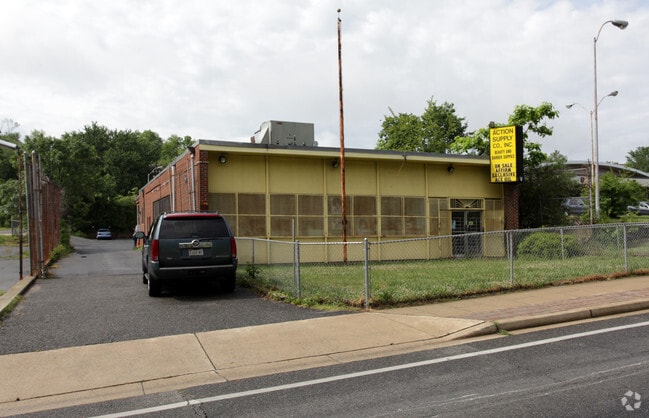
6093 Central Ave
18-2071751
PARCEL E
Storebuilding
Prince George's
X
Maryland
24033C0143E
0.38 AC
2024
Landover/Largo/Captl Hts
2025
Washington, DC
802803
Washington-Arlington-Alexandria, DC-VA-MD-WV
4,272 SF
DEMOGRAPHICS near 6093 Central Ave
1 Mile
3 Mile
5 Mile
2024 Total Population
19,963
163,948
448,054
2029 Population
18,920
156,092
426,021
Pop Growth 2024-2029
(5.22%)
(4.79%)
(4.92%)
Average Age
39
39
39
2024 Total Households
7,410
64,443
177,335
HH Growth 2024-2029
(5.72%)
(5.31%)
(5.54%)
Median Household Inc
$66,243
$62,727
$71,372
Avg Household Size
2.60
2.50
2.40
2024 Avg HH Vehicles
1.00
1.00
1.00
Median Home Value
$295,660
$318,702
$372,054
Median Year Built
1961
1965
1964
Nearby Places
Map Layers
Map Styles
 Street
 Aerial
- Restaurants
- Banks
- Shops
- Fitness
- Groceries
PUBLIC TRANSPORTATION
TRANSIT/SUBWAY
Capitol Heights (Blue Line - Washington Metropolitan Area Transit Authority Metrorail (Metrorail), Silver Line - Washington Metropolitan Area Transit Authority Metrorail (Metrorail))
DRIVE
WALK
Distance
Capitol Heights (Blue Line - Washington Metropolitan Area Transit Authority Metrorail (Metrorail), Silver Line - Washington Metropolitan Area Transit Authority Metrorail (Metrorail))
1 min
3 min
0.2 mi
Addison Road-Seat Pleasant (Blue Line - Washington Metropolitan Area Transit Authority Metrorail (Metrorail), Silver Line - Washington Metropolitan Area Transit Authority Metrorail (Metrorail))
DRIVE
WALK
Distance
Addison Road-Seat Pleasant (Blue Line - Washington Metropolitan Area Transit Authority Metrorail (Metrorail), Silver Line - Washington Metropolitan Area Transit Authority Metrorail (Metrorail))
4 min
18 min
0.9 mi
COMMUTER RAIL
Union Station (Brunswick Line - Maryland Area Regional Commuter Trains (The MARC), Camden Line - Maryland Area Regional Commuter Trains (The MARC), Penn Line - Maryland Area Regional Commuter Trains (The MARC))
DRIVE
WALK
Distance
Union Station (Brunswick Line - Maryland Area Regional Commuter Trains (The MARC), Camden Line - Maryland Area Regional Commuter Trains (The MARC), Penn Line - Maryland Area Regional Commuter Trains (The MARC))
17 min
5.6 mi
Union Station (Fredericksburg Line - Virginia Railway Express, Manassas Line - Virginia Railway Express)
DRIVE
WALK
Distance
Union Station (Fredericksburg Line - Virginia Railway Express, Manassas Line - Virginia Railway Express)
17 min
5.6 mi
AIRPORT
Ronald Reagan Washington Ntl
DRIVE
WALK
Distance
Ronald Reagan Washington Ntl
23 min
11.7 mi
Baltimore/Washington International Thurgood Marshall
DRIVE
WALK
Distance
Baltimore/Washington International Thurgood Marshall
37 min
31.1 mi
Washington Dulles International
DRIVE
WALK
Distance
Washington Dulles International
72 min
41.0 mi
Freight Ports
Port of Baltimore
DRIVE
WALK
Distance
Port of Baltimore
1 min
31.2 mi
SALE & LEASE HISTORY
LISTING DATE
SALE/LEASE

Nov 12, 2018
For Sale
Jun 07, 2019
For Sale
Jul 03, 2019
For Sale
Nearby Properties
Address
Land Use
TOTAL SIZE
Lot Size
Zoning
Address
Land Use
TOTAL SIZE
Lot Size
Zoning
169.85 AC
R-2;RA-1;U
Address
Land Use
TOTAL SIZE
Lot Size
Zoning
2,131,229 SF
144.34 AC
AG
Address
Land Use
TOTAL SIZE
Lot Size
Zoning
236,535 SF
12.54 AC
R-2
Address
Land Use
TOTAL SIZE
Lot Size
Zoning
177,081 SF
23.22 AC
LCD
Address
Land Use
TOTAL SIZE
Lot Size
Zoning
241,725 SF
4.71 AC
MU-7B;PDR-
Address
Land Use
TOTAL SIZE
Lot Size
Zoning
62.03 AC
UNZONED
Address
Land Use
TOTAL SIZE
Lot Size
Zoning
229,238 SF
1.51 AC
MU-7B
Address
Land Use
TOTAL SIZE
Lot Size
Zoning
12.60 AC
LTOC
Address
Land Use
TOTAL SIZE
Lot Size
Zoning
821,240 SF
48.32 AC
IH
Address
Land Use
TOTAL SIZE
Lot Size
Zoning
192,440 SF
7.67 AC
R-2;RA-1
Address
Land Use
TOTAL SIZE
Lot Size
Zoning
26.64 AC
RMF20
Address
Land Use
TOTAL SIZE
Lot Size
Zoning
107,130 SF
2.98 AC
R-2;RA-1
Address
Land Use
TOTAL SIZE
Lot Size
Zoning
419,689 SF
66.84 AC
PDR-1;PDR-
Address
Land Use
TOTAL SIZE
Lot Size
Zoning
132,000 SF
RA-1
Address
Land Use
TOTAL SIZE
Lot Size
Zoning
262,236 SF
15.26 AC
MU-8B
Address
Land Use
TOTAL SIZE
Lot Size
Zoning
379,168 SF
18.94 AC
RMF20
Address
Land Use
TOTAL SIZE
Lot Size
Zoning
181,530 SF
4.72 AC
R-2
Address
Land Use
TOTAL SIZE
Lot Size
Zoning
62,797 SF
0.55 AC
R2
Address
Land Use
TOTAL SIZE
Lot Size
Zoning
92,511 SF
1.48 AC
RA-1
Address
Land Use
TOTAL SIZE
Lot Size
Zoning
262 SF
24.86 AC
RMF20
Address
Land Use
TOTAL SIZE
Lot Size
Zoning
10.63 AC
RMF20
Address
Land Use
TOTAL SIZE
Lot Size
Zoning
123,950 SF
4.65 AC
R-2
Address
Land Use
TOTAL SIZE
Lot Size
Zoning
206,118 SF
0.82 AC
RA-1
Address
Land Use
TOTAL SIZE
Lot Size
Zoning
99,269 SF
4.73 AC
RA-1
Address
Land Use
TOTAL SIZE
Lot Size
Zoning
142,636 SF
3.69 AC
RA-1
Address
Land Use
TOTAL SIZE
Lot Size
Zoning
13.21 AC
RMF48
Address
Land Use
TOTAL SIZE
Lot Size
Zoning
115,788 SF
1.77 AC
MU-4;RA-1
Address
Land Use
TOTAL SIZE
Lot Size
Zoning
29.49 AC
RSFA
Address
Land Use
TOTAL SIZE
Lot Size
Zoning
162,221 SF
1.12 AC
R-2
Address
Land Use
TOTAL SIZE
Lot Size
Zoning
67,763 SF
1.66 AC
R-2
The World's #1 Commercial Real Estate Marketplace
Connect with us
© 2025 CoStar Group
The information above has been obtained from sources believed reliable. While we do not doubt its accuracy we have not verified it and make no guarantee, warranty or representation about it. It is your responsibility to independently confirm its accuracy and completeness. Any projections, opinions, assumptions, or estimates used are for example only and do not represent the current or future performance of the property. The value of this transaction to you depends on tax and other factors which should be evaluated by your tax, financial, and legal advisors. You and your advisors should conduct a careful, independent investigation of the property to determine to your satisfaction the suitability of the property for your needs.