Property Record
6093 Nc Highway 8, Lexington, NC 27292

NEARBY LISTINGS FOR SALE OR LEASE
-
-
View all Lexington listings for sale on LoopNet.com
Property Detail
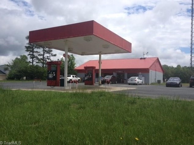
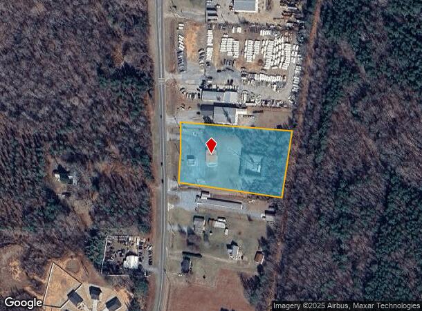
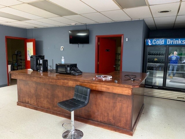
6093 Nc Highway 8
06-018-0-000-0042-0-0-0
L42 BK2638-105 NC 8
Conveniencestore
Davidson
X
North Carolina
3710672200J
3.30 AC
2025
South Davidson County
2025
Greensboro/Winston-Salem
061808
Winston-Salem, NC
2,640 SF
DEMOGRAPHICS near 6093 Nc Highway 8
1 Mile
3 Mile
5 Mile
2024 Total Population
568
6,267
18,800
2029 Population
601
6,623
19,891
Pop Growth 2024-2029
+ 5.81%
+ 5.68%
+ 5.80%
Average Age
44
43
43
2024 Total Households
230
2,573
7,691
HH Growth 2024-2029
+ 6.09%
+ 5.60%
+ 5.73%
Median Household Inc
$53,194
$56,900
$54,009
Avg Household Size
2.40
2.40
2.40
2024 Avg HH Vehicles
2.00
2.00
2.00
Median Home Value
$202,941
$189,652
$184,299
Median Year Built
1988
1984
1983
Nearby Places
Map Layers
Map Styles
 Street
 Aerial
- Restaurants
- Banks
- Shops
- Fitness
- Groceries
SALE & LEASE HISTORY
LISTING DATE
SALE/LEASE

Sep 24, 2016
For Sale
May 16, 2022
For Sale
Feb 21, 2020
For Sale
Nearby Properties
Address
Land Use
TOTAL SIZE
Lot Size
Zoning
Address
Land Use
TOTAL SIZE
Lot Size
Zoning
943,340 SF
202.76 AC
RA1
Address
Land Use
TOTAL SIZE
Lot Size
Zoning
29,313 SF
27.73 AC
RA2
Address
Land Use
TOTAL SIZE
Lot Size
Zoning
90,678 SF
39.70 AC
RA1
Address
Land Use
TOTAL SIZE
Lot Size
Zoning
5,490 SF
212.79 AC
RA1
Address
Land Use
TOTAL SIZE
Lot Size
Zoning
59,281 SF
4.34 AC
B
Address
Land Use
TOTAL SIZE
Lot Size
Zoning
104,230 SF
62.20 AC
I
Address
Land Use
TOTAL SIZE
Lot Size
Zoning
54,524 SF
6.52 AC
HCCU
Address
Land Use
TOTAL SIZE
Lot Size
Zoning
91,618 SF
23.25 AC
RA2
Address
Land Use
TOTAL SIZE
Lot Size
Zoning
2,736 SF
11.64 AC
RS
Address
Land Use
TOTAL SIZE
Lot Size
Zoning
354.84 AC
LICU
Address
Land Use
TOTAL SIZE
Lot Size
Zoning
71,373 SF
4.56 AC
B
Address
Land Use
TOTAL SIZE
Lot Size
Zoning
15,090 SF
39 AC
RS
Address
Land Use
TOTAL SIZE
Lot Size
Zoning
36,099 SF
16.45 AC
HI
Address
Land Use
TOTAL SIZE
Lot Size
Zoning
1.48 AC
HC
Address
Land Use
TOTAL SIZE
Lot Size
Zoning
10,390 SF
2.17 AC
HC
Address
Land Use
TOTAL SIZE
Lot Size
Zoning
10,576 SF
5.31 AC
HC
Address
Land Use
TOTAL SIZE
Lot Size
Zoning
8,507 SF
30.62 AC
LI
Address
Land Use
TOTAL SIZE
Lot Size
Zoning
216.40 AC
RA1
Address
Land Use
TOTAL SIZE
Lot Size
Zoning
17,200 SF
20.71 AC
LI
Address
Land Use
TOTAL SIZE
Lot Size
Zoning
10,193 SF
1.06 AC
HC
Address
Land Use
TOTAL SIZE
Lot Size
Zoning
7,800 SF
5.18 AC
RA1
Address
Land Use
TOTAL SIZE
Lot Size
Zoning
10,810 SF
17.60 AC
RS
Address
Land Use
TOTAL SIZE
Lot Size
Zoning
840 SF
41.87 AC
RM1
Address
Land Use
TOTAL SIZE
Lot Size
Zoning
99.21 AC
RA1
Address
Land Use
TOTAL SIZE
Lot Size
Zoning
17,081 SF
9.24 AC
RA1
Address
Land Use
TOTAL SIZE
Lot Size
Zoning
4,800 SF
1.64 AC
B
Address
Land Use
TOTAL SIZE
Lot Size
Zoning
4,576 SF
3 AC
RS
Address
Land Use
TOTAL SIZE
Lot Size
Zoning
11,022 SF
3.44 AC
RA1
Address
Land Use
TOTAL SIZE
Lot Size
Zoning
9,330 SF
1.59 AC
HC
Address
Land Use
TOTAL SIZE
Lot Size
Zoning
4,200 SF
1.51 AC
HC
The World's #1 Commercial Real Estate Marketplace
Connect with us
© 2026 CoStar Group
The information above has been obtained from sources believed reliable. While we do not doubt its accuracy we have not verified it and make no guarantee, warranty or representation about it. It is your responsibility to independently confirm its accuracy and completeness. Any projections, opinions, assumptions, or estimates used are for example only and do not represent the current or future performance of the property. The value of this transaction to you depends on tax and other factors which should be evaluated by your tax, financial, and legal advisors. You and your advisors should conduct a careful, independent investigation of the property to determine to your satisfaction the suitability of the property for your needs.