Property Record
6095 Main St, Clayton, CA 94517

Property Detail
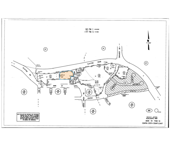
6095 Main St
118-560-011-9
PCL MAP 163 PG 1 POR PCL 4
Publicschool
CONTRA COSTA
AE The base floodplain where base flood elevations are provided. AE Zones are now used on new format FIRMs instead of A1-A30 Zones.
California
2025
1 AC
2025
Concord/Pleasant Hill
355308
East Bay/Oakland
8,732 SF
Oakland-Fremont-Berkeley, CA
NEARBY LISTINGS FOR SALE OR LEASE
-
-
View all Clayton listings for sale on LoopNet.com
DEMOGRAPHICS near 6095 Main St
1 mile
3 mile
5 mile
2025 Total Population
9,237
37,352
100,772
2030 Population
9,248
37,418
101,219
Pop Growth 2025-2030
+ 0.12%
+ 0.18%
+ 0.44%
Average Age
45
44
43
2025 Total Households
3,444
13,800
36,213
HH Growth 2025-2030
+ 0.17%
+ 0.20%
+ 0.45%
Median Household Inc
$168,361
$139,123
$136,536
Avg Household Size
2.70
2.70
2.70
2025 Avg HH Vehicles
2.00
2.00
2.00
Median Home Value
$952,667
$854,932
$840,040
Median Year Built
1979
1976
1974
Nearby Places
Map Layers
Map Styles
 Street
 Aerial
Layers
 Traffic
 Biking
Places
Listings with unknown addresses are not visible on the map
- Restaurants
- Banks
- Shops
- Fitness
- Groceries
PUBLIC TRANSPORTATION
AIRPORT
Metro Oakland International
Drive
Walk
Distance
Metro Oakland International
50 min
33.1 mi
Freight Ports
Port of Oakland
Drive
Walk
Distance
Port of Oakland
40 min
25.9 mi
Nearby Properties
Address
Land Use
TOTAL SIZE
Lot Size
Zoning
Address
Land Use
TOTAL SIZE
Lot Size
Zoning
180,705 SF
4.66 AC
Address
Land Use
TOTAL SIZE
Lot Size
Zoning
57.97 AC
Address
Land Use
TOTAL SIZE
Lot Size
Zoning
6,269 SF
4.40 AC
Address
Land Use
TOTAL SIZE
Lot Size
Zoning
9,272 SF
7.32 AC
Address
Land Use
TOTAL SIZE
Lot Size
Zoning
6,496 SF
7.99 AC
Address
Land Use
TOTAL SIZE
Lot Size
Zoning
42,164 SF
8.27 AC
Address
Land Use
TOTAL SIZE
Lot Size
Zoning
13,548 SF
4.87 AC
Address
Land Use
TOTAL SIZE
Lot Size
Zoning
74,716 SF
6.32 AC
Address
Land Use
TOTAL SIZE
Lot Size
Zoning
14,090 SF
8.79 AC
Address
Land Use
TOTAL SIZE
Lot Size
Zoning
61,012 SF
4.95 AC
Address
Land Use
TOTAL SIZE
Lot Size
Zoning
90,271 SF
12.83 AC
Address
Land Use
TOTAL SIZE
Lot Size
Zoning
93,016 SF
4.95 AC
Address
Land Use
TOTAL SIZE
Lot Size
Zoning
53,867 SF
4.56 AC
Address
Land Use
TOTAL SIZE
Lot Size
Zoning
144,600 SF
4.48 AC
Address
Land Use
TOTAL SIZE
Lot Size
Zoning
0.40 AC
Address
Land Use
TOTAL SIZE
Lot Size
Zoning
23,200 SF
3.74 AC
Address
Land Use
TOTAL SIZE
Lot Size
Zoning
79.31 AC
A4
Address
Land Use
TOTAL SIZE
Lot Size
Zoning
16,515 SF
61.37 AC
Address
Land Use
TOTAL SIZE
Lot Size
Zoning
8,772 SF
8.31 AC
Address
Land Use
TOTAL SIZE
Lot Size
Zoning
6,000 SF
2.73 AC
Address
Land Use
TOTAL SIZE
Lot Size
Zoning
57,354 SF
2.86 AC
Address
Land Use
TOTAL SIZE
Lot Size
Zoning
66,375 SF
1.72 AC
Address
Land Use
TOTAL SIZE
Lot Size
Zoning
61,845 SF
1.52 AC
Address
Land Use
TOTAL SIZE
Lot Size
Zoning
865.42 AC
Address
Land Use
TOTAL SIZE
Lot Size
Zoning
1,949 SF
379.30 AC
Address
Land Use
TOTAL SIZE
Lot Size
Zoning
8,715 SF
1.25 AC
Address
Land Use
TOTAL SIZE
Lot Size
Zoning
22,920 SF
1.30 AC
Address
Land Use
TOTAL SIZE
Lot Size
Zoning
13,997 SF
0.34 AC
Address
Land Use
TOTAL SIZE
Lot Size
Zoning
181.72 AC
A2
Address
Land Use
TOTAL SIZE
Lot Size
Zoning
16,370 SF
1.28 AC
The World's #1 Commercial Real Estate Marketplace
Connect with us
© 2026 CoStar Group
The information above has been obtained from sources believed reliable. While we do not doubt its accuracy we have not verified it and make no guarantee, warranty or representation about it. It is your responsibility to independently confirm its accuracy and completeness. Any projections, opinions, assumptions, or estimates used are for example only and do not represent the current or future performance of the property. The value of this transaction to you depends on tax and other factors which should be evaluated by your tax, financial, and legal advisors. You and your advisors should conduct a careful, independent investigation of the property to determine to your satisfaction the suitability of the property for your needs.