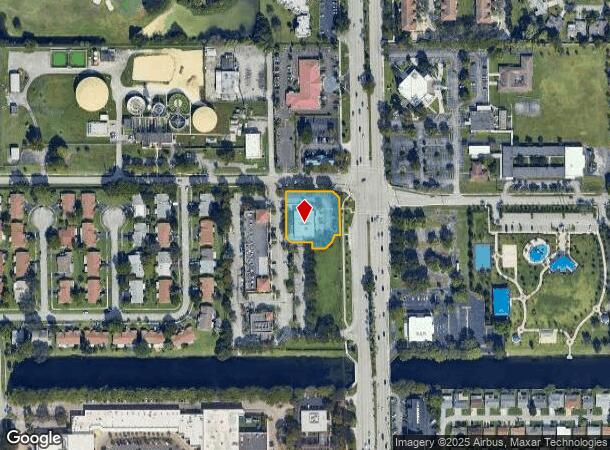
Property Record
6095 N University Dr, Tamarac, FL 33321


NEARBY LISTINGS FOR SALE OR LEASE
Property Detail
6095 N University Dr
49-41-09-45-0011
Westland Plat 172-64 B
Storebuilding
WESTLAND PLAT 172-64 B POR OF PAR B DESC AS: COMM AT NW COR PAR B,E 220.01,S 10 TO POB,S 165.97,SE 22.06,E 74.04,S 21.48, E 47.11,NE 31,NE 27.32,E 18.84, N 131.09,NW 32.16,W 164.60 TO POB
X
Broward
12011C0335H
Florida
2024
0.78 AC
2025
NW Broward/Coral Springs
060129
South Florida
6,840 SF
Fort Lauderdale-Pompano Beach-Deerfield Beach, FL
DEMOGRAPHICS near 6095 N University Dr
1 Mile
3 Mile
5 Mile
2024 Total Population
20,660
192,512
470,160
2029 Population
20,716
191,928
469,810
Pop Growth 2024-2029
+ 0.27%
(0.30%)
(0.07%)
Average Age
42
42
41
2024 Total Households
8,092
74,266
178,298
HH Growth 2024-2029
(0.49%)
(0.58%)
(0.33%)
Median Household Inc
$46,998
$54,638
$56,003
Avg Household Size
2.40
2.50
2.50
2024 Avg HH Vehicles
1.00
2.00
2.00
Median Home Value
$222,366
$234,919
$263,027
Median Year Built
1979
1980
1979
Nearby Places
Map Layers
Map Styles
 Street
 Aerial
- Restaurants
- Banks
- Shops
- Fitness
- Groceries
PUBLIC TRANSPORTATION
COMMUTER RAIL
Cypress Creek (Tri-County Commuter - South Florida Regional Transportation Authority (Tri-Rail))
DRIVE
WALK
Distance
Cypress Creek (Tri-County Commuter - South Florida Regional Transportation Authority (Tri-Rail))
14 min
7.5 mi
AIRPORT
Fort Lauderdale/Hollywood International
DRIVE
WALK
Distance
Fort Lauderdale/Hollywood International
28 min
14.5 mi
Miami International
DRIVE
WALK
Distance
Miami International
49 min
36.3 mi
Palm Beach International
DRIVE
WALK
Distance
Palm Beach International
57 min
42.8 mi
Freight Ports
Port Everglades
DRIVE
WALK
Distance
Port Everglades
27 min
16.5 mi
Nearby Properties
Address
Land Use
TOTAL SIZE
Lot Size
Zoning
Address
Land Use
TOTAL SIZE
Lot Size
Zoning
326,159 SF
15.30 AC
PDD
Address
Land Use
TOTAL SIZE
Lot Size
Zoning
842,307 SF
55.40 AC
BP
Address
Land Use
TOTAL SIZE
Lot Size
Zoning
362,362 SF
17.20 AC
RM-16
Address
Land Use
TOTAL SIZE
Lot Size
Zoning
296,166 SF
18.40 AC
RM-18
Address
Land Use
TOTAL SIZE
Lot Size
Zoning
291,023 SF
22.36 AC
RM-25
Address
Land Use
TOTAL SIZE
Lot Size
Zoning
325,412 SF
6.95 AC
PD
Address
Land Use
TOTAL SIZE
Lot Size
Zoning
328,631 SF
19.96 AC
R-3
Address
Land Use
TOTAL SIZE
Lot Size
Zoning
239,102 SF
7.01 AC
MU-N
Address
Land Use
TOTAL SIZE
Lot Size
Zoning
177,793 SF
22.35 AC
BP
Address
Land Use
TOTAL SIZE
Lot Size
Zoning
566,155 SF
38.24 AC
B-3
Address
Land Use
TOTAL SIZE
Lot Size
Zoning
391,305 SF
30.78 AC
CF-E
Address
Land Use
TOTAL SIZE
Lot Size
Zoning
261,652 SF
13.64 AC
RM-16
Address
Land Use
TOTAL SIZE
Lot Size
Zoning
188,516 SF
4.59 AC
PD
Address
Land Use
TOTAL SIZE
Lot Size
Zoning
460,262 SF
73.87 AC
RM-5
Address
Land Use
TOTAL SIZE
Lot Size
Zoning
495,360 SF
3.09 AC
RM-45
Address
Land Use
TOTAL SIZE
Lot Size
Zoning
265,099 SF
14.59 AC
R-3
Address
Land Use
TOTAL SIZE
Lot Size
Zoning
156,626 SF
14.91 AC
R-3
Address
Land Use
TOTAL SIZE
Lot Size
Zoning
314,004 SF
28.37 AC
CF
Address
Land Use
TOTAL SIZE
Lot Size
Zoning
225,577 SF
21.20 AC
RM-18
Address
Land Use
TOTAL SIZE
Lot Size
Zoning
342,995 SF
14.27 AC
RM-16
Address
Land Use
TOTAL SIZE
Lot Size
Zoning
256,572 SF
17.68 AC
R-3
Address
Land Use
TOTAL SIZE
Lot Size
Zoning
194,766 SF
13.35 AC
RC
Address
Land Use
TOTAL SIZE
Lot Size
Zoning
269,994 SF
10.66 AC
RM-16
Address
Land Use
TOTAL SIZE
Lot Size
Zoning
229,695 SF
20.17 AC
MU-G
Address
Land Use
TOTAL SIZE
Lot Size
Zoning
158,317 SF
17.64 AC
R-3
Address
Land Use
TOTAL SIZE
Lot Size
Zoning
45.51 AC
I-1
Address
Land Use
TOTAL SIZE
Lot Size
Zoning
201,120 SF
12.55 AC
MU-C
Address
Land Use
TOTAL SIZE
Lot Size
Zoning
403,338 SF
8.20 AC
B-3
Address
Land Use
TOTAL SIZE
Lot Size
Zoning
179,157 SF
16.70 AC
R-3
Address
Land Use
TOTAL SIZE
Lot Size
Zoning
300,819 SF
11.30 AC
RM-25
The World's #1 Commercial Real Estate Marketplace
Connect with us
© 2025 CoStar Group
The information above has been obtained from sources believed reliable. While we do not doubt its accuracy we have not verified it and make no guarantee, warranty or representation about it. It is your responsibility to independently confirm its accuracy and completeness. Any projections, opinions, assumptions, or estimates used are for example only and do not represent the current or future performance of the property. The value of this transaction to you depends on tax and other factors which should be evaluated by your tax, financial, and legal advisors. You and your advisors should conduct a careful, independent investigation of the property to determine to your satisfaction the suitability of the property for your needs.