Property Record
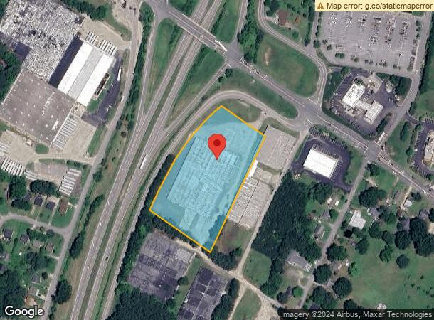
61 Americal Rd, Henderson, NC 27536


Current Lease Availabilities
NEARBY LISTINGS FOR SALE OR LEASE
Property Detail
61 Americal Rd
0083-01010
Mae B Morris Estate
Warehouse
61 AMERICAL RD 4.167
X
Vance
3720198200K
North Carolina
2025
3.90 AC
2025
North Carolina Northeast Area
960500
Other Market Areas
60,036 SF
Henderson, NC
DEMOGRAPHICS near 61 Americal Rd
1 Mile
3 Mile
5 Mile
2024 Total Population
4,619
19,962
27,346
2029 Population
4,639
19,863
27,081
Pop Growth 2024-2029
+ 0.43%
(0.50%)
(0.97%)
Average Age
38
40
40
2024 Total Households
1,780
7,941
10,913
HH Growth 2024-2029
+ 0.45%
(0.45%)
(0.93%)
Median Household Inc
$26,091
$36,331
$40,851
Avg Household Size
2.50
2.40
2.40
2024 Avg HH Vehicles
2.00
2.00
2.00
Median Home Value
$58,455
$89,474
$113,234
Median Year Built
1966
1971
1975
Nearby Places
Map Layers
Map Styles
 Street
 Aerial
- Restaurants
- Banks
- Shops
- Fitness
- Groceries
Nearby Properties
Address
Land Use
TOTAL SIZE
Lot Size
Zoning
Address
Land Use
TOTAL SIZE
Lot Size
Zoning
125,900 SF
38.64 AC
HI2
Address
Land Use
TOTAL SIZE
Lot Size
Zoning
149,688 SF
131.64 AC
HI2
Address
Land Use
TOTAL SIZE
Lot Size
Zoning
96,081 SF
1.33 AC
HB1
Address
Land Use
TOTAL SIZE
Lot Size
Zoning
603,204 SF
45.50 AC
HI2
Address
Land Use
TOTAL SIZE
Lot Size
Zoning
51,768 SF
40.75 AC
HR8M
Address
Land Use
TOTAL SIZE
Lot Size
Zoning
104,496 SF
14.95 AC
HR6
Address
Land Use
TOTAL SIZE
Lot Size
Zoning
64,208 SF
1.90 AC
HB1
Address
Land Use
TOTAL SIZE
Lot Size
Zoning
58,025 SF
12.06 AC
HB4
Address
Land Use
TOTAL SIZE
Lot Size
Zoning
167,900 SF
70.82 AC
HR15
Address
Land Use
TOTAL SIZE
Lot Size
Zoning
230,400 SF
69.68 AC
HI2
Address
Land Use
TOTAL SIZE
Lot Size
Zoning
22,572 SF
88.80 AC
HR15M
Address
Land Use
TOTAL SIZE
Lot Size
Zoning
157,874 SF
40 AC
OI
Address
Land Use
TOTAL SIZE
Lot Size
Zoning
214,900 SF
25.24 AC
HI2
Address
Land Use
TOTAL SIZE
Lot Size
Zoning
24,888 SF
33.39 AC
HR20
Address
Land Use
TOTAL SIZE
Lot Size
Zoning
54,090 SF
7.61 AC
HB3
Address
Land Use
TOTAL SIZE
Lot Size
Zoning
150,320 SF
9.51 AC
HB3
Address
Land Use
TOTAL SIZE
Lot Size
Zoning
54,793 SF
47.70 AC
HR15
Address
Land Use
TOTAL SIZE
Lot Size
Zoning
85,355 SF
13.80 AC
HB4
Address
Land Use
TOTAL SIZE
Lot Size
Zoning
257,656 SF
31.28 AC
HI2
Address
Land Use
TOTAL SIZE
Lot Size
Zoning
27,784 SF
2.04 AC
HB1
Address
Land Use
TOTAL SIZE
Lot Size
Zoning
78,661 SF
4.84 AC
HOI
Address
Land Use
TOTAL SIZE
Lot Size
Zoning
49,414 SF
8.46 AC
HB4
Address
Land Use
TOTAL SIZE
Lot Size
Zoning
1,824 SF
13 AC
HR8
Address
Land Use
TOTAL SIZE
Lot Size
Zoning
56,315 SF
8.69 AC
HB4
Address
Land Use
TOTAL SIZE
Lot Size
Zoning
48,490 SF
6.14 AC
HB2A
Address
Land Use
TOTAL SIZE
Lot Size
Zoning
40,456 SF
2 AC
HB3
Address
Land Use
TOTAL SIZE
Lot Size
Zoning
29,400 SF
8.24 AC
HB2
Address
Land Use
TOTAL SIZE
Lot Size
Zoning
67,977 SF
17.65 AC
HOI
Address
Land Use
TOTAL SIZE
Lot Size
Zoning
12,000 SF
1.50 AC
HI2
Address
Land Use
TOTAL SIZE
Lot Size
Zoning
65,156 SF
46.85 AC
HI2
The World's #1 Commercial Real Estate Marketplace
Connect with us
© 2025 CoStar Group
The information above has been obtained from sources believed reliable. While we do not doubt its accuracy we have not verified it and make no guarantee, warranty or representation about it. It is your responsibility to independently confirm its accuracy and completeness. Any projections, opinions, assumptions, or estimates used are for example only and do not represent the current or future performance of the property. The value of this transaction to you depends on tax and other factors which should be evaluated by your tax, financial, and legal advisors. You and your advisors should conduct a careful, independent investigation of the property to determine to your satisfaction the suitability of the property for your needs.