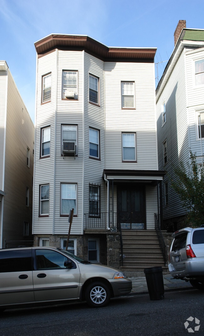
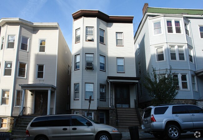
Property Record
61 Cliff Ave, Yonkers, NY 10705
NEARBY LISTINGS FOR SALE OR LEASE
Property Detail
61 Cliff Ave
1800-001-000-00128-000-0035
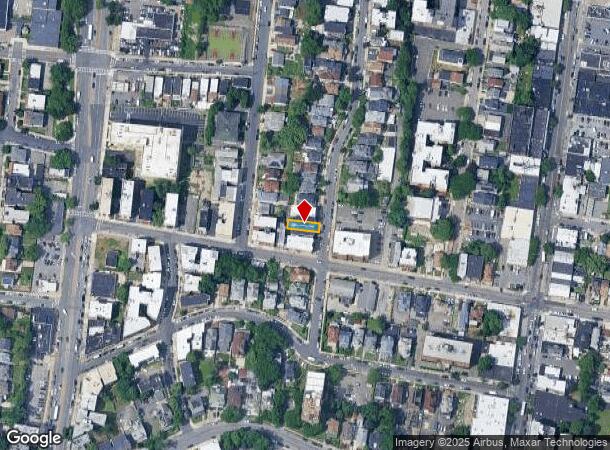
Map 157 Lots Bryn Maur
Apartment
Westchester
X
New York
34003C0220H
35.000
2025
0.05 AC
2024
Ludlow
000205
Westchester/So Connecticut
4,286 SF
New York-Jersey City-White Plains, NY-NJ
DEMOGRAPHICS near 61 Cliff Ave
1 Mile
3 Mile
5 Mile
2024 Total Population
61,091
317,331
1,108,236
2029 Population
59,290
303,357
1,045,791
Pop Growth 2024-2029
(2.95%)
(4.40%)
(5.63%)
Average Age
39
40
40
2024 Total Households
21,553
120,528
406,018
HH Growth 2024-2029
(3.35%)
(4.82%)
(6.06%)
Median Household Inc
$54,573
$64,827
$58,541
Avg Household Size
2.60
2.50
2.60
2024 Avg HH Vehicles
1.00
1.00
1.00
Median Home Value
$466,049
$454,212
$505,408
Median Year Built
1954
1953
1950
Nearby Places
Map Layers
Map Styles
 Street
 Aerial
- Restaurants
- Banks
- Shops
- Fitness
- Groceries
PUBLIC TRANSPORTATION
TRANSIT/SUBWAY
Ludlow Station (Hudson Line - Metro-North Commuter Railroad Company (Metro-North))
DRIVE
WALK
Distance
Ludlow Station (Hudson Line - Metro-North Commuter Railroad Company (Metro-North))
3 min
14 min
0.7 mi
COMMUTER RAIL
Ludlow Station (Hudson Line - Metro-North Commuter Railroad Company (Metro-North))
DRIVE
WALK
Distance
Ludlow Station (Hudson Line - Metro-North Commuter Railroad Company (Metro-North))
3 min
16 min
0.8 mi
Yonkers Station (Hudson Line - Metro-North Commuter Railroad Company (Metro-North))
DRIVE
WALK
Distance
Yonkers Station (Hudson Line - Metro-North Commuter Railroad Company (Metro-North))
4 min
1.6 mi
AIRPORT
LaGuardia
DRIVE
WALK
Distance
LaGuardia
28 min
14.8 mi
Westchester County
DRIVE
WALK
Distance
Westchester County
33 min
21.3 mi
John F Kennedy International
DRIVE
WALK
Distance
John F Kennedy International
42 min
24.6 mi
Freight Ports
NY - Red Hook Container Terminal
DRIVE
WALK
Distance
NY - Red Hook Container Terminal
41 min
20.3 mi
Nearby Properties
Address
Land Use
TOTAL SIZE
Lot Size
Zoning
Address
Land Use
TOTAL SIZE
Lot Size
Zoning
111.37 AC
P1
Address
Land Use
TOTAL SIZE
Lot Size
Zoning
72 AC
P1
Address
Land Use
TOTAL SIZE
Lot Size
Zoning
895,256 SF
8.32 AC
R7-1
Address
Land Use
TOTAL SIZE
Lot Size
Zoning
219.71 AC
O
Address
Land Use
TOTAL SIZE
Lot Size
Zoning
204,200 SF
1.68 AC
R7-1
Address
Land Use
TOTAL SIZE
Lot Size
Zoning
100,151 SF
22.13 AC
B2
Address
Land Use
TOTAL SIZE
Lot Size
Zoning
617,567 SF
3.19 AC
R7-1
Address
Land Use
TOTAL SIZE
Lot Size
Zoning
707,353 SF
29.34 AC
R6
Address
Land Use
TOTAL SIZE
Lot Size
Zoning
135.51 AC
RR
Address
Land Use
TOTAL SIZE
Lot Size
Zoning
94.42 AC
P
Address
Land Use
TOTAL SIZE
Lot Size
Zoning
Address
Land Use
TOTAL SIZE
Lot Size
Zoning
87,000 SF
455.70 AC
PARK
Address
Land Use
TOTAL SIZE
Lot Size
Zoning
225.36 AC
O
Address
Land Use
TOTAL SIZE
Lot Size
Zoning
450,784 SF
42.36 AC
R4
Address
Land Use
TOTAL SIZE
Lot Size
Zoning
18,445 SF
510.83 AC
PARK
Address
Land Use
TOTAL SIZE
Lot Size
Zoning
251,884 SF
21.53 AC
R6
Address
Land Use
TOTAL SIZE
Lot Size
Zoning
28.78 AC
B2
Address
Land Use
TOTAL SIZE
Lot Size
Zoning
677,078 SF
4.91 AC
R6
Address
Land Use
TOTAL SIZE
Lot Size
Zoning
614,887 SF
14.77 AC
R4
Address
Land Use
TOTAL SIZE
Lot Size
Zoning
244,650 SF
2 AC
R7-1
Address
Land Use
TOTAL SIZE
Lot Size
Zoning
Address
Land Use
TOTAL SIZE
Lot Size
Zoning
61,055 SF
343.42 AC
R6
Address
Land Use
TOTAL SIZE
Lot Size
Zoning
285,373 SF
2.66 AC
R4
Address
Land Use
TOTAL SIZE
Lot Size
Zoning
478 SF
10.45 AC
Address
Land Use
TOTAL SIZE
Lot Size
Zoning
203,837 SF
1.92 AC
R6
Address
Land Use
TOTAL SIZE
Lot Size
Zoning
202,062 SF
29 AC
O
Address
Land Use
TOTAL SIZE
Lot Size
Zoning
58.78 AC
P
Address
Land Use
TOTAL SIZE
Lot Size
Zoning
193,520 SF
4.32 AC
R4
Address
Land Use
TOTAL SIZE
Lot Size
Zoning
633,000 SF
9.16 AC
R6
Address
Land Use
TOTAL SIZE
Lot Size
Zoning
The World's #1 Commercial Real Estate Marketplace
Connect with us
© 2025 CoStar Group
The information above has been obtained from sources believed reliable. While we do not doubt its accuracy we have not verified it and make no guarantee, warranty or representation about it. It is your responsibility to independently confirm its accuracy and completeness. Any projections, opinions, assumptions, or estimates used are for example only and do not represent the current or future performance of the property. The value of this transaction to you depends on tax and other factors which should be evaluated by your tax, financial, and legal advisors. You and your advisors should conduct a careful, independent investigation of the property to determine to your satisfaction the suitability of the property for your needs.