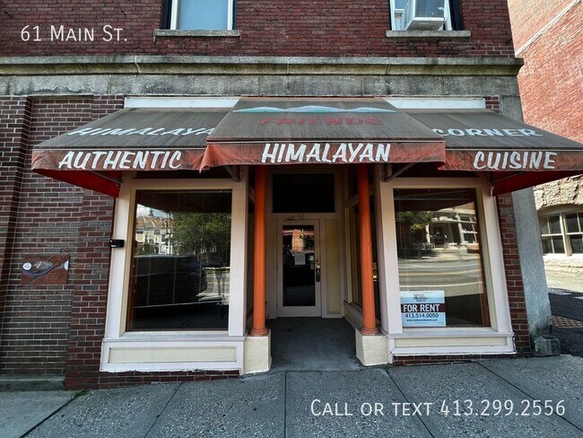
Property Record
61 Main St, Amherst, MA 01002
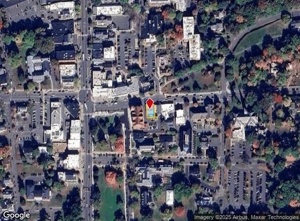
NEARBY LISTINGS FOR SALE OR LEASE
Property Detail
61 Main St
AMHE-000014A-000000-000258
Hampshire
Commercialofficeresidentialmixeduse
Massachusetts
X
258
2501560169D
0.08 AC
2025
Hampshire County
2025
Hartford
820500
Amherst Town-Northampton, MA
5,082 SF
DEMOGRAPHICS near 61 Main St
1 Mile
3 Mile
5 Mile
2024 Total Population
21,258
38,832
47,963
2029 Population
19,826
33,842
41,269
Pop Growth 2024-2029
(6.74%)
(12.85%)
(13.96%)
Average Age
25
31
34
2024 Total Households
2,506
9,469
13,348
HH Growth 2024-2029
(20.99%)
(21.06%)
(20.45%)
Median Household Inc
$55,273
$66,882
$78,930
Avg Household Size
2.10
2.30
2.30
2024 Avg HH Vehicles
2.00
2.00
2.00
Median Home Value
$452,528
$409,803
$406,920
Median Year Built
1951
1973
1973
Nearby Places
Map Layers
Map Styles
 Street
 Aerial
- Restaurants
- Banks
- Shops
- Fitness
- Groceries
PUBLIC TRANSPORTATION
COMMUTER RAIL
DRIVE
WALK
Distance
19 min
7.6 mi
AIRPORT
Bradley International
DRIVE
WALK
Distance
Bradley International
67 min
37.0 mi
Worcester Regional
DRIVE
WALK
Distance
Worcester Regional
82 min
45.6 mi
SALE & LEASE HISTORY
LISTING DATE
SALE/LEASE

Oct 12, 2022
For Lease
May 14, 2024
For Lease
Nearby Properties
Address
Land Use
TOTAL SIZE
Lot Size
Zoning
Address
Land Use
TOTAL SIZE
Lot Size
Zoning
258,531 SF
17.10 AC
Address
Land Use
TOTAL SIZE
Lot Size
Zoning
197,000 SF
22.53 AC
Address
Land Use
TOTAL SIZE
Lot Size
Zoning
1,344 SF
284.31 AC
Address
Land Use
TOTAL SIZE
Lot Size
Zoning
185,998 SF
32.09 AC
I
Address
Land Use
TOTAL SIZE
Lot Size
Zoning
108,000 SF
30.85 AC
Address
Land Use
TOTAL SIZE
Lot Size
Zoning
108,000 SF
14.34 AC
Address
Land Use
TOTAL SIZE
Lot Size
Zoning
90,800 SF
12.07 AC
Address
Land Use
TOTAL SIZE
Lot Size
Zoning
45,220 SF
31.01 AC
Address
Land Use
TOTAL SIZE
Lot Size
Zoning
141,603 SF
35.70 AC
B
Address
Land Use
TOTAL SIZE
Lot Size
Zoning
46,138 SF
0.96 AC
Address
Land Use
TOTAL SIZE
Lot Size
Zoning
103,694 SF
0.81 AC
Address
Land Use
TOTAL SIZE
Lot Size
Zoning
23,690 SF
13.98 AC
Address
Land Use
TOTAL SIZE
Lot Size
Zoning
84,480 SF
6.15 AC
I
Address
Land Use
TOTAL SIZE
Lot Size
Zoning
18,614 SF
22.20 AC
Address
Land Use
TOTAL SIZE
Lot Size
Zoning
373,881 SF
46.52 AC
B
Address
Land Use
TOTAL SIZE
Lot Size
Zoning
99,483 SF
1.04 AC
Address
Land Use
TOTAL SIZE
Lot Size
Zoning
10,248 SF
26.17 AC
Address
Land Use
TOTAL SIZE
Lot Size
Zoning
14,517 SF
34.82 AC
Address
Land Use
TOTAL SIZE
Lot Size
Zoning
12,032 SF
5.11 AC
Address
Land Use
TOTAL SIZE
Lot Size
Zoning
94,415 SF
3.83 AC
Address
Land Use
TOTAL SIZE
Lot Size
Zoning
77,397 SF
0.53 AC
Address
Land Use
TOTAL SIZE
Lot Size
Zoning
5,182 SF
20.70 AC
Address
Land Use
TOTAL SIZE
Lot Size
Zoning
13,426 SF
16 AC
Address
Land Use
TOTAL SIZE
Lot Size
Zoning
11,657 SF
4.26 AC
Address
Land Use
TOTAL SIZE
Lot Size
Zoning
94,560 SF
1.65 AC
Address
Land Use
TOTAL SIZE
Lot Size
Zoning
31.73 AC
Address
Land Use
TOTAL SIZE
Lot Size
Zoning
6,240 SF
19.93 AC
Address
Land Use
TOTAL SIZE
Lot Size
Zoning
6,064 SF
19.39 AC
Address
Land Use
TOTAL SIZE
Lot Size
Zoning
51,018 SF
0.32 AC
Address
Land Use
TOTAL SIZE
Lot Size
Zoning
127,994 SF
8.46 AC
B
The World's #1 Commercial Real Estate Marketplace
Connect with us
© 2026 CoStar Group
The information above has been obtained from sources believed reliable. While we do not doubt its accuracy we have not verified it and make no guarantee, warranty or representation about it. It is your responsibility to independently confirm its accuracy and completeness. Any projections, opinions, assumptions, or estimates used are for example only and do not represent the current or future performance of the property. The value of this transaction to you depends on tax and other factors which should be evaluated by your tax, financial, and legal advisors. You and your advisors should conduct a careful, independent investigation of the property to determine to your satisfaction the suitability of the property for your needs.