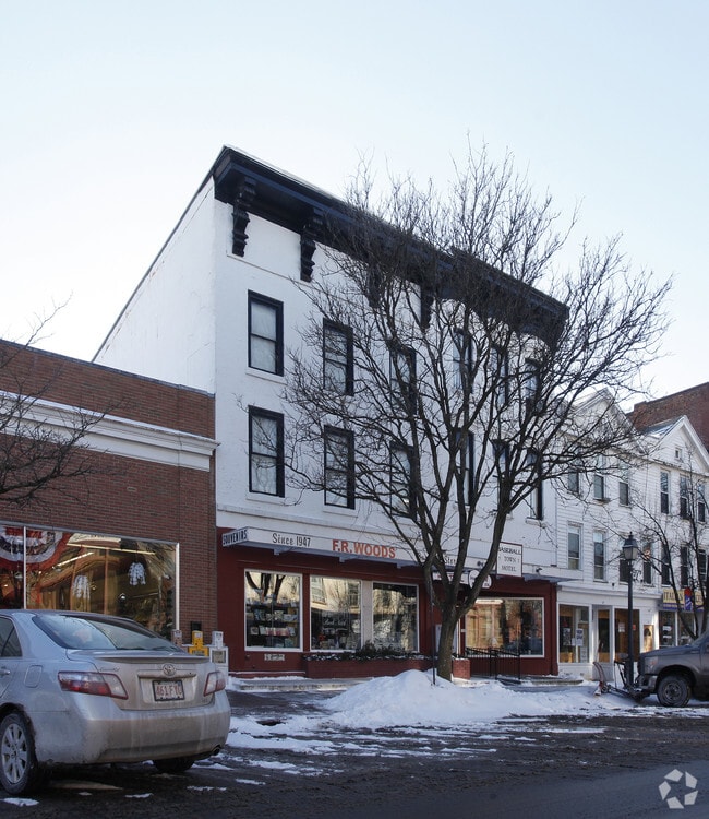
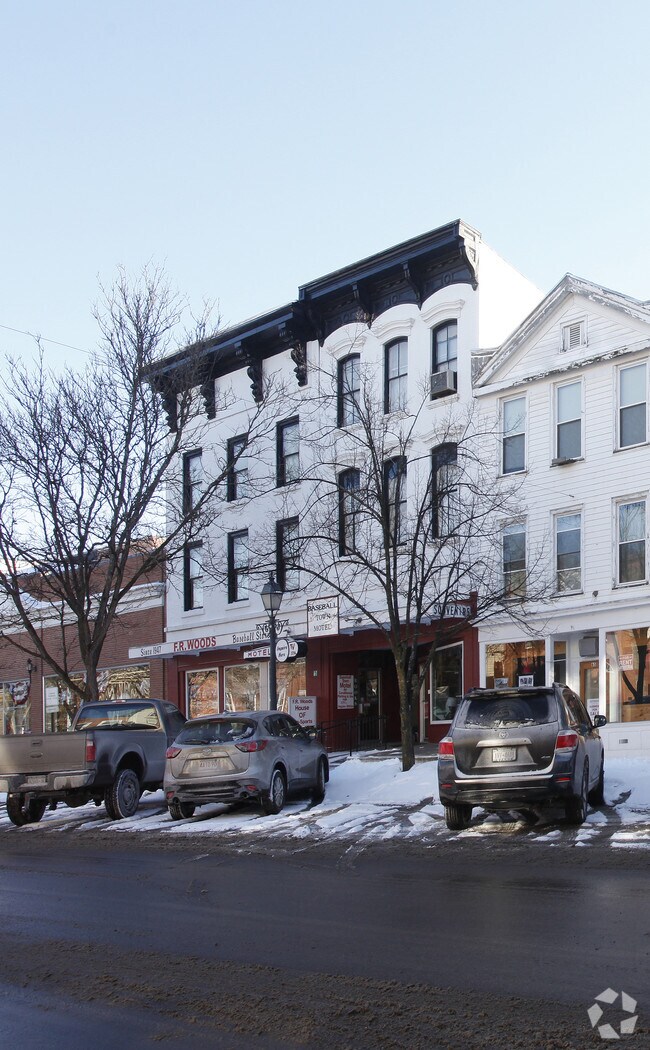
Property Record
61 Main St, Cooperstown, NY 13326
Property Detail
61 Main St
365001-131-006-0002-061-000-0000
961 0 0
Commercialofficeresidentialmixeduse
Otsego
B
New York
B and X Area of moderate flood hazard, usually the area between the limits of the 100-year and 500-year floods.
61.000
2025
0.11 AC
2024
New York Southeast Area
590202
Albany/Schenectady/Troy
6,916 SF
Oneonta, NY
NEARBY LISTINGS FOR SALE OR LEASE
-
-
View all Cooperstown listings for sale on LoopNet.com
DEMOGRAPHICS near 61 Main St
1 mile
3 mile
5 mile
2024 Total Population
2,086
3,276
5,231
2029 Population
2,094
3,302
5,288
Pop Growth 2024-2029
+ 0.38%
+ 0.79%
+ 1.09%
Average Age
48
48
48
2024 Total Households
964
1,469
2,341
HH Growth 2024-2029
+ 0.31%
+ 0.88%
+ 1.37%
Median Household Inc
$63,918
$67,500
$71,386
Avg Household Size
1.90
2.00
2.10
2024 Avg HH Vehicles
2.00
2.00
2.00
Median Home Value
$372,684
$343,023
$329,348
Median Year Built
1946
1948
1949
Nearby Places
Map Layers
Map Styles
 Street
 Aerial
Transit
 Traffic
 Biking
Places
Listings with unknown addresses are not visible on the map
- Restaurants
- Banks
- Shops
- Fitness
- Groceries
Nearby Properties
Address
Land Use
TOTAL SIZE
Lot Size
Zoning
Address
Land Use
TOTAL SIZE
Lot Size
Zoning
5.40 AC
Address
Land Use
TOTAL SIZE
Lot Size
Zoning
Address
Land Use
TOTAL SIZE
Lot Size
Zoning
144,000 SF
18.50 AC
Address
Land Use
TOTAL SIZE
Lot Size
Zoning
103,576 SF
3.47 AC
R1
Address
Land Use
TOTAL SIZE
Lot Size
Zoning
8.29 AC
R1
Address
Land Use
TOTAL SIZE
Lot Size
Zoning
0.24 AC
Address
Land Use
TOTAL SIZE
Lot Size
Zoning
43,488 SF
4.63 AC
R2
Address
Land Use
TOTAL SIZE
Lot Size
Zoning
15.70 AC
01 - NOT Z
Address
Land Use
TOTAL SIZE
Lot Size
Zoning
0.70 AC
Address
Land Use
TOTAL SIZE
Lot Size
Zoning
0.38 AC
Address
Land Use
TOTAL SIZE
Lot Size
Zoning
105,825 SF
49.02 AC
01 - NOT Z
Address
Land Use
TOTAL SIZE
Lot Size
Zoning
69,172 SF
6.44 AC
R2
Address
Land Use
TOTAL SIZE
Lot Size
Zoning
0.15 AC
Address
Land Use
TOTAL SIZE
Lot Size
Zoning
43,110 SF
3.28 AC
R1
Address
Land Use
TOTAL SIZE
Lot Size
Zoning
3,020 SF
9.21 AC
CD
Address
Land Use
TOTAL SIZE
Lot Size
Zoning
25,635 SF
2.20 AC
R2
Address
Land Use
TOTAL SIZE
Lot Size
Zoning
29,994 SF
1.70 AC
C
Address
Land Use
TOTAL SIZE
Lot Size
Zoning
1,531 SF
6.56 AC
01 - NOT Z
Address
Land Use
TOTAL SIZE
Lot Size
Zoning
0.46 AC
R1
Address
Land Use
TOTAL SIZE
Lot Size
Zoning
9.44 AC
01 - NOT Z
Address
Land Use
TOTAL SIZE
Lot Size
Zoning
11,962 SF
2.57 AC
R2
Address
Land Use
TOTAL SIZE
Lot Size
Zoning
Address
Land Use
TOTAL SIZE
Lot Size
Zoning
3,595 SF
7.76 AC
Address
Land Use
TOTAL SIZE
Lot Size
Zoning
19,220 SF
0.41 AC
B
Address
Land Use
TOTAL SIZE
Lot Size
Zoning
6,890 SF
1.81 AC
01 - NOT Z
Address
Land Use
TOTAL SIZE
Lot Size
Zoning
19,368 SF
16.22 AC
Address
Land Use
TOTAL SIZE
Lot Size
Zoning
8,040 SF
0.56 AC
R2
Address
Land Use
TOTAL SIZE
Lot Size
Zoning
11,504 SF
0.78 AC
R2
Address
Land Use
TOTAL SIZE
Lot Size
Zoning
9,657 SF
1.25 AC
C
Address
Land Use
TOTAL SIZE
Lot Size
Zoning
10,697 SF
0.83 AC
C
The World's #1 Commercial Real Estate Marketplace
Connect with us
© 2026 CoStar Group
The information above has been obtained from sources believed reliable. While we do not doubt its accuracy we have not verified it and make no guarantee, warranty or representation about it. It is your responsibility to independently confirm its accuracy and completeness. Any projections, opinions, assumptions, or estimates used are for example only and do not represent the current or future performance of the property. The value of this transaction to you depends on tax and other factors which should be evaluated by your tax, financial, and legal advisors. You and your advisors should conduct a careful, independent investigation of the property to determine to your satisfaction the suitability of the property for your needs.