Property Record
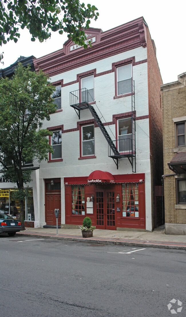
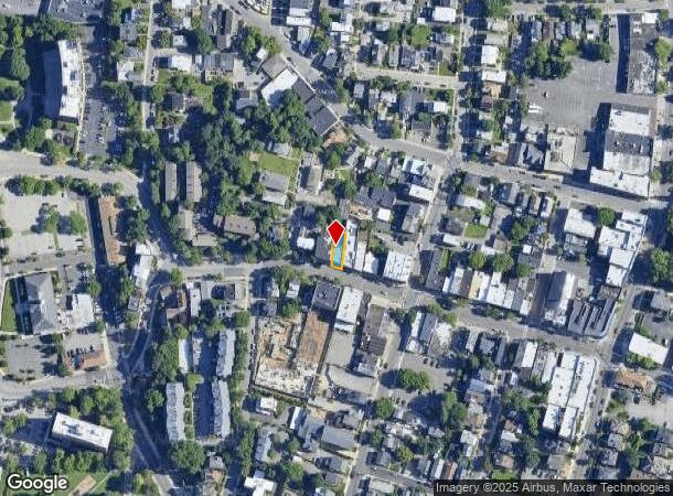
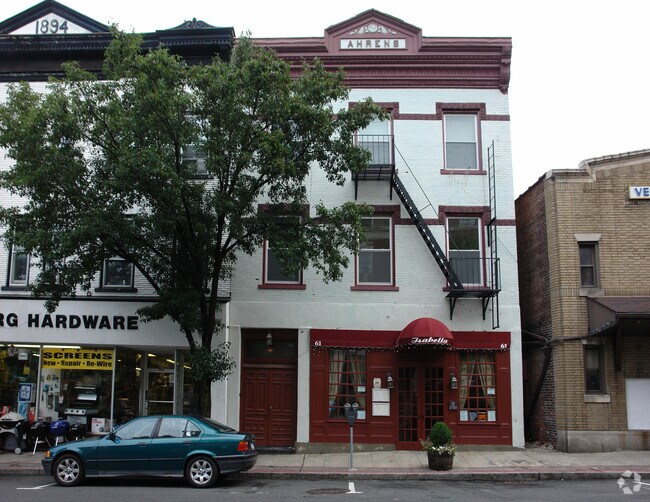
61 Main St, Tarrytown, NY 10591
NEARBY LISTINGS FOR SALE OR LEASE
Property Detail
61 Main St
New York-Jersey City-White Plains, NY-NJ
Map Of The Estates Of Nathaniel Baylers
2611-001-040-00016-000-0044
Westchester
Commercialofficeresidentialmixeduse
New York
X
44.000
36119C0253F
0.06 AC
2025
West I-287 Corridor
2024
Westchester/So Connecticut
011500
DEMOGRAPHICS near 61 Main St
1 Mile
3 Mile
5 Mile
2024 Total Population
17,874
39,308
128,150
2029 Population
17,660
38,802
126,094
Pop Growth 2024-2029
(1.20%)
(1.29%)
(1.60%)
Average Age
41
41
42
2024 Total Households
6,775
14,482
47,394
HH Growth 2024-2029
(1.55%)
(1.50%)
(1.76%)
Median Household Inc
$90,720
$118,096
$129,536
Avg Household Size
2.50
2.60
2.50
2024 Avg HH Vehicles
2.00
2.00
2.00
Median Home Value
$655,156
$696,083
$664,438
Median Year Built
1955
1961
1961
Nearby Places
- Restaurants
- Banks
- Shops
- Fitness
- Groceries
PUBLIC TRANSPORTATION
TRANSIT/SUBWAY
Tarrytown Station (Hudson Line - Metro-North Commuter Railroad Company (Metro-North))
DRIVE
WALK
Distance
Tarrytown Station (Hudson Line - Metro-North Commuter Railroad Company (Metro-North))
1 min
5 min
0.3 mi
COMMUTER RAIL
Tarrytown Station (Hudson Line - Metro-North Commuter Railroad Company (Metro-North))
DRIVE
WALK
Distance
Tarrytown Station (Hudson Line - Metro-North Commuter Railroad Company (Metro-North))
1 min
8 min
0.3 mi
Philipse Manor Station (Hudson Line - Metro-North Commuter Railroad Company (Metro-North))
DRIVE
WALK
Distance
Philipse Manor Station (Hudson Line - Metro-North Commuter Railroad Company (Metro-North))
5 min
2.0 mi
AIRPORT
Westchester County
DRIVE
WALK
Distance
Westchester County
22 min
14.8 mi
LaGuardia
DRIVE
WALK
Distance
LaGuardia
44 min
27.5 mi
John F Kennedy International
DRIVE
WALK
Distance
John F Kennedy International
56 min
36.6 mi
Freight Ports
NY - Red Hook Container Terminal
DRIVE
WALK
Distance
NY - Red Hook Container Terminal
57 min
35.7 mi
Nearby Properties
Address
Land Use
TOTAL SIZE
Lot Size
Zoning
Address
Land Use
TOTAL SIZE
Lot Size
Zoning
85.40 AC
Address
Land Use
TOTAL SIZE
Lot Size
Zoning
2,760 SF
60.76 AC
Address
Land Use
TOTAL SIZE
Lot Size
Zoning
63.40 AC
R-40
Address
Land Use
TOTAL SIZE
Lot Size
Zoning
22.92 AC
Address
Land Use
TOTAL SIZE
Lot Size
Zoning
Address
Land Use
TOTAL SIZE
Lot Size
Zoning
24.28 AC
Address
Land Use
TOTAL SIZE
Lot Size
Zoning
17.61 AC
Address
Land Use
TOTAL SIZE
Lot Size
Zoning
36.59 AC
Address
Land Use
TOTAL SIZE
Lot Size
Zoning
17.17 AC
Address
Land Use
TOTAL SIZE
Lot Size
Zoning
14.86 AC
OB
Address
Land Use
TOTAL SIZE
Lot Size
Zoning
24.66 AC
Address
Land Use
TOTAL SIZE
Lot Size
Zoning
42.30 AC
C2
Address
Land Use
TOTAL SIZE
Lot Size
Zoning
29.35 AC
Address
Land Use
TOTAL SIZE
Lot Size
Zoning
7.78 AC
Address
Land Use
TOTAL SIZE
Lot Size
Zoning
19.25 AC
Address
Land Use
TOTAL SIZE
Lot Size
Zoning
28.51 AC
Address
Land Use
TOTAL SIZE
Lot Size
Zoning
37.99 AC
Address
Land Use
TOTAL SIZE
Lot Size
Zoning
253,167 SF
9.11 AC
OB
Address
Land Use
TOTAL SIZE
Lot Size
Zoning
60.01 AC
Address
Land Use
TOTAL SIZE
Lot Size
Zoning
26.50 AC
Address
Land Use
TOTAL SIZE
Lot Size
Zoning
205,000 SF
7.85 AC
Address
Land Use
TOTAL SIZE
Lot Size
Zoning
9.67 AC
Address
Land Use
TOTAL SIZE
Lot Size
Zoning
11.61 AC
Address
Land Use
TOTAL SIZE
Lot Size
Zoning
Address
Land Use
TOTAL SIZE
Lot Size
Zoning
57.73 AC
Address
Land Use
TOTAL SIZE
Lot Size
Zoning
22.50 AC
Address
Land Use
TOTAL SIZE
Lot Size
Zoning
68,000 SF
1.53 AC
B
Address
Land Use
TOTAL SIZE
Lot Size
Zoning
Address
Land Use
TOTAL SIZE
Lot Size
Zoning
Address
Land Use
TOTAL SIZE
Lot Size
Zoning
1.69 AC
The World's #1 Commercial Real Estate Marketplace
Connect with us
© 2025 CoStar Group
The information above has been obtained from sources believed reliable. While we do not doubt its accuracy we have not verified it and make no guarantee, warranty or representation about it. It is your responsibility to independently confirm its accuracy and completeness. Any projections, opinions, assumptions, or estimates used are for example only and do not represent the current or future performance of the property. The value of this transaction to you depends on tax and other factors which should be evaluated by your tax, financial, and legal advisors. You and your advisors should conduct a careful, independent investigation of the property to determine to your satisfaction the suitability of the property for your needs.