Property Record
61 Pease Rd, Manalapan, NJ 07726


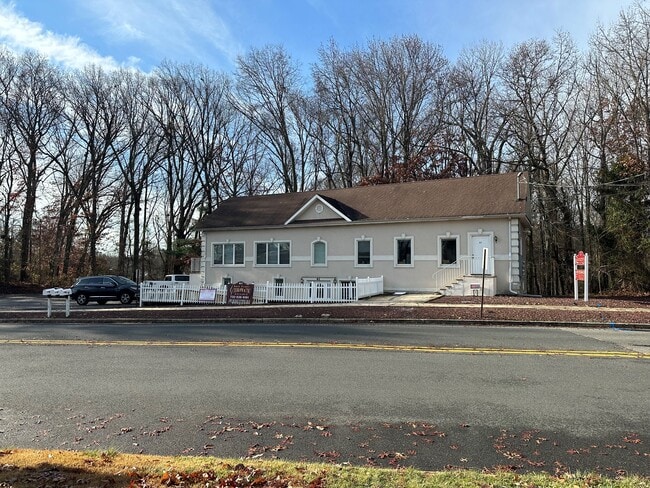
This Property Is For Sale
NEARBY LISTINGS FOR SALE OR LEASE
Property Detail
61 Pease Rd
28-01505-0000-00039
Monmouth
Medicalbuilding
New Jersey
X
39
34025C0140F
0.44 AC
2024
Western Monmouth
2025
Northern New Jersey
810004
Lakewood-New Brunswick, NJ
2,640 SF
DEMOGRAPHICS near 61 Pease Rd
1 Mile
3 Mile
5 Mile
2024 Total Population
6,325
46,226
106,803
2029 Population
6,267
45,809
105,919
Pop Growth 2024-2029
(0.92%)
(0.90%)
(0.83%)
Average Age
41
43
43
2024 Total Households
1,916
16,015
37,207
HH Growth 2024-2029
(1.15%)
(0.94%)
(0.91%)
Median Household Inc
$159,972
$137,732
$130,253
Avg Household Size
3.20
2.80
2.80
2024 Avg HH Vehicles
3.00
2.00
2.00
Median Home Value
$586,408
$573,561
$578,191
Median Year Built
1977
1982
1985
Nearby Places
Map Layers
Map Styles
 Street
 Aerial
- Restaurants
- Banks
- Shops
- Fitness
- Groceries
PUBLIC TRANSPORTATION
COMMUTER RAIL
Aberdeen Matawan (North Jersey Coast Line - NJ Transit Commuter Rail (NJ Transit))
DRIVE
WALK
Distance
Aberdeen Matawan (North Jersey Coast Line - NJ Transit Commuter Rail (NJ Transit))
17 min
9.9 mi
AIRPORT
Trenton Mercer
DRIVE
WALK
Distance
Trenton Mercer
54 min
33.4 mi
Newark Liberty International
DRIVE
WALK
Distance
Newark Liberty International
46 min
37.1 mi
Freight Ports
New York Container Terminal
DRIVE
WALK
Distance
New York Container Terminal
40 min
29.3 mi
Nearby Properties
Address
Land Use
TOTAL SIZE
Lot Size
Zoning
Address
Land Use
TOTAL SIZE
Lot Size
Zoning
67.30 AC
PB
Address
Land Use
TOTAL SIZE
Lot Size
Zoning
56.99 AC
C1
Address
Land Use
TOTAL SIZE
Lot Size
Zoning
12.10 AC
PB
Address
Land Use
TOTAL SIZE
Lot Size
Zoning
25.27 AC
C1
Address
Land Use
TOTAL SIZE
Lot Size
Zoning
223,463 SF
41.75 AC
C-3
Address
Land Use
TOTAL SIZE
Lot Size
Zoning
48,451 SF
12.17 AC
B-10
Address
Land Use
TOTAL SIZE
Lot Size
Zoning
23.08 AC
PB
Address
Land Use
TOTAL SIZE
Lot Size
Zoning
54,065 SF
19.07 AC
CM3A
Address
Land Use
TOTAL SIZE
Lot Size
Zoning
6.97 AC
C2
Address
Land Use
TOTAL SIZE
Lot Size
Zoning
9.28 AC
MF08
Address
Land Use
TOTAL SIZE
Lot Size
Zoning
8.15 AC
C2-M
Address
Land Use
TOTAL SIZE
Lot Size
Zoning
27,535 SF
7.03 AC
CM3A
Address
Land Use
TOTAL SIZE
Lot Size
Zoning
16,496 SF
10.87 AC
CM3A
Address
Land Use
TOTAL SIZE
Lot Size
Zoning
28,383 SF
20.77 AC
B10
Address
Land Use
TOTAL SIZE
Lot Size
Zoning
10.25 AC
PB
Address
Land Use
TOTAL SIZE
Lot Size
Zoning
58,674 SF
44 SF
C-3
Address
Land Use
TOTAL SIZE
Lot Size
Zoning
58,024 SF
9.45 AC
C2
Address
Land Use
TOTAL SIZE
Lot Size
Zoning
98,000 SF
7.52 AC
7663
Address
Land Use
TOTAL SIZE
Lot Size
Zoning
7,356 SF
43.47 AC
R-E
Address
Land Use
TOTAL SIZE
Lot Size
Zoning
2,322 SF
44.35 AC
R-E
Address
Land Use
TOTAL SIZE
Lot Size
Zoning
84,626 SF
15.37 AC
R120
Address
Land Use
TOTAL SIZE
Lot Size
Zoning
41,632 SF
6.26 AC
OB01
Address
Land Use
TOTAL SIZE
Lot Size
Zoning
6.37 AC
C2
Address
Land Use
TOTAL SIZE
Lot Size
Zoning
21.35 AC
CF
Address
Land Use
TOTAL SIZE
Lot Size
Zoning
18 AC
PB
Address
Land Use
TOTAL SIZE
Lot Size
Zoning
16.46 AC
PB
Address
Land Use
TOTAL SIZE
Lot Size
Zoning
6.68 AC
C3
Address
Land Use
TOTAL SIZE
Lot Size
Zoning
32.37 AC
CF
Address
Land Use
TOTAL SIZE
Lot Size
Zoning
28 AC
PB
Address
Land Use
TOTAL SIZE
Lot Size
Zoning
17.70 AC
PB
The World's #1 Commercial Real Estate Marketplace
Connect with us
© 2026 CoStar Group
The information above has been obtained from sources believed reliable. While we do not doubt its accuracy we have not verified it and make no guarantee, warranty or representation about it. It is your responsibility to independently confirm its accuracy and completeness. Any projections, opinions, assumptions, or estimates used are for example only and do not represent the current or future performance of the property. The value of this transaction to you depends on tax and other factors which should be evaluated by your tax, financial, and legal advisors. You and your advisors should conduct a careful, independent investigation of the property to determine to your satisfaction the suitability of the property for your needs.