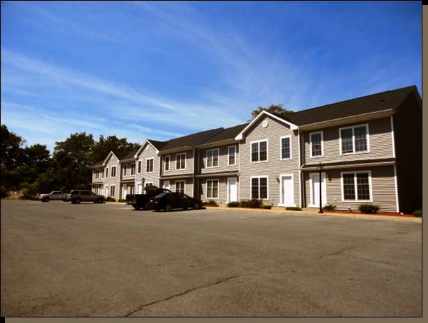
Property Record
61 Samnida Way, Marlboro, NY 12542

NEARBY LISTINGS FOR SALE OR LEASE
Property Detail
61 Samnida Way
3600-103.009-0001-034.100-0000
Ulster
Apartment
New York
X
34.100
36027C0362E
3.19 AC
2025
Newburgh/Kingston
2024
Other Market Areas
953800
Kingston, NY
8,640 SF
DEMOGRAPHICS near 61 Samnida Way
1 Mile
3 Mile
5 Mile
2024 Total Population
1,146
21,701
94,737
2029 Population
1,136
21,701
94,599
Pop Growth 2024-2029
(0.87%)
0.00%
(0.15%)
Average Age
44
44
40
2024 Total Households
471
8,763
36,133
HH Growth 2024-2029
(0.85%)
+ 0.06%
(0.08%)
Median Household Inc
$97,856
$94,815
$73,827
Avg Household Size
2.40
2.40
2.40
2024 Avg HH Vehicles
2.00
2.00
2.00
Median Home Value
$309,783
$314,927
$298,319
Median Year Built
1978
1969
1963
Nearby Places
Map Layers
Map Styles
 Street
 Aerial
- Restaurants
- Banks
- Shops
- Fitness
- Groceries
PUBLIC TRANSPORTATION
COMMUTER RAIL
Poughkeepsie Station (Hudson Line - Metro-North Commuter Railroad Company (Metro-North))
DRIVE
WALK
Distance
Poughkeepsie Station (Hudson Line - Metro-North Commuter Railroad Company (Metro-North))
14 min
6.5 mi
AIRPORT
New York Stewart International
DRIVE
WALK
Distance
New York Stewart International
28 min
18.4 mi
Nearby Properties
Address
Land Use
TOTAL SIZE
Lot Size
Zoning
Address
Land Use
TOTAL SIZE
Lot Size
Zoning
640,854 SF
21.22 AC
H-M
Address
Land Use
TOTAL SIZE
Lot Size
Zoning
193.80 AC
IH
Address
Land Use
TOTAL SIZE
Lot Size
Zoning
802,007 SF
78.21 AC
BH
Address
Land Use
TOTAL SIZE
Lot Size
Zoning
3 AC
R-D
Address
Land Use
TOTAL SIZE
Lot Size
Zoning
11,803 SF
99.04 AC
IH
Address
Land Use
TOTAL SIZE
Lot Size
Zoning
50,363 SF
47.88 AC
IH/R1
Address
Land Use
TOTAL SIZE
Lot Size
Zoning
16,947 SF
6.40 AC
IH
Address
Land Use
TOTAL SIZE
Lot Size
Zoning
105,762 SF
2.41 AC
H-M
Address
Land Use
TOTAL SIZE
Lot Size
Zoning
2.53 AC
R-D
Address
Land Use
TOTAL SIZE
Lot Size
Zoning
126,616 SF
25.57 AC
R20
Address
Land Use
TOTAL SIZE
Lot Size
Zoning
30,420 SF
11.30 AC
R-2
Address
Land Use
TOTAL SIZE
Lot Size
Zoning
297,663 SF
4.45 AC
H-M
Address
Land Use
TOTAL SIZE
Lot Size
Zoning
Address
Land Use
TOTAL SIZE
Lot Size
Zoning
115,817 SF
5.93 AC
R5
Address
Land Use
TOTAL SIZE
Lot Size
Zoning
272,228 SF
25.20 AC
BSC
Address
Land Use
TOTAL SIZE
Lot Size
Zoning
73,130 SF
2.55 AC
H-M
Address
Land Use
TOTAL SIZE
Lot Size
Zoning
55,752 SF
16.14 AC
RM
Address
Land Use
TOTAL SIZE
Lot Size
Zoning
114,443 SF
43.60 AC
IN
Address
Land Use
TOTAL SIZE
Lot Size
Zoning
147,858 SF
12.45 AC
BSC
Address
Land Use
TOTAL SIZE
Lot Size
Zoning
8,186 SF
160.50 AC
R4A
Address
Land Use
TOTAL SIZE
Lot Size
Zoning
128,883 SF
8.63 AC
BH
Address
Land Use
TOTAL SIZE
Lot Size
Zoning
52,807 SF
10.87 AC
R20
Address
Land Use
TOTAL SIZE
Lot Size
Zoning
13.60 AC
I-2
Address
Land Use
TOTAL SIZE
Lot Size
Zoning
206,816 SF
14.56 AC
BSC
Address
Land Use
TOTAL SIZE
Lot Size
Zoning
30,484 SF
10 AC
RM
Address
Land Use
TOTAL SIZE
Lot Size
Zoning
65,100 SF
1.31 AC
BH
Address
Land Use
TOTAL SIZE
Lot Size
Zoning
100,320 SF
4 AC
R-3
Address
Land Use
TOTAL SIZE
Lot Size
Zoning
78,746 SF
5.47 AC
W
Address
Land Use
TOTAL SIZE
Lot Size
Zoning
156,244 SF
1.90 AC
R-5
Address
Land Use
TOTAL SIZE
Lot Size
Zoning
106,850 SF
17.80 AC
R20
The World's #1 Commercial Real Estate Marketplace
Connect with us
© 2025 CoStar Group
The information above has been obtained from sources believed reliable. While we do not doubt its accuracy we have not verified it and make no guarantee, warranty or representation about it. It is your responsibility to independently confirm its accuracy and completeness. Any projections, opinions, assumptions, or estimates used are for example only and do not represent the current or future performance of the property. The value of this transaction to you depends on tax and other factors which should be evaluated by your tax, financial, and legal advisors. You and your advisors should conduct a careful, independent investigation of the property to determine to your satisfaction the suitability of the property for your needs.