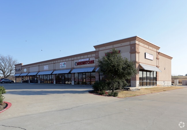
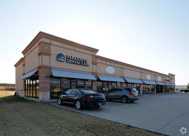
Property Record
610 N Preston Rd, Gunter, TX 75058

Property Detail
610 N Preston Rd
Sherman-Denison, TX
BROOKS PLAZA ADDITION, BLOCK 1, LOT 1, ACRES 1.4
231177
GRAYSON
Commercialnec
Texas
B and X Area of moderate flood hazard, usually the area between the limits of the 100-year and 500-year floods.
1
2024
1.40 AC
2025
Gunter
001901
Other Market Areas
9,288 SF
NEARBY LISTINGS FOR SALE OR LEASE
-
-
View all Gunter listings for lease on LoopNet.com
DEMOGRAPHICS near 610 N Preston Rd
1 mile
3 mile
5 mile
2025 Total Population
1,373
3,865
5,050
2030 Population
1,508
4,239
5,608
Pop Growth 2025-2030
+ 9.83%
+ 9.68%
+ 11.05%
Average Age
35
37
38
2025 Total Households
434
1,232
1,611
HH Growth 2025-2030
+ 10.14%
+ 9.66%
+ 11.11%
Median Household Inc
$97,825
$124,279
$136,278
Avg Household Size
3.20
3.10
3.10
2025 Avg HH Vehicles
2.00
3.00
3.00
Median Home Value
$266,853
$456,421
$499,999
Median Year Built
1995
2005
2007
Nearby Places
Map Layers
Map Styles
 Street
 Aerial
Transit
 Traffic
 Biking
Places
Listings with unknown addresses are not visible on the map
- Restaurants
- Banks
- Shops
- Fitness
- Groceries
SALE & LEASE HISTORY
LISTING DATE
SALE/LEASE

Aug 22, 2017
For Lease
Aug 21, 2020
For Lease
Nearby Properties
Address
Land Use
TOTAL SIZE
Lot Size
Zoning
Address
Land Use
TOTAL SIZE
Lot Size
Zoning
28,882 SF
156.87 AC
Address
Land Use
TOTAL SIZE
Lot Size
Zoning
148,140 SF
55.50 AC
Address
Land Use
TOTAL SIZE
Lot Size
Zoning
151,330 SF
44.86 AC
Address
Land Use
TOTAL SIZE
Lot Size
Zoning
59,691 SF
4.48 AC
Address
Land Use
TOTAL SIZE
Lot Size
Zoning
43,280 SF
24.74 AC
Address
Land Use
TOTAL SIZE
Lot Size
Zoning
29,239 SF
7.61 AC
Address
Land Use
TOTAL SIZE
Lot Size
Zoning
19.25 AC
Address
Land Use
TOTAL SIZE
Lot Size
Zoning
10,800 SF
Address
Land Use
TOTAL SIZE
Lot Size
Zoning
13,400 SF
11.50 AC
Address
Land Use
TOTAL SIZE
Lot Size
Zoning
33,488 SF
3.17 AC
Address
Land Use
TOTAL SIZE
Lot Size
Zoning
6,400 SF
Address
Land Use
TOTAL SIZE
Lot Size
Zoning
3,260 SF
39.68 AC
Address
Land Use
TOTAL SIZE
Lot Size
Zoning
1,080 SF
24.91 AC
Address
Land Use
TOTAL SIZE
Lot Size
Zoning
30,800 SF
2 AC
Address
Land Use
TOTAL SIZE
Lot Size
Zoning
9,396 SF
1.70 AC
Address
Land Use
TOTAL SIZE
Lot Size
Zoning
Address
Land Use
TOTAL SIZE
Lot Size
Zoning
7,225 SF
0.76 AC
Address
Land Use
TOTAL SIZE
Lot Size
Zoning
4,291 SF
1.38 AC
Address
Land Use
TOTAL SIZE
Lot Size
Zoning
17,890 SF
96.80 AC
Address
Land Use
TOTAL SIZE
Lot Size
Zoning
12,366 SF
6.16 AC
Address
Land Use
TOTAL SIZE
Lot Size
Zoning
7,410 SF
3.29 AC
Address
Land Use
TOTAL SIZE
Lot Size
Zoning
6,267 SF
1.01 AC
Address
Land Use
TOTAL SIZE
Lot Size
Zoning
39,388 SF
5.12 AC
Address
Land Use
TOTAL SIZE
Lot Size
Zoning
51,488 SF
2.96 AC
Address
Land Use
TOTAL SIZE
Lot Size
Zoning
224 SF
10.19 AC
Address
Land Use
TOTAL SIZE
Lot Size
Zoning
9,146 SF
1.23 AC
Address
Land Use
TOTAL SIZE
Lot Size
Zoning
5,149 SF
30.51 AC
Address
Land Use
TOTAL SIZE
Lot Size
Zoning
16,012 SF
6.52 AC
The World's #1 Commercial Real Estate Marketplace
Connect with us
© 2026 CoStar Group
The information above has been obtained from sources believed reliable. While we do not doubt its accuracy we have not verified it and make no guarantee, warranty or representation about it. It is your responsibility to independently confirm its accuracy and completeness. Any projections, opinions, assumptions, or estimates used are for example only and do not represent the current or future performance of the property. The value of this transaction to you depends on tax and other factors which should be evaluated by your tax, financial, and legal advisors. You and your advisors should conduct a careful, independent investigation of the property to determine to your satisfaction the suitability of the property for your needs.