Property Record
610 Carroll St, New Lexington, OH 43764
NEARBY LISTINGS FOR SALE OR LEASE
-
-
View all New Lexington listings for sale on LoopNet.com
Property Detail
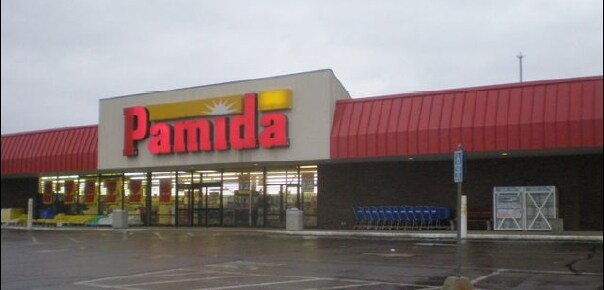
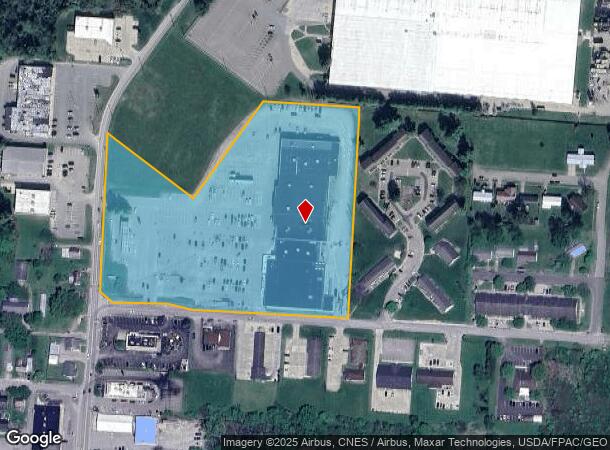
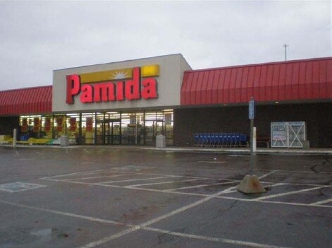
610 Carroll St
Supermarket
PT W SE1/4 SEC 04
X
Perry
39127C0227D
Ohio
2024
8.76 AC
2024
Other Market Areas
966200
Columbus, OH
24,220 SF
270026730000
DEMOGRAPHICS near 610 Carroll St
1 Mile
3 Mile
5 Mile
2024 Total Population
4,404
6,932
9,538
2029 Population
4,507
7,071
9,680
Pop Growth 2024-2029
+ 2.34%
+ 2.01%
+ 1.49%
Average Age
39
39
40
2024 Total Households
1,695
2,653
3,652
HH Growth 2024-2029
+ 2.24%
+ 1.92%
+ 1.42%
Median Household Inc
$45,071
$44,999
$47,939
Avg Household Size
2.50
2.50
2.50
2024 Avg HH Vehicles
2.00
2.00
2.00
Median Home Value
$101,752
$117,668
$130,774
Median Year Built
1967
1970
1973
Nearby Places
Map Layers
Map Styles
 Street
 Aerial
- Restaurants
- Banks
- Shops
- Fitness
- Groceries
Nearby Properties
Address
Land Use
TOTAL SIZE
Lot Size
Zoning
Address
Land Use
TOTAL SIZE
Lot Size
Zoning
75,765 SF
56.37 AC
Address
Land Use
TOTAL SIZE
Lot Size
Zoning
480 SF
4.97 AC
Address
Land Use
TOTAL SIZE
Lot Size
Zoning
1,350 SF
6.97 AC
Address
Land Use
TOTAL SIZE
Lot Size
Zoning
6,576 SF
24.97 AC
Address
Land Use
TOTAL SIZE
Lot Size
Zoning
6,100 SF
28 AC
Address
Land Use
TOTAL SIZE
Lot Size
Zoning
Address
Land Use
TOTAL SIZE
Lot Size
Zoning
576 SF
4.83 AC
Address
Land Use
TOTAL SIZE
Lot Size
Zoning
14,664 SF
6 AC
Address
Land Use
TOTAL SIZE
Lot Size
Zoning
2,840 SF
4.36 AC
Address
Land Use
TOTAL SIZE
Lot Size
Zoning
480 SF
28.65 AC
Address
Land Use
TOTAL SIZE
Lot Size
Zoning
21,560 SF
1.98 AC
Address
Land Use
TOTAL SIZE
Lot Size
Zoning
3,528 SF
11.87 AC
Address
Land Use
TOTAL SIZE
Lot Size
Zoning
2,522 SF
6 AC
Address
Land Use
TOTAL SIZE
Lot Size
Zoning
36,500 SF
19.72 AC
Address
Land Use
TOTAL SIZE
Lot Size
Zoning
576 SF
1.74 AC
Address
Land Use
TOTAL SIZE
Lot Size
Zoning
12.14 AC
Address
Land Use
TOTAL SIZE
Lot Size
Zoning
Address
Land Use
TOTAL SIZE
Lot Size
Zoning
15,000 SF
Address
Land Use
TOTAL SIZE
Lot Size
Zoning
8,884 SF
3.82 AC
Address
Land Use
TOTAL SIZE
Lot Size
Zoning
13,500 SF
8.47 AC
Address
Land Use
TOTAL SIZE
Lot Size
Zoning
1,680 SF
4.49 AC
Address
Land Use
TOTAL SIZE
Lot Size
Zoning
2,842 SF
5.95 AC
Address
Land Use
TOTAL SIZE
Lot Size
Zoning
10,125 SF
1.02 AC
Address
Land Use
TOTAL SIZE
Lot Size
Zoning
14,400 SF
3 AC
Address
Land Use
TOTAL SIZE
Lot Size
Zoning
11,583 SF
5.61 AC
Address
Land Use
TOTAL SIZE
Lot Size
Zoning
1,600 SF
27.80 AC
Address
Land Use
TOTAL SIZE
Lot Size
Zoning
3,496 SF
1.31 AC
Address
Land Use
TOTAL SIZE
Lot Size
Zoning
10,596 SF
5.71 AC
Address
Land Use
TOTAL SIZE
Lot Size
Zoning
11,215 SF
5.47 AC
The World's #1 Commercial Real Estate Marketplace
Connect with us
© 2026 CoStar Group
The information above has been obtained from sources believed reliable. While we do not doubt its accuracy we have not verified it and make no guarantee, warranty or representation about it. It is your responsibility to independently confirm its accuracy and completeness. Any projections, opinions, assumptions, or estimates used are for example only and do not represent the current or future performance of the property. The value of this transaction to you depends on tax and other factors which should be evaluated by your tax, financial, and legal advisors. You and your advisors should conduct a careful, independent investigation of the property to determine to your satisfaction the suitability of the property for your needs.