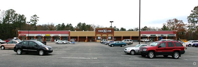
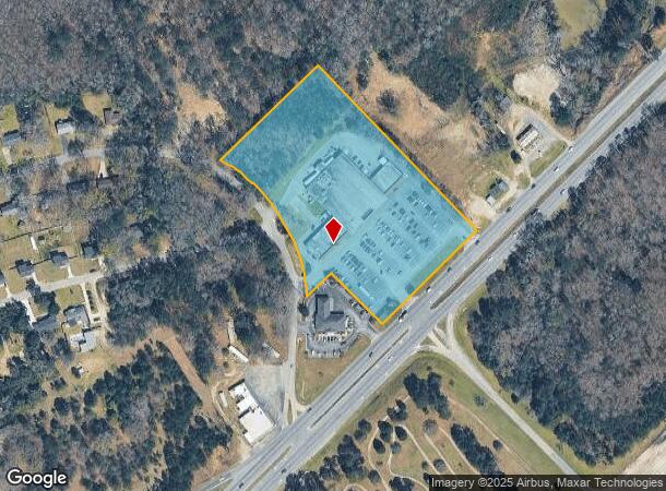
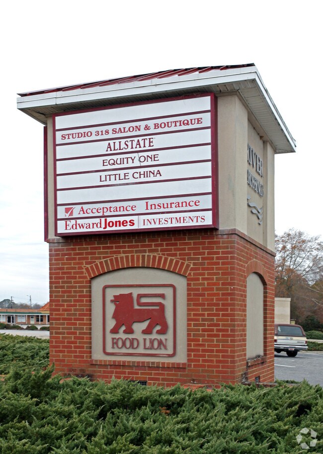
Property Record
610 Highway 1 S, Lugoff, SC 29078
NEARBY LISTINGS FOR SALE OR LEASE
Property Detail
610 Highway 1 S
283-00-00-011
692-33 229-242 120-279 JA-134 610 HWY 1 SOUTH
Regionalshoppingcenterormallwithanchorstore
Kershaw
X
South Carolina
45055C0435F
6.53 AC
2025
Kershaw County
2025
Columbia
970402
Columbia, SC
37,872 SF
DEMOGRAPHICS near 610 Highway 1 S
1 Mile
3 Mile
5 Mile
2024 Total Population
1,050
9,157
21,991
2029 Population
1,127
9,961
23,999
Pop Growth 2024-2029
+ 7.33%
+ 8.78%
+ 9.13%
Average Age
39
41
42
2024 Total Households
452
3,676
9,024
HH Growth 2024-2029
+ 7.30%
+ 8.68%
+ 9.01%
Median Household Inc
$30,662
$38,846
$43,048
Avg Household Size
2.30
2.40
2.40
2024 Avg HH Vehicles
2.00
2.00
2.00
Median Home Value
$149,707
$160,926
$175,861
Median Year Built
1983
1985
1983
Nearby Places
Map Layers
Map Styles
 Street
 Aerial
- Restaurants
- Banks
- Shops
- Fitness
- Groceries
PUBLIC TRANSPORTATION
COMMUTER RAIL
Camden Amtrak Station (Silver Star - Amtrak)
DRIVE
WALK
Distance
Camden Amtrak Station (Silver Star - Amtrak)
6 min
2.7 mi
Freight Ports
North Charleston Terminal
DRIVE
WALK
Distance
North Charleston Terminal
149 min
128.6 mi
SALE & LEASE HISTORY
LISTING DATE
SALE/LEASE

Sep 25, 2016
For Lease
Nearby Properties
Address
Land Use
TOTAL SIZE
Lot Size
Zoning
Address
Land Use
TOTAL SIZE
Lot Size
Zoning
183,825 SF
20.09 AC
MUNICIPAL
Address
Land Use
TOTAL SIZE
Lot Size
Zoning
539,600 SF
20.47 AC
I1
Address
Land Use
TOTAL SIZE
Lot Size
Zoning
390,425 SF
24.06 AC
I1
Address
Land Use
TOTAL SIZE
Lot Size
Zoning
117,844 SF
12.21 AC
MUNICIPAL
Address
Land Use
TOTAL SIZE
Lot Size
Zoning
116,508 SF
14.91 AC
MUNICIPAL
Address
Land Use
TOTAL SIZE
Lot Size
Zoning
101,650 SF
8.48 AC
Address
Land Use
TOTAL SIZE
Lot Size
Zoning
37,794 SF
28.77 AC
GD
Address
Land Use
TOTAL SIZE
Lot Size
Zoning
60,023 SF
5.70 AC
B2
Address
Land Use
TOTAL SIZE
Lot Size
Zoning
75,636 SF
6.28 AC
MUNICIPAL
Address
Land Use
TOTAL SIZE
Lot Size
Zoning
72,502 SF
12 AC
GD
Address
Land Use
TOTAL SIZE
Lot Size
Zoning
37,872 SF
6.53 AC
B2
Address
Land Use
TOTAL SIZE
Lot Size
Zoning
41,160 SF
3.37 AC
Address
Land Use
TOTAL SIZE
Lot Size
Zoning
71,157 SF
7.19 AC
MUNICIPAL
Address
Land Use
TOTAL SIZE
Lot Size
Zoning
66,678 SF
5.28 AC
R6
Address
Land Use
TOTAL SIZE
Lot Size
Zoning
20.23 AC
MUNICIPAL
Address
Land Use
TOTAL SIZE
Lot Size
Zoning
82,125 SF
8.42 AC
GD
Address
Land Use
TOTAL SIZE
Lot Size
Zoning
22,076 SF
3.53 AC
MUNICIPAL
Address
Land Use
TOTAL SIZE
Lot Size
Zoning
54,906 SF
4.51 AC
Address
Land Use
TOTAL SIZE
Lot Size
Zoning
8,804 SF
0.73 AC
Address
Land Use
TOTAL SIZE
Lot Size
Zoning
31,087 SF
9.63 AC
GD
Address
Land Use
TOTAL SIZE
Lot Size
Zoning
3.93 AC
B2
Address
Land Use
TOTAL SIZE
Lot Size
Zoning
91,301 SF
7.32 AC
MUNICIPAL
Address
Land Use
TOTAL SIZE
Lot Size
Zoning
87,548 SF
10 AC
GD
Address
Land Use
TOTAL SIZE
Lot Size
Zoning
64,714 SF
5.93 AC
B2
Address
Land Use
TOTAL SIZE
Lot Size
Zoning
20,359 SF
5.39 AC
RD2
Address
Land Use
TOTAL SIZE
Lot Size
Zoning
35,700 SF
2.03 AC
B2
Address
Land Use
TOTAL SIZE
Lot Size
Zoning
25,953 SF
5.63 AC
B2
Address
Land Use
TOTAL SIZE
Lot Size
Zoning
10,726 SF
1.50 AC
MUNICIPAL
Address
Land Use
TOTAL SIZE
Lot Size
Zoning
15,040 SF
2.52 AC
B2
Address
Land Use
TOTAL SIZE
Lot Size
Zoning
31,700 SF
17.76 AC
GD
The World's #1 Commercial Real Estate Marketplace
Connect with us
© 2026 CoStar Group
The information above has been obtained from sources believed reliable. While we do not doubt its accuracy we have not verified it and make no guarantee, warranty or representation about it. It is your responsibility to independently confirm its accuracy and completeness. Any projections, opinions, assumptions, or estimates used are for example only and do not represent the current or future performance of the property. The value of this transaction to you depends on tax and other factors which should be evaluated by your tax, financial, and legal advisors. You and your advisors should conduct a careful, independent investigation of the property to determine to your satisfaction the suitability of the property for your needs.