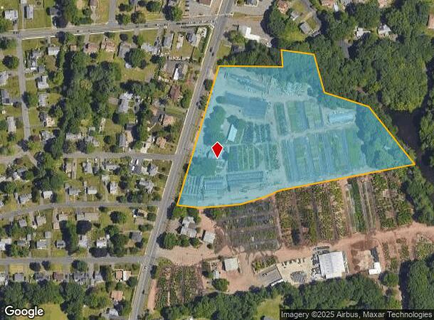
Property Record
610 Main St, Cromwell, CT 06416

NEARBY LISTINGS FOR SALE OR LEASE
Property Detail
610 Main St
47-38A
Middlesex
Commercialnec
Connecticut
X
38a
09003C0519F
8.50 AC
2025
NW Middlesex/Middletown
2025
Hartford
570300
Hartford-West Hartford-East Hartford, CT
DEMOGRAPHICS near 610 Main St
1 Mile
3 Mile
5 Mile
2024 Total Population
3,475
33,576
93,862
2029 Population
3,456
33,604
93,557
Pop Growth 2024-2029
(0.55%)
+ 0.08%
(0.32%)
Average Age
44
42
42
2024 Total Households
1,380
14,261
40,113
HH Growth 2024-2029
(0.72%)
+ 0.08%
(0.33%)
Median Household Inc
$120,416
$93,888
$91,036
Avg Household Size
2.50
2.30
2.20
2024 Avg HH Vehicles
2.00
2.00
2.00
Median Home Value
$293,694
$277,366
$290,946
Median Year Built
1965
1977
1974
Nearby Places
Map Layers
Map Styles
 Street
 Aerial
- Restaurants
- Banks
- Shops
- Fitness
- Groceries
PUBLIC TRANSPORTATION
COMMUTER RAIL
DRIVE
WALK
Distance
15 min
8.4 mi
DRIVE
WALK
Distance
15 min
8.4 mi
AIRPORT
Bradley International
DRIVE
WALK
Distance
Bradley International
47 min
27.7 mi
Tweed/New Haven
DRIVE
WALK
Distance
Tweed/New Haven
49 min
33.1 mi
Nearby Properties
Address
Land Use
TOTAL SIZE
Lot Size
Zoning
Address
Land Use
TOTAL SIZE
Lot Size
Zoning
24.70 AC
R-20
Address
Land Use
TOTAL SIZE
Lot Size
Zoning
81,507 SF
21.60 AC
R-20
Address
Land Use
TOTAL SIZE
Lot Size
Zoning
117,178 SF
13.02 AC
R-20
Address
Land Use
TOTAL SIZE
Lot Size
Zoning
33,524 SF
37.71 AC
ID
Address
Land Use
TOTAL SIZE
Lot Size
Zoning
33.30 AC
R-20
Address
Land Use
TOTAL SIZE
Lot Size
Zoning
43.15 AC
R-20
Address
Land Use
TOTAL SIZE
Lot Size
Zoning
248,626 SF
92.26 AC
BP-2
Address
Land Use
TOTAL SIZE
Lot Size
Zoning
403,000 SF
33.55 AC
IND
Address
Land Use
TOTAL SIZE
Lot Size
Zoning
23.08 AC
BP-2
Address
Land Use
TOTAL SIZE
Lot Size
Zoning
87,037 SF
10.44 AC
R-20
Address
Land Use
TOTAL SIZE
Lot Size
Zoning
Address
Land Use
TOTAL SIZE
Lot Size
Zoning
310,582 SF
32.72 AC
OP
Address
Land Use
TOTAL SIZE
Lot Size
Zoning
27,152 SF
8.75 AC
R-25
Address
Land Use
TOTAL SIZE
Lot Size
Zoning
10.10 AC
IND
Address
Land Use
TOTAL SIZE
Lot Size
Zoning
9.81 AC
OP
Address
Land Use
TOTAL SIZE
Lot Size
Zoning
1.99 AC
C
Address
Land Use
TOTAL SIZE
Lot Size
Zoning
24.45 AC
HB
Address
Land Use
TOTAL SIZE
Lot Size
Zoning
10.45 AC
R-20
Address
Land Use
TOTAL SIZE
Lot Size
Zoning
145,956 SF
11.27 AC
OP
Address
Land Use
TOTAL SIZE
Lot Size
Zoning
13.85 AC
R-20
Address
Land Use
TOTAL SIZE
Lot Size
Zoning
49,724 SF
9.02 AC
OP
Address
Land Use
TOTAL SIZE
Lot Size
Zoning
8.56 AC
TC
Address
Land Use
TOTAL SIZE
Lot Size
Zoning
161,959 SF
45.61 AC
R-25
Address
Land Use
TOTAL SIZE
Lot Size
Zoning
172,155 SF
57.35 AC
OP
Address
Land Use
TOTAL SIZE
Lot Size
Zoning
15,395 SF
158.10 AC
R-25
Address
Land Use
TOTAL SIZE
Lot Size
Zoning
88,369 SF
26 AC
R-15
Address
Land Use
TOTAL SIZE
Lot Size
Zoning
85,262 SF
34.64 AC
Address
Land Use
TOTAL SIZE
Lot Size
Zoning
80,627 SF
10.54 AC
HB
Address
Land Use
TOTAL SIZE
Lot Size
Zoning
146.96 AC
IND
Address
Land Use
TOTAL SIZE
Lot Size
Zoning
14.11 AC
C
The World's #1 Commercial Real Estate Marketplace
Connect with us
© 2026 CoStar Group
The information above has been obtained from sources believed reliable. While we do not doubt its accuracy we have not verified it and make no guarantee, warranty or representation about it. It is your responsibility to independently confirm its accuracy and completeness. Any projections, opinions, assumptions, or estimates used are for example only and do not represent the current or future performance of the property. The value of this transaction to you depends on tax and other factors which should be evaluated by your tax, financial, and legal advisors. You and your advisors should conduct a careful, independent investigation of the property to determine to your satisfaction the suitability of the property for your needs.