Property Record
610 N Main St, Wichita, KS 67203


NEARBY LISTINGS FOR SALE OR LEASE
Property Detail
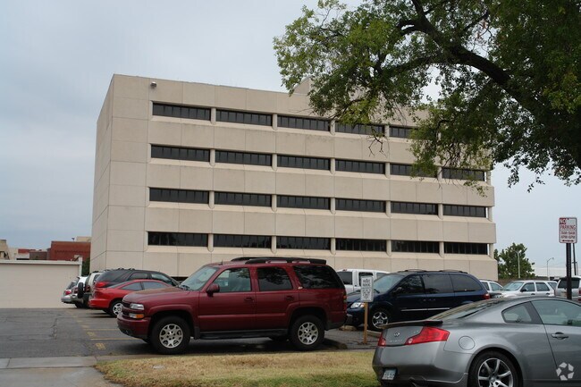
610 N Main St
Wichita, KS
Envision Vision Rehabilitation Clinic Co
124-17-0-44-06-005.01
EVEN LOTS 58-60-62-64 MAIN ST. MUNGERS ORIGINAL TOWN ADD.
Officebuilding
Sedgwick
X
Kansas
20173C0354G
58
2024
0.27 AC
2025
Downtown
001400
Wichita
60,966 SF
DEMOGRAPHICS near 610 N Main St
1 Mile
3 Mile
5 Mile
2024 Total Population
13,056
113,922
229,094
2029 Population
13,625
117,793
235,349
Pop Growth 2024-2029
+ 4.36%
+ 3.40%
+ 2.73%
Average Age
37
37
37
2024 Total Households
5,824
46,725
94,293
HH Growth 2024-2029
+ 5.08%
+ 3.46%
+ 2.73%
Median Household Inc
$36,930
$42,400
$44,991
Avg Household Size
1.80
2.20
2.30
2024 Avg HH Vehicles
1.00
2.00
2.00
Median Home Value
$103,030
$91,057
$108,774
Median Year Built
1958
1954
1958
Nearby Places
Map Layers
Map Styles
 Street
 Aerial
- Restaurants
- Banks
- Shops
- Fitness
- Groceries
PUBLIC TRANSPORTATION
AIRPORT
Wichita Dwight D Eisenhower Ntl
DRIVE
WALK
Distance
Wichita Dwight D Eisenhower Ntl
14 min
7.8 mi
Nearby Properties
Address
Land Use
TOTAL SIZE
Lot Size
Zoning
Address
Land Use
TOTAL SIZE
Lot Size
Zoning
468,755 SF
10.41 AC
CBD,LI
Address
Land Use
TOTAL SIZE
Lot Size
Zoning
499,239 SF
18.70 AC
GO
Address
Land Use
TOTAL SIZE
Lot Size
Zoning
515,640 SF
14.49 AC
CBD
Address
Land Use
TOTAL SIZE
Lot Size
Zoning
481,160 SF
63.37 AC
SF-5
Address
Land Use
TOTAL SIZE
Lot Size
Zoning
154,716 SF
12.18 AC
LC
Address
Land Use
TOTAL SIZE
Lot Size
Zoning
386,803 SF
13.33 AC
CBD
Address
Land Use
TOTAL SIZE
Lot Size
Zoning
346,728 SF
15.91 AC
SF-5
Address
Land Use
TOTAL SIZE
Lot Size
Zoning
576,707 SF
53.70 AC
B,LC
Address
Land Use
TOTAL SIZE
Lot Size
Zoning
197,464 SF
4.05 AC
CBD
Address
Land Use
TOTAL SIZE
Lot Size
Zoning
227,462 SF
17.80 AC
TF-3
Address
Land Use
TOTAL SIZE
Lot Size
Zoning
109,743 SF
6.10 AC
CBD
Address
Land Use
TOTAL SIZE
Lot Size
Zoning
225,962 SF
0.24 AC
CBD
Address
Land Use
TOTAL SIZE
Lot Size
Zoning
84,757 SF
1.44 AC
GC
Address
Land Use
TOTAL SIZE
Lot Size
Zoning
328,487 SF
25.95 AC
MF-29
Address
Land Use
TOTAL SIZE
Lot Size
Zoning
180,527 SF
1.93 AC
LI
Address
Land Use
TOTAL SIZE
Lot Size
Zoning
143,110 SF
1.57 AC
LI
Address
Land Use
TOTAL SIZE
Lot Size
Zoning
62,535 SF
8.34 AC
B
Address
Land Use
TOTAL SIZE
Lot Size
Zoning
110,839 SF
0.81 AC
CBD
Address
Land Use
TOTAL SIZE
Lot Size
Zoning
169,321 SF
14.61 AC
U
Address
Land Use
TOTAL SIZE
Lot Size
Zoning
79,041 SF
19.51 AC
LC
Address
Land Use
TOTAL SIZE
Lot Size
Zoning
945,203 SF
9.53 AC
GO
Address
Land Use
TOTAL SIZE
Lot Size
Zoning
89,057 SF
18.91 AC
B
Address
Land Use
TOTAL SIZE
Lot Size
Zoning
35,097 SF
2.82 AC
U
Address
Land Use
TOTAL SIZE
Lot Size
Zoning
167,923 SF
18.01 AC
SF-5
Address
Land Use
TOTAL SIZE
Lot Size
Zoning
92,973 SF
5.52 AC
PUD
Address
Land Use
TOTAL SIZE
Lot Size
Zoning
111,805 SF
20.09 AC
SF-5
Address
Land Use
TOTAL SIZE
Lot Size
Zoning
108,232 SF
3.72 AC
PUD
Address
Land Use
TOTAL SIZE
Lot Size
Zoning
98,677 SF
5.62 AC
TF-3
Address
Land Use
TOTAL SIZE
Lot Size
Zoning
84,452 SF
0.46 AC
B
The World's #1 Commercial Real Estate Marketplace
Connect with us
© 2026 CoStar Group
The information above has been obtained from sources believed reliable. While we do not doubt its accuracy we have not verified it and make no guarantee, warranty or representation about it. It is your responsibility to independently confirm its accuracy and completeness. Any projections, opinions, assumptions, or estimates used are for example only and do not represent the current or future performance of the property. The value of this transaction to you depends on tax and other factors which should be evaluated by your tax, financial, and legal advisors. You and your advisors should conduct a careful, independent investigation of the property to determine to your satisfaction the suitability of the property for your needs.