Property Record
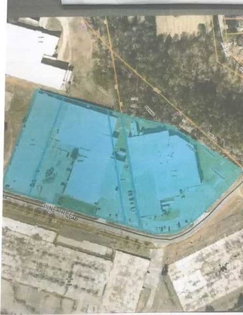
610 Pine Tree Rd, Oxford, NC 27565

Property Detail
610 Pine Tree Rd
Lightindustrial
610 PINE TREE RD
I2
Granville
B and X Area of moderate flood hazard, usually the area between the limits of the 100-year and 500-year floods.
North Carolina
2025
2.53 AC
2025
North Carolina Northeast Area
970300
Other Market Areas
55,526 SF
191207588689
NEARBY LISTINGS FOR SALE OR LEASE
DEMOGRAPHICS near 610 Pine Tree Rd
1 mile
3 mile
5 mile
2025 Total Population
2,439
10,542
14,990
2030 Population
2,494
10,721
15,287
Pop Growth 2025-2030
+ 2.26%
+ 1.70%
+ 1.98%
Average Age
40
42
42
2025 Total Households
1,022
4,362
6,102
HH Growth 2025-2030
+ 2.35%
+ 1.95%
+ 2.15%
Median Household Inc
$62,563
$54,748
$57,928
Avg Household Size
2.30
2.30
2.40
2025 Avg HH Vehicles
2.00
2.00
2.00
Median Home Value
$179,901
$205,077
$221,081
Median Year Built
1966
1972
1976
Nearby Places
Map Layers
Map Styles
 Street
 Aerial
Transit
 Traffic
 Biking
Places
Listings with unknown addresses are not visible on the map
- Restaurants
- Banks
- Shops
- Fitness
- Groceries
SALE & LEASE HISTORY
LISTING DATE
SALE/LEASE

Mar 16, 2021
For Sale
Jan 26, 2024
For Lease
Apr 29, 2022
For Lease
Nearby Properties
Address
Land Use
TOTAL SIZE
Lot Size
Zoning
Address
Land Use
TOTAL SIZE
Lot Size
Zoning
25,364 SF
266.74 AC
RAR6
Address
Land Use
TOTAL SIZE
Lot Size
Zoning
111,264 SF
5.81 AC
OI
Address
Land Use
TOTAL SIZE
Lot Size
Zoning
144,698 SF
42.10 AC
RA
Address
Land Use
TOTAL SIZE
Lot Size
Zoning
110,126 SF
40 AC
Address
Land Use
TOTAL SIZE
Lot Size
Zoning
149,950 SF
29.95 AC
B2
Address
Land Use
TOTAL SIZE
Lot Size
Zoning
65,740 SF
37.29 AC
RA
Address
Land Use
TOTAL SIZE
Lot Size
Zoning
8,352 SF
110.84 AC
I2
Address
Land Use
TOTAL SIZE
Lot Size
Zoning
8,640 SF
13.13 AC
Address
Land Use
TOTAL SIZE
Lot Size
Zoning
9,000 SF
36.08 AC
Address
Land Use
TOTAL SIZE
Lot Size
Zoning
14,634 SF
11.97 AC
B1
Address
Land Use
TOTAL SIZE
Lot Size
Zoning
5,294 SF
19.44 AC
B1
Address
Land Use
TOTAL SIZE
Lot Size
Zoning
15,346 SF
5.87 AC
I2
Address
Land Use
TOTAL SIZE
Lot Size
Zoning
186,443 SF
6 AC
I2
Address
Land Use
TOTAL SIZE
Lot Size
Zoning
88,275 SF
15.56 AC
I2AR40
Address
Land Use
TOTAL SIZE
Lot Size
Zoning
176,080 SF
8.32 AC
Address
Land Use
TOTAL SIZE
Lot Size
Zoning
33,547 SF
10.03 AC
Address
Land Use
TOTAL SIZE
Lot Size
Zoning
39,844 SF
5.91 AC
B
Address
Land Use
TOTAL SIZE
Lot Size
Zoning
1,760 SF
9.91 AC
RA
Address
Land Use
TOTAL SIZE
Lot Size
Zoning
34,972 SF
19.19 AC
B1
Address
Land Use
TOTAL SIZE
Lot Size
Zoning
76,072 SF
26.53 AC
I2
Address
Land Use
TOTAL SIZE
Lot Size
Zoning
42,806 SF
0.96 AC
B1
Address
Land Use
TOTAL SIZE
Lot Size
Zoning
161,949 SF
69.03 AC
I2
Address
Land Use
TOTAL SIZE
Lot Size
Zoning
133,676 SF
11 AC
Address
Land Use
TOTAL SIZE
Lot Size
Zoning
2,812 SF
8.37 AC
Address
Land Use
TOTAL SIZE
Lot Size
Zoning
18,729 SF
6.66 AC
B1
Address
Land Use
TOTAL SIZE
Lot Size
Zoning
1,454 SF
12.25 AC
R6
Address
Land Use
TOTAL SIZE
Lot Size
Zoning
70,040 SF
15.32 AC
B2
Address
Land Use
TOTAL SIZE
Lot Size
Zoning
28,880 SF
41.25 AC
I1
Address
Land Use
TOTAL SIZE
Lot Size
Zoning
90,875 SF
20 AC
I2
Address
Land Use
TOTAL SIZE
Lot Size
Zoning
29,960 SF
8.70 AC
OI
The World's #1 Commercial Real Estate Marketplace
Connect with us
© 2026 CoStar Group
The information above has been obtained from sources believed reliable. While we do not doubt its accuracy we have not verified it and make no guarantee, warranty or representation about it. It is your responsibility to independently confirm its accuracy and completeness. Any projections, opinions, assumptions, or estimates used are for example only and do not represent the current or future performance of the property. The value of this transaction to you depends on tax and other factors which should be evaluated by your tax, financial, and legal advisors. You and your advisors should conduct a careful, independent investigation of the property to determine to your satisfaction the suitability of the property for your needs.