Property Record
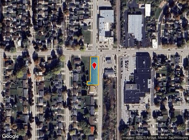
610 S 29Th St, Manitowoc, WI 54220

NEARBY LISTINGS FOR SALE OR LEASE
-
-
View all Manitowoc listings for sale on LoopNet.com
Property Detail
610 S 29Th St
052-825-101-130.00
TR 12 OF CSM V26 P1 BEING A RESUBDIVISION OF TR 1A OF CSM V9 P27 LOCATED IN THE NE 1/4 NE 1/4 OF SEC 25-19-23
Commercialnec
Manitowoc
X
Wisconsin
55071C0306D
0.44 AC
2024
Wisconsin South Area
2024
Other Market Areas
000600
Manitowoc, WI
8,712 SF
DEMOGRAPHICS near 610 S 29Th St
1 Mile
3 Mile
5 Mile
2024 Total Population
9,350
34,674
38,655
2029 Population
9,404
34,777
38,766
Pop Growth 2024-2029
+ 0.58%
+ 0.30%
+ 0.29%
Average Age
42
43
43
2024 Total Households
4,107
15,242
16,963
HH Growth 2024-2029
+ 0.56%
+ 0.30%
+ 0.30%
Median Household Inc
$46,173
$52,030
$53,927
Avg Household Size
2.20
2.20
2.20
2024 Avg HH Vehicles
2.00
2.00
2.00
Median Home Value
$102,204
$142,017
$148,025
Median Year Built
1953
1958
1961
Nearby Places
Map Layers
Map Styles
 Street
 Aerial
- Restaurants
- Banks
- Shops
- Fitness
- Groceries
PUBLIC TRANSPORTATION
AIRPORT
Green Bay/Austin Straubel International
DRIVE
WALK
Distance
Green Bay/Austin Straubel International
55 min
41.5 mi
SALE & LEASE HISTORY
LISTING DATE
SALE/LEASE

Jul 24, 2019
For Sale
Nearby Properties
Address
Land Use
TOTAL SIZE
Lot Size
Zoning
Address
Land Use
TOTAL SIZE
Lot Size
Zoning
140,000 SF
5.63 AC
Address
Land Use
TOTAL SIZE
Lot Size
Zoning
36.16 AC
Address
Land Use
TOTAL SIZE
Lot Size
Zoning
74,004 SF
12.64 AC
Address
Land Use
TOTAL SIZE
Lot Size
Zoning
159,900 SF
35.31 AC
Address
Land Use
TOTAL SIZE
Lot Size
Zoning
202,432 SF
20.27 AC
Address
Land Use
TOTAL SIZE
Lot Size
Zoning
49.62 AC
Address
Land Use
TOTAL SIZE
Lot Size
Zoning
176,600 SF
18.79 AC
Address
Land Use
TOTAL SIZE
Lot Size
Zoning
45,901 SF
9.26 AC
Address
Land Use
TOTAL SIZE
Lot Size
Zoning
12.50 AC
Address
Land Use
TOTAL SIZE
Lot Size
Zoning
15,775 SF
1.64 AC
Address
Land Use
TOTAL SIZE
Lot Size
Zoning
66,328 SF
6.09 AC
Address
Land Use
TOTAL SIZE
Lot Size
Zoning
160,600 SF
20.73 AC
Address
Land Use
TOTAL SIZE
Lot Size
Zoning
15.62 AC
Address
Land Use
TOTAL SIZE
Lot Size
Zoning
21.54 AC
Address
Land Use
TOTAL SIZE
Lot Size
Zoning
76,362 SF
7.83 AC
Address
Land Use
TOTAL SIZE
Lot Size
Zoning
150,045 SF
10.42 AC
Address
Land Use
TOTAL SIZE
Lot Size
Zoning
29.89 AC
Address
Land Use
TOTAL SIZE
Lot Size
Zoning
187,990 SF
12.45 AC
Address
Land Use
TOTAL SIZE
Lot Size
Zoning
677,161 SF
9.15 AC
Address
Land Use
TOTAL SIZE
Lot Size
Zoning
48,828 SF
0.65 AC
Address
Land Use
TOTAL SIZE
Lot Size
Zoning
21.54 AC
Address
Land Use
TOTAL SIZE
Lot Size
Zoning
22.60 AC
Address
Land Use
TOTAL SIZE
Lot Size
Zoning
18,483 SF
3.12 AC
Address
Land Use
TOTAL SIZE
Lot Size
Zoning
7.08 AC
Address
Land Use
TOTAL SIZE
Lot Size
Zoning
17.41 AC
Address
Land Use
TOTAL SIZE
Lot Size
Zoning
25,460 SF
5.06 AC
Address
Land Use
TOTAL SIZE
Lot Size
Zoning
45,708 SF
5.66 AC
Address
Land Use
TOTAL SIZE
Lot Size
Zoning
59,680 SF
6.40 AC
Address
Land Use
TOTAL SIZE
Lot Size
Zoning
64,206 SF
3.76 AC
Address
Land Use
TOTAL SIZE
Lot Size
Zoning
107,800 SF
11.92 AC
The World's #1 Commercial Real Estate Marketplace
Connect with us
© 2025 CoStar Group
The information above has been obtained from sources believed reliable. While we do not doubt its accuracy we have not verified it and make no guarantee, warranty or representation about it. It is your responsibility to independently confirm its accuracy and completeness. Any projections, opinions, assumptions, or estimates used are for example only and do not represent the current or future performance of the property. The value of this transaction to you depends on tax and other factors which should be evaluated by your tax, financial, and legal advisors. You and your advisors should conduct a careful, independent investigation of the property to determine to your satisfaction the suitability of the property for your needs.