Property Record
610 Sylvan Heights Way, Nashville, TN 37209


NEARBY LISTINGS FOR SALE OR LEASE
Property Detail
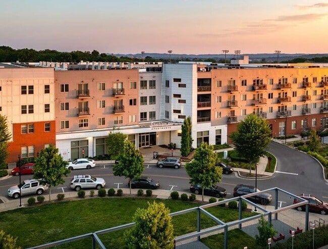
610 Sylvan Heights Way
Nashville-Davidson--Murfreesboro--Franklin, TN
Hill Center Sylvan Heights
091-16-0-392
LOT 1 HILL CENTER SYLVAN HEIGHTS
Highriseapartments
Davidson
X
Tennessee
47037C0239J
1
2025
3.25 AC
2025
Sylvan Heights
013500
Nashville
234,840 SF
DEMOGRAPHICS near 610 Sylvan Heights Way
1 Mile
3 Mile
5 Mile
2024 Total Population
16,251
117,184
222,708
2029 Population
16,567
118,936
226,130
Pop Growth 2024-2029
+ 1.94%
+ 1.50%
+ 1.54%
Average Age
34
36
37
2024 Total Households
7,710
53,359
101,299
HH Growth 2024-2029
+ 1.74%
+ 1.74%
+ 1.80%
Median Household Inc
$73,672
$65,905
$68,927
Avg Household Size
2.10
1.90
2.00
2024 Avg HH Vehicles
1.00
1.00
1.00
Median Home Value
$596,684
$520,135
$534,957
Median Year Built
2002
1997
1998
Nearby Places
Map Layers
Map Styles
 Street
 Aerial
- Restaurants
- Banks
- Shops
- Fitness
- Groceries
PUBLIC TRANSPORTATION
COMMUTER RAIL
Riverfront (East Corridor Line - Tennessee Regional Transportation Authority Music City Star (Music City Star))
DRIVE
WALK
Distance
Riverfront (East Corridor Line - Tennessee Regional Transportation Authority Music City Star (Music City Star))
7 min
3.9 mi
AIRPORT
Nashville International
DRIVE
WALK
Distance
Nashville International
18 min
12.6 mi
Freight Ports
Port of Mobile
DRIVE
WALK
Distance
Port of Mobile
488 min
448.0 mi
Nearby Properties
Address
Land Use
TOTAL SIZE
Lot Size
Zoning
Address
Land Use
TOTAL SIZE
Lot Size
Zoning
6,216 SF
131.92 AC
MULTI-ZONE
Address
Land Use
TOTAL SIZE
Lot Size
Zoning
289,697 SF
10.18 AC
MUI-A
Address
Land Use
TOTAL SIZE
Lot Size
Zoning
30,648 SF
37.73 AC
ORI
Address
Land Use
TOTAL SIZE
Lot Size
Zoning
5,397 SF
36.19 AC
MULTI-ZONE
Address
Land Use
TOTAL SIZE
Lot Size
Zoning
1,339,972 SF
16.18 AC
ORI
Address
Land Use
TOTAL SIZE
Lot Size
Zoning
17.48 AC
MUG
Address
Land Use
TOTAL SIZE
Lot Size
Zoning
57,264 SF
7.80 AC
MUI
Address
Land Use
TOTAL SIZE
Lot Size
Zoning
24.42 AC
ORI
Address
Land Use
TOTAL SIZE
Lot Size
Zoning
220,779 SF
2.93 AC
DTC
Address
Land Use
TOTAL SIZE
Lot Size
Zoning
18,446 SF
5.97 AC
DTC
Address
Land Use
TOTAL SIZE
Lot Size
Zoning
148,222 SF
25.86 AC
MULTI-ZONE
Address
Land Use
TOTAL SIZE
Lot Size
Zoning
15.48 AC
MUI
Address
Land Use
TOTAL SIZE
Lot Size
Zoning
30.16 AC
MULTI-ZONE
Address
Land Use
TOTAL SIZE
Lot Size
Zoning
3.11 AC
MULTIZONE
Address
Land Use
TOTAL SIZE
Lot Size
Zoning
112,896 SF
3.40 AC
MULTIZONE
Address
Land Use
TOTAL SIZE
Lot Size
Zoning
208,992 SF
6.09 AC
MUG
Address
Land Use
TOTAL SIZE
Lot Size
Zoning
17.03 AC
ORI
Address
Land Use
TOTAL SIZE
Lot Size
Zoning
564,166 SF
1.62 AC
DTC
Address
Land Use
TOTAL SIZE
Lot Size
Zoning
207,950 SF
3.47 AC
RM20
Address
Land Use
TOTAL SIZE
Lot Size
Zoning
1.97 AC
DTC
Address
Land Use
TOTAL SIZE
Lot Size
Zoning
4.23 AC
DTC
Address
Land Use
TOTAL SIZE
Lot Size
Zoning
2.43 AC
MULTI-ZONE
Address
Land Use
TOTAL SIZE
Lot Size
Zoning
4.89 AC
DTC
Address
Land Use
TOTAL SIZE
Lot Size
Zoning
315,516 SF
3.72 AC
SP
Address
Land Use
TOTAL SIZE
Lot Size
Zoning
304,445 SF
X
Address
Land Use
TOTAL SIZE
Lot Size
Zoning
545,321 SF
5.34 AC
DTC
Address
Land Use
TOTAL SIZE
Lot Size
Zoning
255,425 SF
1.88 AC
MULTIZONE
Address
Land Use
TOTAL SIZE
Lot Size
Zoning
489,992 SF
1.50 AC
DTC
Address
Land Use
TOTAL SIZE
Lot Size
Zoning
284,720 SF
1.16 AC
MULTIZONE
Address
Land Use
TOTAL SIZE
Lot Size
Zoning
556,277 SF
1.85 AC
SP
The World's #1 Commercial Real Estate Marketplace
Connect with us
© 2026 CoStar Group
The information above has been obtained from sources believed reliable. While we do not doubt its accuracy we have not verified it and make no guarantee, warranty or representation about it. It is your responsibility to independently confirm its accuracy and completeness. Any projections, opinions, assumptions, or estimates used are for example only and do not represent the current or future performance of the property. The value of this transaction to you depends on tax and other factors which should be evaluated by your tax, financial, and legal advisors. You and your advisors should conduct a careful, independent investigation of the property to determine to your satisfaction the suitability of the property for your needs.