Property Record
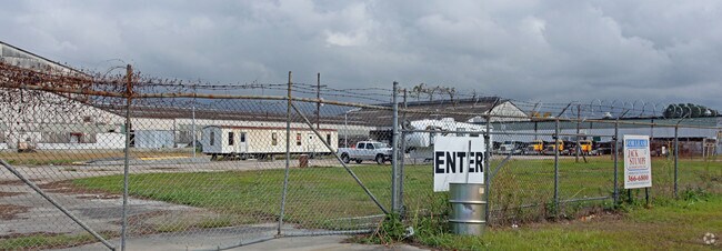
6100 4Th St, Marrero, LA 70072


Property Detail
6100 4Th St
New Orleans-Metairie, LA
& A PORT OF AMES BLVD NOW CLOSED AMES FARM LAND CO & HARBOR INDST
0420002676
Jefferson
Miscpropertynotclassed
Louisiana
M2
7.73 AC
2025
Outer Jefferson Parish
2025
New Orleans/Metairie/Kenner
026900
NEARBY LISTINGS FOR SALE OR LEASE
DEMOGRAPHICS near 6100 4Th St
1 mile
3 mile
5 mile
2025 Total Population
7,160
110,045
260,556
2030 Population
7,072
107,820
255,542
Pop Growth 2025-2030
(1.23%)
(2.02%)
(1.92%)
Average Age
42
41
40
2025 Total Households
2,969
45,657
109,730
HH Growth 2025-2030
(1.35%)
(2.33%)
(2.02%)
Median Household Inc
$35,394
$65,308
$59,048
Avg Household Size
2.30
2.20
2.20
2025 Avg HH Vehicles
2.00
1.00
1.00
Median Home Value
$145,193
$294,171
$270,248
Median Year Built
1964
1958
1962
Nearby Places
Map Layers
Map Styles
 Street
 Aerial
Transit
 Traffic
 Biking
Places
Listings with unknown addresses are not visible on the map
- Restaurants
- Banks
- Shops
- Fitness
- Groceries
PUBLIC TRANSPORTATION
COMMUTER RAIL
New Orleans Union Passenger Terminal (City of New Orleans - Amtrak, Crescent - Amtrak, Sunset Limited - Amtrak)
Drive
Walk
Distance
New Orleans Union Passenger Terminal (City of New Orleans - Amtrak, Crescent - Amtrak, Sunset Limited - Amtrak)
14 min
9.4 mi
AIRPORT
Louis Armstrong New Orleans International
Drive
Walk
Distance
Louis Armstrong New Orleans International
30 min
17.8 mi
Freight Ports
Port of New Orleans
Drive
Walk
Distance
Port of New Orleans
19 min
10.1 mi
SALE & LEASE HISTORY
LISTING DATE
SALE/LEASE

Dec 07, 2020
For Sale
Nearby Properties
Address
Land Use
TOTAL SIZE
Lot Size
Zoning
Address
Land Use
TOTAL SIZE
Lot Size
Zoning
80.92 AC
EC
Address
Land Use
TOTAL SIZE
Lot Size
Zoning
468,704 SF
8.66 AC
MC
Address
Land Use
TOTAL SIZE
Lot Size
Zoning
3.66 AC
MC
Address
Land Use
TOTAL SIZE
Lot Size
Zoning
197,182 SF
0.01 AC
OS-R
Address
Land Use
TOTAL SIZE
Lot Size
Zoning
Address
Land Use
TOTAL SIZE
Lot Size
Zoning
609,449 SF
1 AC
EC
Address
Land Use
TOTAL SIZE
Lot Size
Zoning
3.36 AC
EC
Address
Land Use
TOTAL SIZE
Lot Size
Zoning
4.12 AC
Address
Land Use
TOTAL SIZE
Lot Size
Zoning
315,570 SF
4.42 AC
HU-RM2
Address
Land Use
TOTAL SIZE
Lot Size
Zoning
0.08 AC
Address
Land Use
TOTAL SIZE
Lot Size
Zoning
Address
Land Use
TOTAL SIZE
Lot Size
Zoning
11.29 AC
HU-RD1
Address
Land Use
TOTAL SIZE
Lot Size
Zoning
1.15 AC
Address
Land Use
TOTAL SIZE
Lot Size
Zoning
0.17 AC
Address
Land Use
TOTAL SIZE
Lot Size
Zoning
20.13 AC
EC
Address
Land Use
TOTAL SIZE
Lot Size
Zoning
151,320 SF
27.55 AC
Address
Land Use
TOTAL SIZE
Lot Size
Zoning
0.17 AC
Address
Land Use
TOTAL SIZE
Lot Size
Zoning
9.02 AC
HU-RD2
Address
Land Use
TOTAL SIZE
Lot Size
Zoning
7,468 SF
8.13 AC
HU-RD2
Address
Land Use
TOTAL SIZE
Lot Size
Zoning
1.27 AC
HU-RM1
Address
Land Use
TOTAL SIZE
Lot Size
Zoning
4.12 AC
HU-MU
Address
Land Use
TOTAL SIZE
Lot Size
Zoning
Address
Land Use
TOTAL SIZE
Lot Size
Zoning
2.09 AC
HU-RD2
Address
Land Use
TOTAL SIZE
Lot Size
Zoning
3.46 AC
HU-RD2
Address
Land Use
TOTAL SIZE
Lot Size
Zoning
Address
Land Use
TOTAL SIZE
Lot Size
Zoning
298,450 SF
17.22 AC
MC
Address
Land Use
TOTAL SIZE
Lot Size
Zoning
3.55 AC
Address
Land Use
TOTAL SIZE
Lot Size
Zoning
12.79 AC
Address
Land Use
TOTAL SIZE
Lot Size
Zoning
0.16 AC
Address
Land Use
TOTAL SIZE
Lot Size
Zoning
14.69 AC
The World's #1 Commercial Real Estate Marketplace
Connect with us
© 2026 CoStar Group
The information above has been obtained from sources believed reliable. While we do not doubt its accuracy we have not verified it and make no guarantee, warranty or representation about it. It is your responsibility to independently confirm its accuracy and completeness. Any projections, opinions, assumptions, or estimates used are for example only and do not represent the current or future performance of the property. The value of this transaction to you depends on tax and other factors which should be evaluated by your tax, financial, and legal advisors. You and your advisors should conduct a careful, independent investigation of the property to determine to your satisfaction the suitability of the property for your needs.