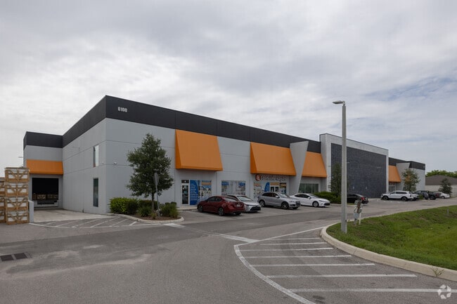
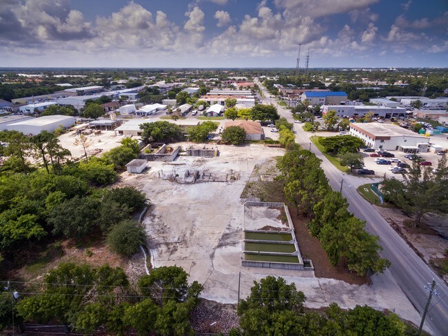
Property Record
6100 Shirley St, Naples, FL 34109

NEARBY LISTINGS FOR SALE OR LEASE
Property Detail
6100 Shirley St
00248880008
Acreage Header
Warehouse
11 49 25 COMM W1/4 CNR, E992.7 FT, N 430.61FT, E 30FT TO POB, N 350FT, E 250FT, S 350FT, W 250FT TO POB
AE
Collier
12021C0382J
Florida
2024
2 AC
2025
North Naples
010216
Southwest Florida
32,000 SF
Naples-Immokalee-Marco Island, FL
DEMOGRAPHICS near 6100 Shirley St
1 Mile
3 Mile
5 Mile
2024 Total Population
5,833
57,518
119,870
2029 Population
6,596
65,757
136,334
Pop Growth 2024-2029
+ 13.08%
+ 14.32%
+ 13.73%
Average Age
46
54
52
2024 Total Households
2,721
27,578
55,037
HH Growth 2024-2029
+ 12.20%
+ 14.05%
+ 13.69%
Median Household Inc
$67,304
$94,346
$88,271
Avg Household Size
2.10
2.00
2.10
2024 Avg HH Vehicles
1.00
2.00
2.00
Median Home Value
$441,342
$695,754
$608,439
Median Year Built
1994
1993
1993
Nearby Places
- Restaurants
- Banks
- Shops
- Fitness
- Groceries
SALE & LEASE HISTORY
LISTING DATE
SALE/LEASE

Sep 01, 2017
For Sale
May 09, 2017
For Sale
Mar 20, 2018
For Sale
Jul 17, 2017
For Sale
Aug 30, 2017
For Sale
Nearby Properties
Address
Land Use
TOTAL SIZE
Lot Size
Zoning
Address
Land Use
TOTAL SIZE
Lot Size
Zoning
688,632 SF
29.28 AC
A
Address
Land Use
TOTAL SIZE
Lot Size
Zoning
905,326 SF
69.45 AC
GC
Address
Land Use
TOTAL SIZE
Lot Size
Zoning
735,070 SF
41.34 AC
A
Address
Land Use
TOTAL SIZE
Lot Size
Zoning
411,909 SF
181.63 AC
RSF-3
Address
Land Use
TOTAL SIZE
Lot Size
Zoning
123,282 SF
6.50 AC
PUD
Address
Land Use
TOTAL SIZE
Lot Size
Zoning
398,094 SF
17.31 AC
A
Address
Land Use
TOTAL SIZE
Lot Size
Zoning
216,788 SF
85.21 AC
PUD
Address
Land Use
TOTAL SIZE
Lot Size
Zoning
363,275 SF
21.02 AC
PUD
Address
Land Use
TOTAL SIZE
Lot Size
Zoning
218,013 SF
77.73 AC
A
Address
Land Use
TOTAL SIZE
Lot Size
Zoning
353,756 SF
23.26 AC
ROAD
Address
Land Use
TOTAL SIZE
Lot Size
Zoning
418,075 SF
38.19 AC
Address
Land Use
TOTAL SIZE
Lot Size
Zoning
292,967 SF
13.12 AC
PUD
Address
Land Use
TOTAL SIZE
Lot Size
Zoning
453,819 SF
4.53 AC
Address
Land Use
TOTAL SIZE
Lot Size
Zoning
256,507 SF
26.32 AC
PUD
Address
Land Use
TOTAL SIZE
Lot Size
Zoning
72,844 SF
15.94 AC
RSF-1
Address
Land Use
TOTAL SIZE
Lot Size
Zoning
277,290 SF
31.01 AC
PUD
Address
Land Use
TOTAL SIZE
Lot Size
Zoning
255,522 SF
21.83 AC
NAPLES
Address
Land Use
TOTAL SIZE
Lot Size
Zoning
82,382 SF
9.98 AC
PUD
Address
Land Use
TOTAL SIZE
Lot Size
Zoning
363,194 SF
2.51 AC
A
Address
Land Use
TOTAL SIZE
Lot Size
Zoning
134,551 SF
19.50 AC
PUD
Address
Land Use
TOTAL SIZE
Lot Size
Zoning
192,347 SF
7.84 AC
PUD
Address
Land Use
TOTAL SIZE
Lot Size
Zoning
145,061 SF
18.82 AC
PUD
Address
Land Use
TOTAL SIZE
Lot Size
Zoning
164,004 SF
2.66 AC
Address
Land Use
TOTAL SIZE
Lot Size
Zoning
133,302 SF
3.82 AC
NAPLES
Address
Land Use
TOTAL SIZE
Lot Size
Zoning
188,741 SF
9.04 AC
A
Address
Land Use
TOTAL SIZE
Lot Size
Zoning
100,375 SF
3.71 AC
Address
Land Use
TOTAL SIZE
Lot Size
Zoning
174,104 SF
13.36 AC
PUD
Address
Land Use
TOTAL SIZE
Lot Size
Zoning
223,844 SF
27.55 AC
PUD
Address
Land Use
TOTAL SIZE
Lot Size
Zoning
189,520 SF
9.98 AC
Address
Land Use
TOTAL SIZE
Lot Size
Zoning
153,644 SF
14.69 AC
PUD
The World's #1 Commercial Real Estate Marketplace
Connect with us
© 2025 CoStar Group
The information above has been obtained from sources believed reliable. While we do not doubt its accuracy we have not verified it and make no guarantee, warranty or representation about it. It is your responsibility to independently confirm its accuracy and completeness. Any projections, opinions, assumptions, or estimates used are for example only and do not represent the current or future performance of the property. The value of this transaction to you depends on tax and other factors which should be evaluated by your tax, financial, and legal advisors. You and your advisors should conduct a careful, independent investigation of the property to determine to your satisfaction the suitability of the property for your needs.