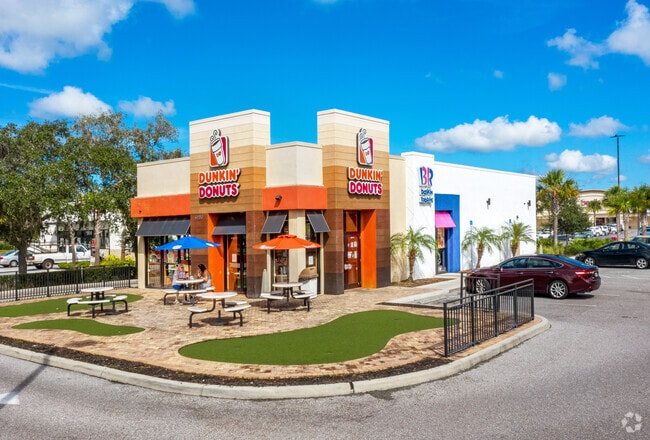
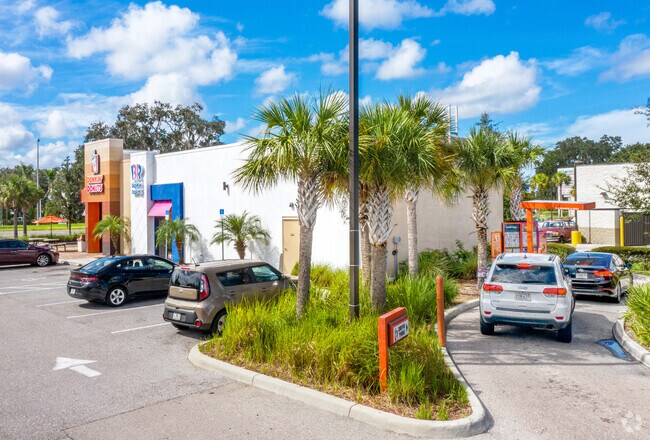
Property Record
6100 Us Highway 301 N, Ellenton, FL 34222
NEARBY LISTINGS FOR SALE OR LEASE
Property Detail
6100 Us Highway 301 N
North Port-Sarasota-Bradenton, FL
Phillips & Allen Resubdivided
8168-0027-9
A TRACT OF LAND BEGINNING AT THE NE COR OF THE SE1/4 OF THE SE1/4 OF SEC 9; TH S 89 DEG 24 MIN 32 SEC W A DIST OF 25 FT; TH S 00 DEG 35 MIN 43 SEC W A DIST OF 72.19 FT; TH S 80 DEG
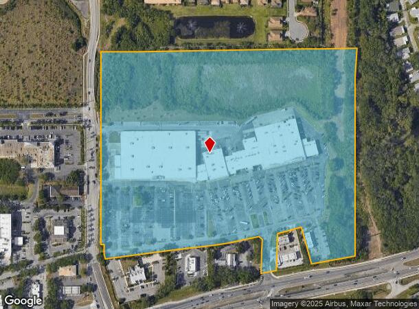
Regionalshoppingcenterormallwithanchorstore
Manatee
X
Florida
12081C0167F
of
2023
30.35 AC
2025
Manatee
001908
Tampa/St Petersburg
191,100 SF
DEMOGRAPHICS near 6100 Us Highway 301 N
1 Mile
3 Mile
5 Mile
2024 Total Population
4,815
47,919
126,348
2029 Population
5,611
56,159
148,269
Pop Growth 2024-2029
+ 16.53%
+ 17.20%
+ 17.35%
Average Age
58
46
45
2024 Total Households
2,438
20,254
50,138
HH Growth 2024-2029
+ 15.79%
+ 16.34%
+ 16.60%
Median Household Inc
$49,279
$70,444
$67,538
Avg Household Size
2.00
2.30
2.40
2024 Avg HH Vehicles
1.00
2.00
2.00
Median Home Value
$143,688
$274,468
$275,563
Median Year Built
1991
2001
1999
Nearby Places
Map Layers
Map Styles
 Street
 Aerial
- Restaurants
- Banks
- Shops
- Fitness
- Groceries
PUBLIC TRANSPORTATION
AIRPORT
Sarasota/Bradenton International
DRIVE
WALK
Distance
Sarasota/Bradenton International
27 min
14.2 mi
St Pete-Clearwater International
DRIVE
WALK
Distance
St Pete-Clearwater International
53 min
37.5 mi
Freight Ports
Port Manatee
DRIVE
WALK
Distance
Port Manatee
18 min
10.2 mi
Nearby Properties
Address
Land Use
TOTAL SIZE
Lot Size
Zoning
Address
Land Use
TOTAL SIZE
Lot Size
Zoning
622,266 SF
68.76 AC
PD-MU
Address
Land Use
TOTAL SIZE
Lot Size
Zoning
881,490 SF
83.09 AC
BR_R-3
Address
Land Use
TOTAL SIZE
Lot Size
Zoning
513,465 SF
78.39 AC
PD-MU
Address
Land Use
TOTAL SIZE
Lot Size
Zoning
707,409 SF
27.98 AC
PD-MU
Address
Land Use
TOTAL SIZE
Lot Size
Zoning
359,241 SF
27.68 AC
PD-MU
Address
Land Use
TOTAL SIZE
Lot Size
Zoning
294,300 SF
10.33 AC
PD-MU
Address
Land Use
TOTAL SIZE
Lot Size
Zoning
319,679 SF
31.78 AC
BR_R-1
Address
Land Use
TOTAL SIZE
Lot Size
Zoning
311,669 SF
34.55 AC
BR_R-2
Address
Land Use
TOTAL SIZE
Lot Size
Zoning
225,768 SF
18.47 AC
BR_R-1
Address
Land Use
TOTAL SIZE
Lot Size
Zoning
313,422 SF
47.93 AC
PD-C
Address
Land Use
TOTAL SIZE
Lot Size
Zoning
456,375 SF
112.07 AC
PD-MU
Address
Land Use
TOTAL SIZE
Lot Size
Zoning
885,776 SF
46.22 AC
LM LIGHT M
Address
Land Use
TOTAL SIZE
Lot Size
Zoning
270,900 SF
44.35 AC
PD-MU
Address
Land Use
TOTAL SIZE
Lot Size
Zoning
456,317 SF
46.75 AC
PD-R
Address
Land Use
TOTAL SIZE
Lot Size
Zoning
312,546 SF
39.60 AC
A-1 SUBURB
Address
Land Use
TOTAL SIZE
Lot Size
Zoning
107,298 SF
12.91 AC
PD-MU
Address
Land Use
TOTAL SIZE
Lot Size
Zoning
220,706 SF
24.13 AC
PD-C, A-1
Address
Land Use
TOTAL SIZE
Lot Size
Zoning
171,461 SF
7.56 AC
PL_CHI
Address
Land Use
TOTAL SIZE
Lot Size
Zoning
201,982 SF
16.65 AC
BR_SCC
Address
Land Use
TOTAL SIZE
Lot Size
Zoning
185,272 SF
18.11 AC
PD-R
Address
Land Use
TOTAL SIZE
Lot Size
Zoning
13,621 SF
61.72 AC
PD-RV,RSF-
Address
Land Use
TOTAL SIZE
Lot Size
Zoning
61,770 SF
79.85 AC
A,A-1
Address
Land Use
TOTAL SIZE
Lot Size
Zoning
138,535 SF
13.94 AC
BR_SCC
Address
Land Use
TOTAL SIZE
Lot Size
Zoning
59,222 SF
4.49 AC
PD-C
Address
Land Use
TOTAL SIZE
Lot Size
Zoning
65,761 SF
11.91 AC
BR_SCC
Address
Land Use
TOTAL SIZE
Lot Size
Zoning
33.49 AC
Address
Land Use
TOTAL SIZE
Lot Size
Zoning
56,442 SF
6.18 AC
GC GENERA
Address
Land Use
TOTAL SIZE
Lot Size
Zoning
56,246 SF
8.06 AC
BR_SCC
Address
Land Use
TOTAL SIZE
Lot Size
Zoning
35,784 SF
6.26 AC
PD-MU
The World's #1 Commercial Real Estate Marketplace
Connect with us
© 2026 CoStar Group
The information above has been obtained from sources believed reliable. While we do not doubt its accuracy we have not verified it and make no guarantee, warranty or representation about it. It is your responsibility to independently confirm its accuracy and completeness. Any projections, opinions, assumptions, or estimates used are for example only and do not represent the current or future performance of the property. The value of this transaction to you depends on tax and other factors which should be evaluated by your tax, financial, and legal advisors. You and your advisors should conduct a careful, independent investigation of the property to determine to your satisfaction the suitability of the property for your needs.