Property Record
6100 W Ridge Rd, Erie, PA 16506


NEARBY LISTINGS FOR SALE OR LEASE
Property Detail
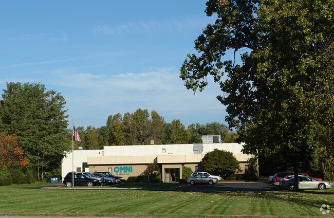
6100 W Ridge Rd
21-055-081.0-007.00
6100 WEST RIDGE RD 6.63 AC
Manufacturinglight
Erie
X
Pennsylvania
42049C0187D
6.63 AC
2025
Outlying Erie County
2025
Erie
010303
Erie, PA
40,406 SF
DEMOGRAPHICS near 6100 W Ridge Rd
1 Mile
3 Mile
5 Mile
2024 Total Population
2,870
21,563
47,978
2029 Population
2,851
21,290
47,469
Pop Growth 2024-2029
(0.66%)
(1.27%)
(1.06%)
Average Age
48
44
44
2024 Total Households
1,129
8,453
19,897
HH Growth 2024-2029
(0.71%)
(1.41%)
(1.14%)
Median Household Inc
$77,953
$91,186
$78,236
Avg Household Size
2.30
2.50
2.30
2024 Avg HH Vehicles
2.00
2.00
2.00
Median Home Value
$224,412
$229,364
$198,589
Median Year Built
1973
1974
1974
Nearby Places
Map Layers
Map Styles
 Street
 Aerial
- Restaurants
- Banks
- Shops
- Fitness
- Groceries
PUBLIC TRANSPORTATION
COMMUTER RAIL
DRIVE
WALK
Distance
17 min
8.5 mi
AIRPORT
Erie International/Tom Ridge Field
DRIVE
WALK
Distance
Erie International/Tom Ridge Field
7 min
3.3 mi
Nearby Properties
Address
Land Use
TOTAL SIZE
Lot Size
Zoning
Address
Land Use
TOTAL SIZE
Lot Size
Zoning
56.46 AC
AR
Address
Land Use
TOTAL SIZE
Lot Size
Zoning
28.65 AC
AR
Address
Land Use
TOTAL SIZE
Lot Size
Zoning
35,669 SF
290.27 AC
LI
Address
Land Use
TOTAL SIZE
Lot Size
Zoning
177,906 SF
32.06 AC
AR
Address
Land Use
TOTAL SIZE
Lot Size
Zoning
39,948 SF
5.02 AC
BB
Address
Land Use
TOTAL SIZE
Lot Size
Zoning
12,622 SF
AR
Address
Land Use
TOTAL SIZE
Lot Size
Zoning
79,679 SF
13.94 AC
DB
Address
Land Use
TOTAL SIZE
Lot Size
Zoning
18.93 AC
AR
Address
Land Use
TOTAL SIZE
Lot Size
Zoning
16,329 SF
7.18 AC
BB
Address
Land Use
TOTAL SIZE
Lot Size
Zoning
135,492 SF
19.03 AC
LI
Address
Land Use
TOTAL SIZE
Lot Size
Zoning
111,348 SF
4.38 AC
BB
Address
Land Use
TOTAL SIZE
Lot Size
Zoning
74,750 SF
16.07 AC
Address
Land Use
TOTAL SIZE
Lot Size
Zoning
124,338 SF
22.58 AC
DB
Address
Land Use
TOTAL SIZE
Lot Size
Zoning
7,980 SF
3.40 AC
AR
Address
Land Use
TOTAL SIZE
Lot Size
Zoning
4,608 SF
3.46 AC
DR
Address
Land Use
TOTAL SIZE
Lot Size
Zoning
36,288 SF
2.88 AC
AR
Address
Land Use
TOTAL SIZE
Lot Size
Zoning
20,168 SF
4.19 AC
BB
Address
Land Use
TOTAL SIZE
Lot Size
Zoning
12,720 SF
3.92 AC
BB
Address
Land Use
TOTAL SIZE
Lot Size
Zoning
50,426 SF
125.45 AC
R3
Address
Land Use
TOTAL SIZE
Lot Size
Zoning
364 SF
19.58 AC
AR
Address
Land Use
TOTAL SIZE
Lot Size
Zoning
12,000 SF
6.80 AC
B2
Address
Land Use
TOTAL SIZE
Lot Size
Zoning
3.82 AC
AR
Address
Land Use
TOTAL SIZE
Lot Size
Zoning
1,507 SF
26.32 AC
A3
Address
Land Use
TOTAL SIZE
Lot Size
Zoning
8,064 SF
2.48 AC
BB
Address
Land Use
TOTAL SIZE
Lot Size
Zoning
114,220 SF
5.64 AC
Address
Land Use
TOTAL SIZE
Lot Size
Zoning
12,288 SF
4.70 AC
DR
Address
Land Use
TOTAL SIZE
Lot Size
Zoning
18.75 AC
AR
Address
Land Use
TOTAL SIZE
Lot Size
Zoning
91,144 SF
15 AC
R2
Address
Land Use
TOTAL SIZE
Lot Size
Zoning
12,157 SF
7.02 AC
A1
Address
Land Use
TOTAL SIZE
Lot Size
Zoning
12,679 SF
13.99 AC
AR
The World's #1 Commercial Real Estate Marketplace
Connect with us
© 2026 CoStar Group
The information above has been obtained from sources believed reliable. While we do not doubt its accuracy we have not verified it and make no guarantee, warranty or representation about it. It is your responsibility to independently confirm its accuracy and completeness. Any projections, opinions, assumptions, or estimates used are for example only and do not represent the current or future performance of the property. The value of this transaction to you depends on tax and other factors which should be evaluated by your tax, financial, and legal advisors. You and your advisors should conduct a careful, independent investigation of the property to determine to your satisfaction the suitability of the property for your needs.