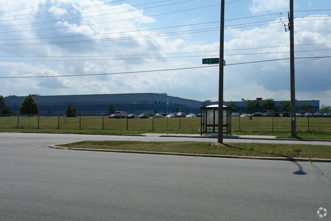
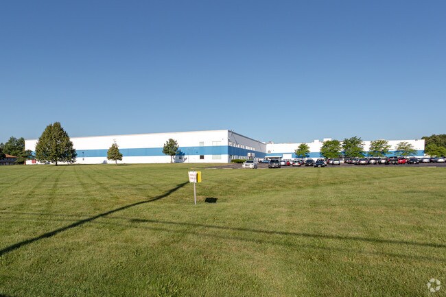
Property Record
6101 N 64Th St, Milwaukee, WI 53218


NEARBY LISTINGS FOR SALE OR LEASE
Property Detail
6101 N 64Th St
155-9983-100-X
LANDS IN NE 1/4 SEC 27-8-21 COM SW COR SD 1/4 SEC-TH N ALG W LI SD 1/4 SEC 918.23-TH E 178.61-TH N 31-TH E 1159.26 TO E LI W 1/2 SD 1/4 SEC-TH S ALG SD E LI TO S LI SD 1/4 SEC-TH W ALG SD S LI TO PT OF COM EXC STS BID #31
Warehouse
Milwaukee
X
Wisconsin
55089C0265G
26.39 AC
2024
Milwaukee NW
2024
Milwaukee/Madison
001300
Milwaukee-Waukesha-West Allis, WI
344,223 SF
DEMOGRAPHICS near 6101 N 64Th St
1 Mile
3 Mile
5 Mile
2024 Total Population
15,362
126,256
299,962
2029 Population
15,121
124,028
295,293
Pop Growth 2024-2029
(1.57%)
(1.76%)
(1.56%)
Average Age
33
36
37
2024 Total Households
5,289
47,871
119,175
HH Growth 2024-2029
(1.70%)
(1.84%)
(1.67%)
Median Household Inc
$40,195
$45,426
$51,009
Avg Household Size
2.80
2.50
2.40
2024 Avg HH Vehicles
1.00
1.00
1.00
Median Home Value
$107,260
$134,429
$170,380
Median Year Built
1959
1957
1955
Nearby Places
Map Layers
Map Styles
 Street
 Aerial
- Restaurants
- Banks
- Shops
- Fitness
- Groceries
PUBLIC TRANSPORTATION
AIRPORT
General Mitchell International
DRIVE
WALK
Distance
General Mitchell International
32 min
17.3 mi
Freight Ports
Port Milwaukee
DRIVE
WALK
Distance
Port Milwaukee
25 min
13.2 mi
SALE & LEASE HISTORY
LISTING DATE
SALE/LEASE

Feb 08, 2019
For Lease
Aug 23, 2019
For Sale
Nearby Properties
Address
Land Use
TOTAL SIZE
Lot Size
Zoning
Address
Land Use
TOTAL SIZE
Lot Size
Zoning
527,776 SF
33.23 AC
Address
Land Use
TOTAL SIZE
Lot Size
Zoning
33.49 AC
TL
Address
Land Use
TOTAL SIZE
Lot Size
Zoning
145,218 SF
10.23 AC
Address
Land Use
TOTAL SIZE
Lot Size
Zoning
0.71 AC
RM2
Address
Land Use
TOTAL SIZE
Lot Size
Zoning
0.71 AC
RM2
Address
Land Use
TOTAL SIZE
Lot Size
Zoning
298,666 SF
5.09 AC
PD
Address
Land Use
TOTAL SIZE
Lot Size
Zoning
12.49 AC
TL
Address
Land Use
TOTAL SIZE
Lot Size
Zoning
104,365 SF
9.85 AC
PD
Address
Land Use
TOTAL SIZE
Lot Size
Zoning
66.42 AC
IL1
Address
Land Use
TOTAL SIZE
Lot Size
Zoning
17.84 AC
TL
Address
Land Use
TOTAL SIZE
Lot Size
Zoning
169,550 SF
12.04 AC
RB2
Address
Land Use
TOTAL SIZE
Lot Size
Zoning
18.54 AC
RS6
Address
Land Use
TOTAL SIZE
Lot Size
Zoning
17.91 AC
RS5
Address
Land Use
TOTAL SIZE
Lot Size
Zoning
297,894 SF
19.67 AC
IL1
Address
Land Use
TOTAL SIZE
Lot Size
Zoning
333,971 SF
16.93 AC
IL1
Address
Land Use
TOTAL SIZE
Lot Size
Zoning
166,245 SF
55 AC
PD
Address
Land Use
TOTAL SIZE
Lot Size
Zoning
28.12 AC
RM1
Address
Land Use
TOTAL SIZE
Lot Size
Zoning
116,862 SF
14.39 AC
RM1
Address
Land Use
TOTAL SIZE
Lot Size
Zoning
23.38 AC
RS6
Address
Land Use
TOTAL SIZE
Lot Size
Zoning
17,613 SF
1.44 AC
Address
Land Use
TOTAL SIZE
Lot Size
Zoning
163,539 SF
7.17 AC
PUD
Address
Land Use
TOTAL SIZE
Lot Size
Zoning
49.03 AC
PK
Address
Land Use
TOTAL SIZE
Lot Size
Zoning
9.94 AC
IL1
Address
Land Use
TOTAL SIZE
Lot Size
Zoning
56,706 SF
4.53 AC
Address
Land Use
TOTAL SIZE
Lot Size
Zoning
92,303 SF
19.02 AC
PD
Address
Land Use
TOTAL SIZE
Lot Size
Zoning
90,360 SF
6.52 AC
LB1
Address
Land Use
TOTAL SIZE
Lot Size
Zoning
157,000 SF
17.15 AC
PD
Address
Land Use
TOTAL SIZE
Lot Size
Zoning
75,221 SF
7.46 AC
RM1
Address
Land Use
TOTAL SIZE
Lot Size
Zoning
432,369 SF
22.97 AC
IL1
The World's #1 Commercial Real Estate Marketplace
Connect with us
© 2026 CoStar Group
The information above has been obtained from sources believed reliable. While we do not doubt its accuracy we have not verified it and make no guarantee, warranty or representation about it. It is your responsibility to independently confirm its accuracy and completeness. Any projections, opinions, assumptions, or estimates used are for example only and do not represent the current or future performance of the property. The value of this transaction to you depends on tax and other factors which should be evaluated by your tax, financial, and legal advisors. You and your advisors should conduct a careful, independent investigation of the property to determine to your satisfaction the suitability of the property for your needs.