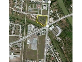
Property Record
6101 Paredes Line Rd, Brownsville, TX 78526


NEARBY LISTINGS FOR SALE OR LEASE
Property Detail
6101 Paredes Line Rd
Brownsville-Harlingen, TX
The Preserve At Forest North
789650-0070-001000
THE PRESERVE AT FOREST NORTH LOT 1 BLK 7 (CAB 1 SLOT 2393-A)
Commercialnec
Cameron
A
Texas
48061C0580F
1
2024
4.64 AC
2025
Greater Brownsville
014402
Brownsville/Harlingen
3,007 SF
DEMOGRAPHICS near 6101 Paredes Line Rd
1 Mile
3 Mile
5 Mile
2024 Total Population
10,843
54,567
139,163
2029 Population
11,042
55,623
142,428
Pop Growth 2024-2029
+ 1.84%
+ 1.94%
+ 2.35%
Average Age
34
35
35
2024 Total Households
3,149
16,918
42,999
HH Growth 2024-2029
+ 1.81%
+ 1.97%
+ 2.38%
Median Household Inc
$63,438
$62,902
$56,179
Avg Household Size
3.40
3.20
3.10
2024 Avg HH Vehicles
2.00
2.00
2.00
Median Home Value
$168,354
$146,327
$130,935
Median Year Built
2000
1999
1996
Nearby Places
Map Layers
Map Styles
 Street
 Aerial
- Restaurants
- Banks
- Shops
- Fitness
- Groceries
PUBLIC TRANSPORTATION
AIRPORT
Brownsville/South Padre Island International
DRIVE
WALK
Distance
Brownsville/South Padre Island International
15 min
8.3 mi
Valley International
DRIVE
WALK
Distance
Valley International
40 min
24.7 mi
SALE & LEASE HISTORY
LISTING DATE
SALE/LEASE

Sep 24, 2016
For Sale
May 19, 2023
For Sale
Apr 11, 2018
For Sale
Nearby Properties
Address
Land Use
TOTAL SIZE
Lot Size
Zoning
Address
Land Use
TOTAL SIZE
Lot Size
Zoning
1,019,535 SF
83.42 AC
I
Address
Land Use
TOTAL SIZE
Lot Size
Zoning
452,559 SF
13.79 AC
C
Address
Land Use
TOTAL SIZE
Lot Size
Zoning
232,467 SF
25.82 AC
C
Address
Land Use
TOTAL SIZE
Lot Size
Zoning
112,834 SF
16.70 AC
C
Address
Land Use
TOTAL SIZE
Lot Size
Zoning
135,686 SF
19.05 AC
C
Address
Land Use
TOTAL SIZE
Lot Size
Zoning
196,847 SF
19.63 AC
Address
Land Use
TOTAL SIZE
Lot Size
Zoning
145,218 SF
23.16 AC
Address
Land Use
TOTAL SIZE
Lot Size
Zoning
100,491 SF
14 AC
C
Address
Land Use
TOTAL SIZE
Lot Size
Zoning
66,340 SF
3.85 AC
C
Address
Land Use
TOTAL SIZE
Lot Size
Zoning
56,804 SF
1.83 AC
Address
Land Use
TOTAL SIZE
Lot Size
Zoning
73,090 SF
3.08 AC
C
Address
Land Use
TOTAL SIZE
Lot Size
Zoning
148,781 SF
10.28 AC
B
Address
Land Use
TOTAL SIZE
Lot Size
Zoning
60,747 SF
2.59 AC
C
Address
Land Use
TOTAL SIZE
Lot Size
Zoning
4.56 AC
C
Address
Land Use
TOTAL SIZE
Lot Size
Zoning
188,446 SF
18.42 AC
Address
Land Use
TOTAL SIZE
Lot Size
Zoning
62,344 SF
2.92 AC
Address
Land Use
TOTAL SIZE
Lot Size
Zoning
204,001 SF
20.13 AC
C
Address
Land Use
TOTAL SIZE
Lot Size
Zoning
52,668 SF
2.23 AC
Address
Land Use
TOTAL SIZE
Lot Size
Zoning
102,042 SF
8.68 AC
C
Address
Land Use
TOTAL SIZE
Lot Size
Zoning
78,583 SF
5.01 AC
C
Address
Land Use
TOTAL SIZE
Lot Size
Zoning
86,682 SF
25.76 AC
C
Address
Land Use
TOTAL SIZE
Lot Size
Zoning
241,619 SF
14.68 AC
Address
Land Use
TOTAL SIZE
Lot Size
Zoning
174,826 SF
5.82 AC
Address
Land Use
TOTAL SIZE
Lot Size
Zoning
46,381 SF
2.16 AC
Address
Land Use
TOTAL SIZE
Lot Size
Zoning
48,862 SF
1.22 AC
C
Address
Land Use
TOTAL SIZE
Lot Size
Zoning
71,229 SF
12.58 AC
Address
Land Use
TOTAL SIZE
Lot Size
Zoning
97,077 SF
16.78 AC
Address
Land Use
TOTAL SIZE
Lot Size
Zoning
299,792 SF
12.88 AC
C
Address
Land Use
TOTAL SIZE
Lot Size
Zoning
48,468 SF
2.65 AC
C
The World's #1 Commercial Real Estate Marketplace
Connect with us
© 2026 CoStar Group
The information above has been obtained from sources believed reliable. While we do not doubt its accuracy we have not verified it and make no guarantee, warranty or representation about it. It is your responsibility to independently confirm its accuracy and completeness. Any projections, opinions, assumptions, or estimates used are for example only and do not represent the current or future performance of the property. The value of this transaction to you depends on tax and other factors which should be evaluated by your tax, financial, and legal advisors. You and your advisors should conduct a careful, independent investigation of the property to determine to your satisfaction the suitability of the property for your needs.