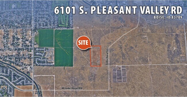
Property Record
6101 S Pleasant Valley Rd, Boise, ID 83709


NEARBY LISTINGS FOR SALE OR LEASE
Property Detail
6101 S Pleasant Valley Rd
S1031449200
W2SE4SE4 SEC 31 3N 2E #449000-S
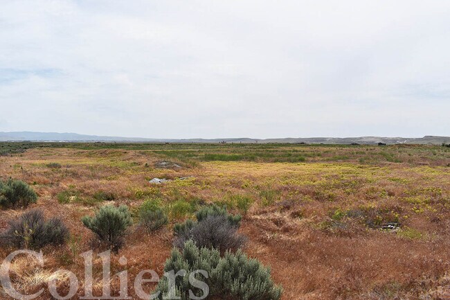
Industrialacreage
Ada
X
Idaho
16001C0267H
20 AC
2024
Airport
2025
Boise City/Nampa
002229
Boise City, ID
DEMOGRAPHICS near 6101 S Pleasant Valley Rd
1 Mile
3 Mile
5 Mile
2024 Total Population
1,403
35,244
136,917
2029 Population
1,632
39,872
155,361
Pop Growth 2024-2029
+ 16.32%
+ 13.13%
+ 13.47%
Average Age
43
38
38
2024 Total Households
541
12,859
53,868
HH Growth 2024-2029
+ 16.45%
+ 13.42%
+ 13.83%
Median Household Inc
$85,807
$76,407
$67,302
Avg Household Size
2.60
2.60
2.40
2024 Avg HH Vehicles
2.00
2.00
2.00
Median Home Value
$455,599
$422,699
$432,622
Median Year Built
1981
1995
1988
Nearby Places
Map Layers
Map Styles
 Street
 Aerial
- Restaurants
- Banks
- Shops
- Fitness
- Groceries
PUBLIC TRANSPORTATION
AIRPORT
Boise Air Trml/Gowen Field
DRIVE
WALK
Distance
Boise Air Trml/Gowen Field
8 min
2.7 mi
SALE & LEASE HISTORY
LISTING DATE
SALE/LEASE

Jun 21, 2022
For Sale
Jun 12, 2023
For Sale
Nearby Properties
Address
Land Use
TOTAL SIZE
Lot Size
Zoning
Address
Land Use
TOTAL SIZE
Lot Size
Zoning
164,981 SF
7.47 AC
R20
Address
Land Use
TOTAL SIZE
Lot Size
Zoning
173,766 SF
9.53 AC
ZC-245
Address
Land Use
TOTAL SIZE
Lot Size
Zoning
164,141 SF
24.32 AC
ZC-269
Address
Land Use
TOTAL SIZE
Lot Size
Zoning
130,560 SF
7.72 AC
R-2
Address
Land Use
TOTAL SIZE
Lot Size
Zoning
196,326 SF
ZC-269
Address
Land Use
TOTAL SIZE
Lot Size
Zoning
91,433 SF
3.54 AC
ZC-243
Address
Land Use
TOTAL SIZE
Lot Size
Zoning
98,120 SF
2.95 AC
MX-3
Address
Land Use
TOTAL SIZE
Lot Size
Zoning
102,196 SF
2.93 AC
ZC-245
Address
Land Use
TOTAL SIZE
Lot Size
Zoning
78,219 SF
2.53 AC
ZC-243
Address
Land Use
TOTAL SIZE
Lot Size
Zoning
87,194 SF
12.42 AC
ZC-269
Address
Land Use
TOTAL SIZE
Lot Size
Zoning
60,760 SF
3.10 AC
ZC-243
Address
Land Use
TOTAL SIZE
Lot Size
Zoning
69,620 SF
6.22 AC
ZC-269
Address
Land Use
TOTAL SIZE
Lot Size
Zoning
31,460 SF
12.64 AC
ZC-269
Address
Land Use
TOTAL SIZE
Lot Size
Zoning
153,264 SF
9.13 AC
ZC-243
Address
Land Use
TOTAL SIZE
Lot Size
Zoning
84,000 SF
ZC-269
Address
Land Use
TOTAL SIZE
Lot Size
Zoning
67,012 SF
3.87 AC
R-2
Address
Land Use
TOTAL SIZE
Lot Size
Zoning
79,914 SF
10.67 AC
ZC-248
Address
Land Use
TOTAL SIZE
Lot Size
Zoning
57,569 SF
18.58 AC
ZC-242
Address
Land Use
TOTAL SIZE
Lot Size
Zoning
74,785 SF
2.03 AC
R-3
Address
Land Use
TOTAL SIZE
Lot Size
Zoning
70.14 AC
SP-03
Address
Land Use
TOTAL SIZE
Lot Size
Zoning
61,312 SF
2.84 AC
ZC-245
Address
Land Use
TOTAL SIZE
Lot Size
Zoning
92,750 SF
ZC-269
Address
Land Use
TOTAL SIZE
Lot Size
Zoning
82,851 SF
4.57 AC
ZC-269
Address
Land Use
TOTAL SIZE
Lot Size
Zoning
48,864 SF
1.93 AC
ZC-245
Address
Land Use
TOTAL SIZE
Lot Size
Zoning
97,046 SF
6.79 AC
ZC-269
Address
Land Use
TOTAL SIZE
Lot Size
Zoning
120.94 AC
ZC-273
Address
Land Use
TOTAL SIZE
Lot Size
Zoning
88,648 SF
5.15 AC
ZC-269
Address
Land Use
TOTAL SIZE
Lot Size
Zoning
48,000 SF
2.04 AC
ZC-243
Address
Land Use
TOTAL SIZE
Lot Size
Zoning
48,770 SF
3.56 AC
ZC-243
Address
Land Use
TOTAL SIZE
Lot Size
Zoning
61,871 SF
1.92 AC
ZC-245
The World's #1 Commercial Real Estate Marketplace
Connect with us
© 2026 CoStar Group
The information above has been obtained from sources believed reliable. While we do not doubt its accuracy we have not verified it and make no guarantee, warranty or representation about it. It is your responsibility to independently confirm its accuracy and completeness. Any projections, opinions, assumptions, or estimates used are for example only and do not represent the current or future performance of the property. The value of this transaction to you depends on tax and other factors which should be evaluated by your tax, financial, and legal advisors. You and your advisors should conduct a careful, independent investigation of the property to determine to your satisfaction the suitability of the property for your needs.