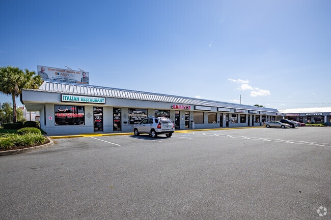
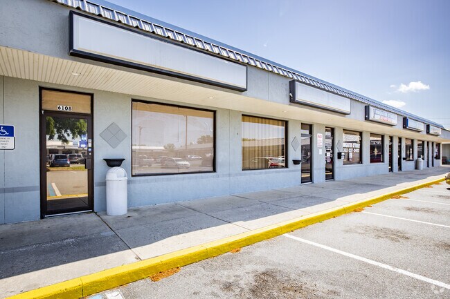
Property Record
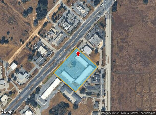
6102 Sw Highway 200, Ocala, FL 34476

NEARBY LISTINGS FOR SALE OR LEASE
Property Detail
6102 Sw Highway 200
35497-002-00
SEC 08 TWP 16 RGE 21 COM AT THE SE COR TH N 00-27-29 E ALONG THE E BDY LINE 665.73 FT TO THE SE COR OF N 1/2 OF SE 1/4 O SE 1/4 TH N 89-39-32 W ALONG THE S BDY OF THE N 1/2 OF SE 1/4 OF SE 1/4 30 FT TO A POINT ON THE WLY ROW LINE OF SW 60TH AVE TH N
Regionalshoppingcenterormallwithanchorstore
Marion
X
Florida
12083C0701E
4.02 AC
2025
Outlying Marion County
2025
Ocala
001010
Ocala, FL
41,012 SF
DEMOGRAPHICS near 6102 Sw Highway 200
1 Mile
3 Mile
5 Mile
2024 Total Population
2,715
22,108
67,078
2029 Population
3,073
24,943
75,991
Pop Growth 2024-2029
+ 13.19%
+ 12.82%
+ 13.29%
Average Age
54
49
53
2024 Total Households
1,293
9,626
31,279
HH Growth 2024-2029
+ 13.15%
+ 12.75%
+ 13.21%
Median Household Inc
$50,560
$60,221
$58,292
Avg Household Size
2.10
2.30
2.10
2024 Avg HH Vehicles
1.00
2.00
2.00
Median Home Value
$165,740
$223,171
$213,261
Median Year Built
1993
2000
1996
Nearby Places
Map Layers
Map Styles
 Street
 Aerial
- Restaurants
- Banks
- Shops
- Fitness
- Groceries
Nearby Properties
Address
Land Use
TOTAL SIZE
Lot Size
Zoning
Address
Land Use
TOTAL SIZE
Lot Size
Zoning
156,201 SF
36.77 AC
INST
Address
Land Use
TOTAL SIZE
Lot Size
Zoning
283,913 SF
24.22 AC
B2
Address
Land Use
TOTAL SIZE
Lot Size
Zoning
120,296 SF
35.67 AC
PD
Address
Land Use
TOTAL SIZE
Lot Size
Zoning
192,480 SF
23.19 AC
R3
Address
Land Use
TOTAL SIZE
Lot Size
Zoning
324,262 SF
40.79 AC
SC
Address
Land Use
TOTAL SIZE
Lot Size
Zoning
189,662 SF
25.54 AC
B2
Address
Land Use
TOTAL SIZE
Lot Size
Zoning
87,034 SF
14.45 AC
R3
Address
Land Use
TOTAL SIZE
Lot Size
Zoning
380,749 SF
40.05 AC
PUD
Address
Land Use
TOTAL SIZE
Lot Size
Zoning
124,557 SF
39.04 AC
GU
Address
Land Use
TOTAL SIZE
Lot Size
Zoning
304,259 SF
31.62 AC
PUD
Address
Land Use
TOTAL SIZE
Lot Size
Zoning
186,474 SF
18.52 AC
SC
Address
Land Use
TOTAL SIZE
Lot Size
Zoning
59,706 SF
10.01 AC
PD
Address
Land Use
TOTAL SIZE
Lot Size
Zoning
96,094 SF
13.66 AC
B2
Address
Land Use
TOTAL SIZE
Lot Size
Zoning
62,253 SF
6.52 AC
PUD
Address
Land Use
TOTAL SIZE
Lot Size
Zoning
95,496 SF
25.25 AC
R3
Address
Land Use
TOTAL SIZE
Lot Size
Zoning
74,928 SF
7.80 AC
PUD
Address
Land Use
TOTAL SIZE
Lot Size
Zoning
68,372 SF
21.78 AC
B4
Address
Land Use
TOTAL SIZE
Lot Size
Zoning
44,276 SF
5 AC
O1
Address
Land Use
TOTAL SIZE
Lot Size
Zoning
139,728 SF
22.86 AC
B4
Address
Land Use
TOTAL SIZE
Lot Size
Zoning
10,494 SF
1.63 AC
B2
Address
Land Use
TOTAL SIZE
Lot Size
Zoning
84,004 SF
9.77 AC
SC
Address
Land Use
TOTAL SIZE
Lot Size
Zoning
65,060 SF
11.90 AC
B2
Address
Land Use
TOTAL SIZE
Lot Size
Zoning
23,783 SF
3.27 AC
B2
Address
Land Use
TOTAL SIZE
Lot Size
Zoning
56,605 SF
4.12 AC
B2
Address
Land Use
TOTAL SIZE
Lot Size
Zoning
137,103 SF
13.83 AC
B2
Address
Land Use
TOTAL SIZE
Lot Size
Zoning
77,877 SF
13.38 AC
B2
Address
Land Use
TOTAL SIZE
Lot Size
Zoning
81,299 SF
18.32 AC
A1
Address
Land Use
TOTAL SIZE
Lot Size
Zoning
24,999 SF
9.04 AC
B4
Address
Land Use
TOTAL SIZE
Lot Size
Zoning
128,206 SF
11.38 AC
SC
Address
Land Use
TOTAL SIZE
Lot Size
Zoning
42,673 SF
13.72 AC
A1
The World's #1 Commercial Real Estate Marketplace
Connect with us
© 2026 CoStar Group
The information above has been obtained from sources believed reliable. While we do not doubt its accuracy we have not verified it and make no guarantee, warranty or representation about it. It is your responsibility to independently confirm its accuracy and completeness. Any projections, opinions, assumptions, or estimates used are for example only and do not represent the current or future performance of the property. The value of this transaction to you depends on tax and other factors which should be evaluated by your tax, financial, and legal advisors. You and your advisors should conduct a careful, independent investigation of the property to determine to your satisfaction the suitability of the property for your needs.