Property Record
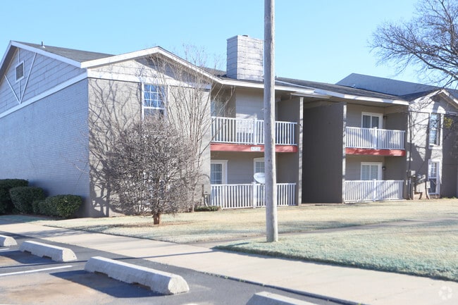
6103 Nw 63Rd St, Oklahoma City, OK 73132

NEARBY LISTINGS FOR SALE OR LEASE
-
-
View all Oklahoma City listings for sale on LoopNet.com
Property Detail
6103 Nw 63Rd St
189095500
Unpltd Pt Sec 04 12N 4W
Multifamilydwelling
UNPLTD PT SEC 04 12N 4W 000 000 PT SE4 SEC 4 12N 4W BEG SE/C W 1/2 W 1/2 SE4 SD SE4 TH N ON E LINE W 1/2 W 1/2 SE4 SE4 660.61FT W15FT N660.61FT TO A POINT 15FT W NE/C W 1/2 W 1/2 SE4 SD SE4 W675.22FT TO POINT 33FT W NW/C E 1/2 E 1/2 SW4 SE4 S1321.22F
A
Oklahoma
40109C0165H
Oklahoma
2023
15.93 AC
2024
West Oklahoma City
106710
Oklahoma City
245,768 SF
Oklahoma City, OK
DEMOGRAPHICS near 6103 Nw 63Rd St
1 Mile
3 Mile
5 Mile
2024 Total Population
14,889
81,396
222,188
2029 Population
15,468
83,419
230,261
Pop Growth 2024-2029
+ 3.89%
+ 2.49%
+ 3.63%
Average Age
36
39
39
2024 Total Households
5,970
33,707
93,649
HH Growth 2024-2029
+ 4.17%
+ 2.60%
+ 3.51%
Median Household Inc
$45,654
$53,940
$57,862
Avg Household Size
2.40
2.30
2.30
2024 Avg HH Vehicles
2.00
2.00
2.00
Median Home Value
$157,603
$169,751
$184,209
Median Year Built
1971
1972
1972
Nearby Places
Map Layers
Map Styles
 Street
 Aerial
- Restaurants
- Banks
- Shops
- Fitness
- Groceries
PUBLIC TRANSPORTATION
AIRPORT
Will Rogers World
DRIVE
WALK
Distance
Will Rogers World
26 min
14.0 mi
Freight Ports
Tulsa Port Of Catoosa
DRIVE
WALK
Distance
Tulsa Port Of Catoosa
141 min
126.5 mi
Nearby Properties
Address
Land Use
TOTAL SIZE
Lot Size
Zoning
Address
Land Use
TOTAL SIZE
Lot Size
Zoning
44,519 SF
3.39 AC
SPUD
Address
Land Use
TOTAL SIZE
Lot Size
Zoning
37,400 SF
4.23 AC
PUD
Address
Land Use
TOTAL SIZE
Lot Size
Zoning
312,308 SF
9.76 AC
C-3
Address
Land Use
TOTAL SIZE
Lot Size
Zoning
90,059 SF
14.99 AC
O-2
Address
Land Use
TOTAL SIZE
Lot Size
Zoning
430,092 SF
17.35 AC
R-4
Address
Land Use
TOTAL SIZE
Lot Size
Zoning
641,860 SF
62.12 AC
R-4
Address
Land Use
TOTAL SIZE
Lot Size
Zoning
28,099 SF
1.21 AC
O-2
Address
Land Use
TOTAL SIZE
Lot Size
Zoning
49,950 SF
3.69 AC
R-1
Address
Land Use
TOTAL SIZE
Lot Size
Zoning
21,111 SF
2.57 AC
R-4
Address
Land Use
TOTAL SIZE
Lot Size
Zoning
347,288 SF
19 AC
C-3
Address
Land Use
TOTAL SIZE
Lot Size
Zoning
213,085 SF
3.64 AC
Address
Land Use
TOTAL SIZE
Lot Size
Zoning
29,274 SF
0.93 AC
C-3
Address
Land Use
TOTAL SIZE
Lot Size
Zoning
286,485 SF
14.86 AC
R-4
Address
Land Use
TOTAL SIZE
Lot Size
Zoning
363,374 SF
15.85 AC
R-4
Address
Land Use
TOTAL SIZE
Lot Size
Zoning
164,880 SF
8.95 AC
O-2
Address
Land Use
TOTAL SIZE
Lot Size
Zoning
69,370 SF
O-2
Address
Land Use
TOTAL SIZE
Lot Size
Zoning
263,560 SF
13.10 AC
R-4
Address
Land Use
TOTAL SIZE
Lot Size
Zoning
327,372 SF
14.79 AC
R-4
Address
Land Use
TOTAL SIZE
Lot Size
Zoning
157,279 SF
15.07 AC
PUD
Address
Land Use
TOTAL SIZE
Lot Size
Zoning
259,024 SF
28.32 AC
R-4
Address
Land Use
TOTAL SIZE
Lot Size
Zoning
153,065 SF
13.87 AC
C-3
Address
Land Use
TOTAL SIZE
Lot Size
Zoning
342,342 SF
27.20 AC
R-4
Address
Land Use
TOTAL SIZE
Lot Size
Zoning
252,731 SF
7.39 AC
C-3
Address
Land Use
TOTAL SIZE
Lot Size
Zoning
220,304 SF
19.54 AC
PUD
Address
Land Use
TOTAL SIZE
Lot Size
Zoning
69,060 SF
4.90 AC
C-CBD
Address
Land Use
TOTAL SIZE
Lot Size
Zoning
199,832 SF
9.72 AC
PUD
Address
Land Use
TOTAL SIZE
Lot Size
Zoning
224,982 SF
7.63 AC
O-2
Address
Land Use
TOTAL SIZE
Lot Size
Zoning
164,336 SF
0.80 AC
R-4
Address
Land Use
TOTAL SIZE
Lot Size
Zoning
243,906 SF
9.56 AC
C-3
The World's #1 Commercial Real Estate Marketplace
Connect with us
© 2025 CoStar Group
The information above has been obtained from sources believed reliable. While we do not doubt its accuracy we have not verified it and make no guarantee, warranty or representation about it. It is your responsibility to independently confirm its accuracy and completeness. Any projections, opinions, assumptions, or estimates used are for example only and do not represent the current or future performance of the property. The value of this transaction to you depends on tax and other factors which should be evaluated by your tax, financial, and legal advisors. You and your advisors should conduct a careful, independent investigation of the property to determine to your satisfaction the suitability of the property for your needs.