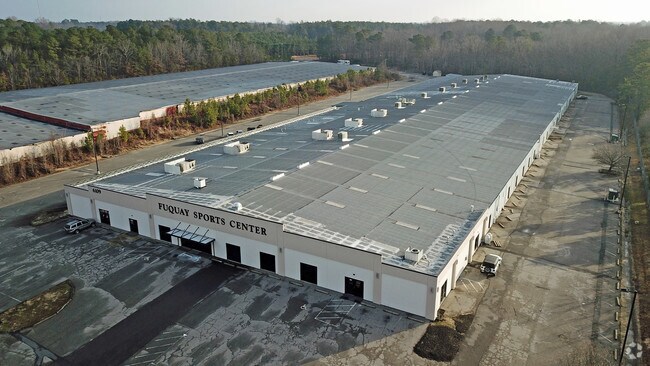
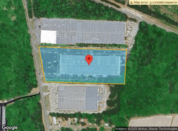
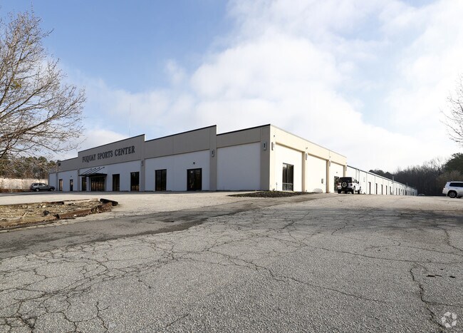
Property Record
6109 S Nc 55 Hwy, Fuquay Varina, NC 27526
NEARBY LISTINGS FOR SALE OR LEASE
Property Detail
6109 S Nc 55 Hwy
0677.03-20-3753-000
Judd Est
Warehouse
JUDD EST
X
Wake
3720067700K
North Carolina
2025
8 AC
2025
Southeast Wake County
053109
Raleigh/Durham
130,000 SF
Raleigh, NC
DEMOGRAPHICS near 6109 S Nc 55 Hwy
1 Mile
3 Mile
5 Mile
2024 Total Population
4,923
38,063
86,877
2029 Population
5,427
42,202
95,795
Pop Growth 2024-2029
+ 10.24%
+ 10.87%
+ 10.27%
Average Age
39
40
39
2024 Total Households
1,770
13,939
30,642
HH Growth 2024-2029
+ 10.34%
+ 10.84%
+ 10.28%
Median Household Inc
$78,672
$86,448
$93,400
Avg Household Size
2.80
2.70
2.80
2024 Avg HH Vehicles
2.00
2.00
2.00
Median Home Value
$341,100
$344,628
$363,211
Median Year Built
2007
2005
2004
Nearby Places
Map Layers
Map Styles
 Street
 Aerial
- Restaurants
- Banks
- Shops
- Fitness
- Groceries
PUBLIC TRANSPORTATION
AIRPORT
Raleigh-Durham International
DRIVE
WALK
Distance
Raleigh-Durham International
40 min
26.6 mi
Freight Ports
Port of Wilmington
DRIVE
WALK
Distance
Port of Wilmington
149 min
125.8 mi
Nearby Properties
Address
Land Use
TOTAL SIZE
Lot Size
Zoning
Address
Land Use
TOTAL SIZE
Lot Size
Zoning
435,576 SF
29.37 AC
RHD-C
Address
Land Use
TOTAL SIZE
Lot Size
Zoning
311,701 SF
19.97 AC
RHD
Address
Land Use
TOTAL SIZE
Lot Size
Zoning
201,371 SF
9.68 AC
O&I
Address
Land Use
TOTAL SIZE
Lot Size
Zoning
207,800 SF
7.18 AC
NMU
Address
Land Use
TOTAL SIZE
Lot Size
Zoning
346,384 SF
56.12 AC
HI
Address
Land Use
TOTAL SIZE
Lot Size
Zoning
125,079 SF
15.15 AC
OI-CZ
Address
Land Use
TOTAL SIZE
Lot Size
Zoning
161,685 SF
14.55 AC
O&I
Address
Land Use
TOTAL SIZE
Lot Size
Zoning
158,656 SF
10.31 AC
CC-CZ
Address
Land Use
TOTAL SIZE
Lot Size
Zoning
68,452 SF
50.57 AC
OI-CZD
Address
Land Use
TOTAL SIZE
Lot Size
Zoning
237,750 SF
41.18 AC
RLI
Address
Land Use
TOTAL SIZE
Lot Size
Zoning
290,054 SF
34.18 AC
HI
Address
Land Use
TOTAL SIZE
Lot Size
Zoning
83,208 SF
27.68 AC
O&I
Address
Land Use
TOTAL SIZE
Lot Size
Zoning
101,680 SF
2.36 AC
UMU
Address
Land Use
TOTAL SIZE
Lot Size
Zoning
83,283 SF
14.79 AC
GC
Address
Land Use
TOTAL SIZE
Lot Size
Zoning
99,307 SF
10.91 AC
CC
Address
Land Use
TOTAL SIZE
Lot Size
Zoning
79,212 SF
4.10 AC
CC-CZ
Address
Land Use
TOTAL SIZE
Lot Size
Zoning
82,857 SF
9.56 AC
O&I
Address
Land Use
TOTAL SIZE
Lot Size
Zoning
30,043 SF
12.77 AC
GC
Address
Land Use
TOTAL SIZE
Lot Size
Zoning
111,627 SF
2.55 AC
CC
Address
Land Use
TOTAL SIZE
Lot Size
Zoning
112,700 SF
15.84 AC
HI
Address
Land Use
TOTAL SIZE
Lot Size
Zoning
149,975 SF
18.73 AC
GC
Address
Land Use
TOTAL SIZE
Lot Size
Zoning
73,410 SF
21.97 AC
O&I
Address
Land Use
TOTAL SIZE
Lot Size
Zoning
183,855 SF
19.67 AC
HI
Address
Land Use
TOTAL SIZE
Lot Size
Zoning
1.83 AC
RMU
Address
Land Use
TOTAL SIZE
Lot Size
Zoning
69,135 SF
13.58 AC
RA
Address
Land Use
TOTAL SIZE
Lot Size
Zoning
58,386 SF
14.41 AC
O&I
Address
Land Use
TOTAL SIZE
Lot Size
Zoning
56,940 SF
7.20 AC
GC
Address
Land Use
TOTAL SIZE
Lot Size
Zoning
64,774 SF
10.90 AC
OI-CZ
Address
Land Use
TOTAL SIZE
Lot Size
Zoning
107,689 SF
10.18 AC
CC
The World's #1 Commercial Real Estate Marketplace
Connect with us
© 2025 CoStar Group
The information above has been obtained from sources believed reliable. While we do not doubt its accuracy we have not verified it and make no guarantee, warranty or representation about it. It is your responsibility to independently confirm its accuracy and completeness. Any projections, opinions, assumptions, or estimates used are for example only and do not represent the current or future performance of the property. The value of this transaction to you depends on tax and other factors which should be evaluated by your tax, financial, and legal advisors. You and your advisors should conduct a careful, independent investigation of the property to determine to your satisfaction the suitability of the property for your needs.