Property Record
615 E Ashby Rd, Florence, SC 29506


This Property Is For Sale
Property Detail
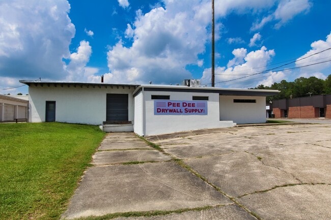
615 E Ashby Rd
00175-01-067
ST HWY 358
Distributionwarehouseregional
FLORENCE
B and X Area of moderate flood hazard, usually the area between the limits of the 100-year and 500-year floods.
South Carolina
2025
0.68 AC
2025
Florence/Dillon
000502
Other Market Areas
18,584 SF
Florence, SC
NEARBY LISTINGS FOR SALE OR LEASE
-
-
View all Florence listings for sale on LoopNet.com
DEMOGRAPHICS near 615 E Ashby Rd
1 mile
3 mile
5 mile
2025 Total Population
1,560
16,016
36,914
2030 Population
1,590
16,462
37,712
Pop Growth 2025-2030
+ 1.92%
+ 2.78%
+ 2.16%
Average Age
41
41
40
2025 Total Households
599
6,405
15,079
HH Growth 2025-2030
+ 1.84%
+ 2.92%
+ 2.23%
Median Household Inc
$58,957
$38,124
$44,396
Avg Household Size
2.60
2.40
2.30
2025 Avg HH Vehicles
2.00
2.00
2.00
Median Home Value
$169,607
$99,789
$155,180
Median Year Built
1979
1975
1974
Nearby Places
Map Layers
Map Styles
 Street
 Aerial
Layers
 Traffic
 Biking
Places
Listings with unknown addresses are not visible on the map
- Restaurants
- Banks
- Shops
- Fitness
- Groceries
PUBLIC TRANSPORTATION
COMMUTER RAIL
Florence Amtrak Station (Palmetto - Amtrak, Silver Meteor - Amtrak)
Drive
Walk
Distance
Florence Amtrak Station (Palmetto - Amtrak, Silver Meteor - Amtrak)
8 min
3.6 mi
Freight Ports
North Charleston Terminal
Drive
Walk
Distance
North Charleston Terminal
146 min
106.0 mi
Nearby Properties
Address
Land Use
TOTAL SIZE
Lot Size
Zoning
Address
Land Use
TOTAL SIZE
Lot Size
Zoning
4,550 SF
275.48 AC
Address
Land Use
TOTAL SIZE
Lot Size
Zoning
8,416 SF
2.10 AC
B4
Address
Land Use
TOTAL SIZE
Lot Size
Zoning
125,000 SF
6.84 AC
B1
Address
Land Use
TOTAL SIZE
Lot Size
Zoning
1,347.68 AC
Address
Land Use
TOTAL SIZE
Lot Size
Zoning
86,950 SF
6.82 AC
B2
Address
Land Use
TOTAL SIZE
Lot Size
Zoning
66,715 SF
0.52 AC
Address
Land Use
TOTAL SIZE
Lot Size
Zoning
Address
Land Use
TOTAL SIZE
Lot Size
Zoning
19,617 SF
0.31 AC
B2
Address
Land Use
TOTAL SIZE
Lot Size
Zoning
195.43 AC
B3
Address
Land Use
TOTAL SIZE
Lot Size
Zoning
422,500 SF
92 AC
Address
Land Use
TOTAL SIZE
Lot Size
Zoning
133,616 SF
10.98 AC
Address
Land Use
TOTAL SIZE
Lot Size
Zoning
26.36 AC
B1
Address
Land Use
TOTAL SIZE
Lot Size
Zoning
79,263 SF
1.34 AC
B4
Address
Land Use
TOTAL SIZE
Lot Size
Zoning
Address
Land Use
TOTAL SIZE
Lot Size
Zoning
20,265 SF
28.17 AC
B3
Address
Land Use
TOTAL SIZE
Lot Size
Zoning
71,400 SF
3.71 AC
B3
Address
Land Use
TOTAL SIZE
Lot Size
Zoning
47,600 SF
4.57 AC
R4
Address
Land Use
TOTAL SIZE
Lot Size
Zoning
Address
Land Use
TOTAL SIZE
Lot Size
Zoning
100.01 AC
Address
Land Use
TOTAL SIZE
Lot Size
Zoning
2.39 AC
B1
Address
Land Use
TOTAL SIZE
Lot Size
Zoning
2,327 SF
0.92 AC
Address
Land Use
TOTAL SIZE
Lot Size
Zoning
218,850 SF
7.54 AC
B3
Address
Land Use
TOTAL SIZE
Lot Size
Zoning
64,416 SF
3.29 AC
B4
Address
Land Use
TOTAL SIZE
Lot Size
Zoning
34,164 SF
8.95 AC
Address
Land Use
TOTAL SIZE
Lot Size
Zoning
12,582 SF
11.23 AC
B3
Address
Land Use
TOTAL SIZE
Lot Size
Zoning
22,242 SF
0.15 AC
B4
Address
Land Use
TOTAL SIZE
Lot Size
Zoning
19,336 SF
0.23 AC
B4
Address
Land Use
TOTAL SIZE
Lot Size
Zoning
28,125 SF
0.27 AC
B4
The World's #1 Commercial Real Estate Marketplace
Connect with us
© 2026 CoStar Group
The information above has been obtained from sources believed reliable. While we do not doubt its accuracy we have not verified it and make no guarantee, warranty or representation about it. It is your responsibility to independently confirm its accuracy and completeness. Any projections, opinions, assumptions, or estimates used are for example only and do not represent the current or future performance of the property. The value of this transaction to you depends on tax and other factors which should be evaluated by your tax, financial, and legal advisors. You and your advisors should conduct a careful, independent investigation of the property to determine to your satisfaction the suitability of the property for your needs.