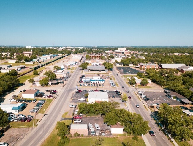
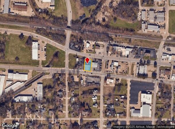
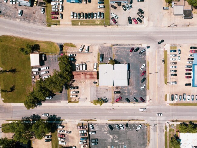
Property Record
611 W Davis St, Mesquite, TX 75149
NEARBY LISTINGS FOR SALE OR LEASE
Property Detail
611 W Davis St
Dallas-Fort Worth-Arlington, TX
William Carter Jr
38019500070060000
WILLIAM CARTER JR BLK 7 LT 006 A ORIG TOWN MESQUITE PG 747 INT202300062283 DD03302023 CO-DC 0195000700600 3CM01950007
Warehouse
Dallas
X
Texas
48257C0025E
006
2024
0.24 AC
2025
East Dallas/Mesquite
017704
Dallas/Ft Worth
1,440 SF
DEMOGRAPHICS near 611 W Davis St
1 Mile
3 Mile
5 Mile
2024 Total Population
10,207
99,896
242,895
2029 Population
10,117
98,164
239,448
Pop Growth 2024-2029
(0.88%)
(1.73%)
(1.42%)
Average Age
36
35
35
2024 Total Households
3,386
32,046
75,610
HH Growth 2024-2029
(1.15%)
(2.06%)
(1.71%)
Median Household Inc
$56,361
$58,442
$56,202
Avg Household Size
2.90
3.00
3.10
2024 Avg HH Vehicles
2.00
2.00
2.00
Median Home Value
$171,549
$183,311
$183,600
Median Year Built
1969
1982
1981
Nearby Places
Map Layers
Map Styles
 Street
 Aerial
- Restaurants
- Banks
- Shops
- Fitness
- Groceries
PUBLIC TRANSPORTATION
AIRPORT
Dallas Love Field
DRIVE
WALK
Distance
Dallas Love Field
31 min
18.1 mi
Dallas-Fort Worth International
DRIVE
WALK
Distance
Dallas-Fort Worth International
44 min
37.2 mi
Nearby Properties
Address
Land Use
TOTAL SIZE
Lot Size
Zoning
Address
Land Use
TOTAL SIZE
Lot Size
Zoning
768,482 SF
40.44 AC
Z109
Address
Land Use
TOTAL SIZE
Lot Size
Zoning
194,385 SF
44.63 AC
Z396
Address
Land Use
TOTAL SIZE
Lot Size
Zoning
144,858 SF
9.69 AC
Z206
Address
Land Use
TOTAL SIZE
Lot Size
Zoning
296,370 SF
17.15 AC
Z16
Address
Land Use
TOTAL SIZE
Lot Size
Zoning
255,008 SF
30.39 AC
Z250
Address
Land Use
TOTAL SIZE
Lot Size
Zoning
100 SF
0.01 AC
Z268
Address
Land Use
TOTAL SIZE
Lot Size
Zoning
588,625 SF
29.01 AC
Z109
Address
Land Use
TOTAL SIZE
Lot Size
Zoning
487,200 SF
29.56 AC
Z109
Address
Land Use
TOTAL SIZE
Lot Size
Zoning
902,719 SF
50.31 AC
Z109
Address
Land Use
TOTAL SIZE
Lot Size
Zoning
530,100 SF
28.84 AC
Z109
Address
Land Use
TOTAL SIZE
Lot Size
Zoning
1,229,138 SF
115.08 AC
Z117
Address
Land Use
TOTAL SIZE
Lot Size
Zoning
491,561 SF
27.70 AC
Z109
Address
Land Use
TOTAL SIZE
Lot Size
Zoning
622,615 SF
35 AC
Z104
Address
Land Use
TOTAL SIZE
Lot Size
Zoning
457,076 SF
27.74 AC
Z109
Address
Land Use
TOTAL SIZE
Lot Size
Zoning
242,741 SF
14.25 AC
Z237
Address
Land Use
TOTAL SIZE
Lot Size
Zoning
263,564 SF
12.71 AC
Z237
Address
Land Use
TOTAL SIZE
Lot Size
Zoning
223,216 SF
17.17 AC
Z31
Address
Land Use
TOTAL SIZE
Lot Size
Zoning
214,853 SF
6.60 AC
Z372
Address
Land Use
TOTAL SIZE
Lot Size
Zoning
87,104 SF
18.31 AC
Z87
Address
Land Use
TOTAL SIZE
Lot Size
Zoning
407,195 SF
31.32 AC
Z109
Address
Land Use
TOTAL SIZE
Lot Size
Zoning
320,390 SF
21.50 AC
Z267
Address
Land Use
TOTAL SIZE
Lot Size
Zoning
206,646 SF
10.35 AC
Z237
Address
Land Use
TOTAL SIZE
Lot Size
Zoning
395,065 SF
24.18 AC
Z206
Address
Land Use
TOTAL SIZE
Lot Size
Zoning
364,000 SF
40.25 AC
Z236
Address
Land Use
TOTAL SIZE
Lot Size
Zoning
389,005 SF
25.25 AC
Z109
Address
Land Use
TOTAL SIZE
Lot Size
Zoning
298,150 SF
20.01 AC
Z14
Address
Land Use
TOTAL SIZE
Lot Size
Zoning
349,440 SF
20.07 AC
Z104
Address
Land Use
TOTAL SIZE
Lot Size
Zoning
260,634 SF
13.94 AC
Z237
Address
Land Use
TOTAL SIZE
Lot Size
Zoning
255,121 SF
10.89 AC
Z237
Address
Land Use
TOTAL SIZE
Lot Size
Zoning
217,606 SF
10.01 AC
Z237
The World's #1 Commercial Real Estate Marketplace
Connect with us
© 2025 CoStar Group
The information above has been obtained from sources believed reliable. While we do not doubt its accuracy we have not verified it and make no guarantee, warranty or representation about it. It is your responsibility to independently confirm its accuracy and completeness. Any projections, opinions, assumptions, or estimates used are for example only and do not represent the current or future performance of the property. The value of this transaction to you depends on tax and other factors which should be evaluated by your tax, financial, and legal advisors. You and your advisors should conduct a careful, independent investigation of the property to determine to your satisfaction the suitability of the property for your needs.